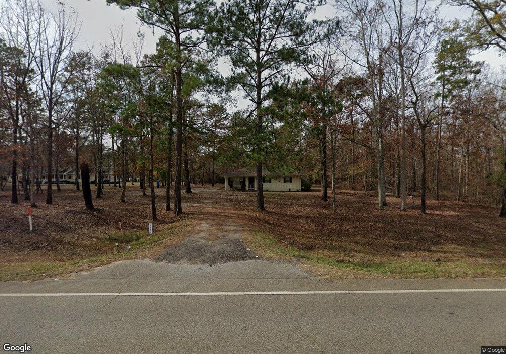
12483 Ga Highway 216 Edison, GA 39846
Estimated Value: $150,664 - $217,000
--
Bed
2
Baths
1,444
Sq Ft
$125/Sq Ft
Est. Value
About This Home
This home is located at 12483 Ga Highway 216, Edison, GA 39846 and is currently estimated at $180,666, approximately $125 per square foot. 12483 Ga Highway 216 is a home located in Calhoun County with nearby schools including Calhoun County Elementary School, Calhoun County Middle School, and Calhoun County High School.
Ownership History
Date
Name
Owned For
Owner Type
Purchase Details
Closed on
Feb 15, 2013
Sold by
The Bank Of Edison
Bought by
Lovett Clifford
Current Estimated Value
Home Financials for this Owner
Home Financials are based on the most recent Mortgage that was taken out on this home.
Original Mortgage
$93,490
Interest Rate
3.4%
Mortgage Type
New Conventional
Purchase Details
Closed on
Dec 4, 2012
Sold by
The Bank Of Edison
Bought by
The Bank Of Edison
Purchase Details
Closed on
Dec 22, 2006
Sold by
Wilson Mary
Bought by
Jordan J Wiley
Purchase Details
Closed on
May 31, 2006
Sold by
Wilson Willie and Wilson Mary
Bought by
Wilson Mary
Purchase Details
Closed on
Apr 9, 1996
Bought by
Wilson Willie and Wilson Mary
Create a Home Valuation Report for This Property
The Home Valuation Report is an in-depth analysis detailing your home's value as well as a comparison with similar homes in the area
Home Values in the Area
Average Home Value in this Area
Purchase History
| Date | Buyer | Sale Price | Title Company |
|---|---|---|---|
| Lovett Clifford | $92,000 | -- | |
| The Bank Of Edison | -- | -- | |
| Jordan J Wiley | $60,000 | -- | |
| Wilson Mary | -- | -- | |
| Wilson Willie | -- | -- |
Source: Public Records
Mortgage History
| Date | Status | Borrower | Loan Amount |
|---|---|---|---|
| Closed | Lovett Clifford | $93,490 |
Source: Public Records
Tax History Compared to Growth
Tax History
| Year | Tax Paid | Tax Assessment Tax Assessment Total Assessment is a certain percentage of the fair market value that is determined by local assessors to be the total taxable value of land and additions on the property. | Land | Improvement |
|---|---|---|---|---|
| 2025 | $1,266 | $36,998 | $6,726 | $30,272 |
| 2024 | $1,267 | $36,998 | $6,726 | $30,272 |
| 2023 | $1,275 | $36,998 | $6,726 | $30,272 |
| 2022 | $1,243 | $36,798 | $6,726 | $30,072 |
| 2021 | $1,207 | $34,345 | $6,726 | $27,619 |
| 2020 | $1,244 | $34,345 | $6,726 | $27,619 |
| 2019 | $1,328 | $35,542 | $6,726 | $28,816 |
| 2018 | $1,228 | $35,542 | $6,726 | $28,816 |
| 2017 | $1,128 | $35,542 | $6,726 | $28,816 |
| 2016 | $1,128 | $35,542 | $6,726 | $28,816 |
| 2015 | -- | $35,143 | $6,726 | $28,416 |
| 2014 | -- | $36,814 | $6,726 | $30,088 |
| 2013 | -- | $36,814 | $6,726 | $30,088 |
Source: Public Records
Map
Nearby Homes
- 19468 Hartford St E
- Pine St NW
- 464 Bay Ave NE
- 2236 County Road 150
- Home Place
- 1626 Pine St
- 5 Pine St
- 1 Pine St
- 4 Pine St
- 0 Pine St
- 203 Wayback Rd
- 69 Greenleaf Ave NE
- Gin Pond
- Nantze Springs Rd
- 10 Re Jennings Ave SE
- 17234 S Highland Ave
- 17015 Arlington Hwy
- 2700 Silo Rd
- 0 Nantze Springs Rd
- 0 Buck Rd Unit 10658812