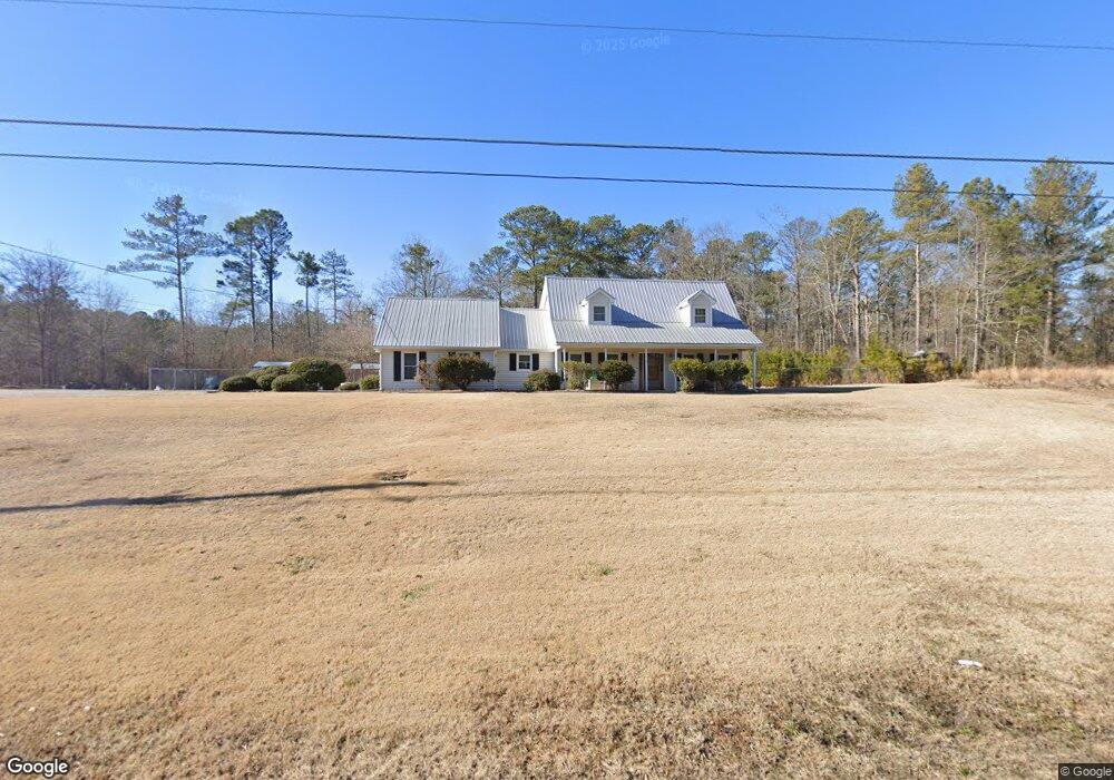
1249 Old Cartersville Rd Dallas, GA 30132
East Paulding County NeighborhoodEstimated Value: $436,000 - $460,979
3
Beds
3
Baths
2,533
Sq Ft
$176/Sq Ft
Est. Value
About This Home
This home is located at 1249 Old Cartersville Rd, Dallas, GA 30132 and is currently estimated at $446,995, approximately $176 per square foot. 1249 Old Cartersville Rd is a home located in Paulding County with nearby schools including Northside Elementary School, Herschel Jones Middle School, and North Paulding High School.
Ownership History
Date
Name
Owned For
Owner Type
Purchase Details
Closed on
Sep 14, 2018
Sold by
Evett Grady Mark
Bought by
Evett Grady Mark and Jackson Angela A
Current Estimated Value
Purchase Details
Closed on
Aug 26, 1992
Sold by
Evett Grady Mark and Evett Angela S
Bought by
Evett Grady Mark
Create a Home Valuation Report for This Property
The Home Valuation Report is an in-depth analysis detailing your home's value as well as a comparison with similar homes in the area
Home Values in the Area
Average Home Value in this Area
Purchase History
| Date | Buyer | Sale Price | Title Company |
|---|---|---|---|
| Evett Grady Mark | -- | -- | |
| Evett Grady Mark | -- | -- |
Source: Public Records
Tax History Compared to Growth
Tax History
| Year | Tax Paid | Tax Assessment Tax Assessment Total Assessment is a certain percentage of the fair market value that is determined by local assessors to be the total taxable value of land and additions on the property. | Land | Improvement |
|---|---|---|---|---|
| 2024 | $4,025 | $165,064 | $37,480 | $127,584 |
| 2023 | $3,992 | $155,660 | $36,560 | $119,100 |
| 2022 | $3,531 | $137,320 | $30,120 | $107,200 |
| 2021 | $3,077 | $107,732 | $25,400 | $82,332 |
| 2020 | $2,814 | $96,604 | $25,400 | $71,204 |
| 2019 | $2,796 | $94,644 | $24,200 | $70,444 |
| 2018 | $2,434 | $82,640 | $23,400 | $59,240 |
| 2017 | $2,134 | $71,712 | $22,400 | $49,312 |
| 2016 | $1,764 | $60,188 | $21,040 | $39,148 |
| 2015 | $1,696 | $56,960 | $20,440 | $36,520 |
| 2014 | $1,548 | $50,900 | $18,520 | $32,380 |
| 2013 | -- | $47,640 | $20,120 | $27,520 |
Source: Public Records
Map
Nearby Homes
- 272 Kades Cove Dr
- 18 Mountain Ct
- The McGinnis Plan at Jones Ridge
- The Langford Plan at Jones Ridge
- The Ellijay Plan at Jones Ridge
- The Palmer Plan at Jones Ridge
- The James Plan at Jones Ridge
- The Lancaster Plan at Jones Ridge
- The Avery Plan at Jones Ridge
- 89 Dundee Crossing
- 16 Riders Ridge
- 74 Riders Ridge
- 70 Stallion Run
- 38 Kelso Way
- 144 Aberdeen Way
- 219 Aberdeen Way
- 443 Brooks Rd
- 427 Wagon Trail Cir
- 17 John Walraven Rd
- 1238 Old Cartersville Rd
- 6 John Walraven Rd
- 3 John Walraven Rd
- 5 John Walraven Rd
- 4 John Walraven Rd
- 2 John Walraven Rd
- 1 John Walraven Rd
- 55 John Walraven Rd
- 0 John Walraven Rd Unit LOT 1A 7597555
- 0 John Walraven Rd Unit 5A 8305105
- 0 John Walraven Rd Unit LOT 1 8012470
- 0 John Walraven Rd Unit 8042845
- 0 John Walraven Rd Unit LOT 6 8086155
- 0 John Walraven Rd Unit LOT 5 8086152
- 0 John Walraven Rd Unit LOT 4 8086149
- 0 John Walraven Rd Unit LOT 3 8086144
- 0 John Walraven Rd Unit 2 8086139
- 0 John Walraven Rd
- 0 John Walraven Rd Unit 8105753