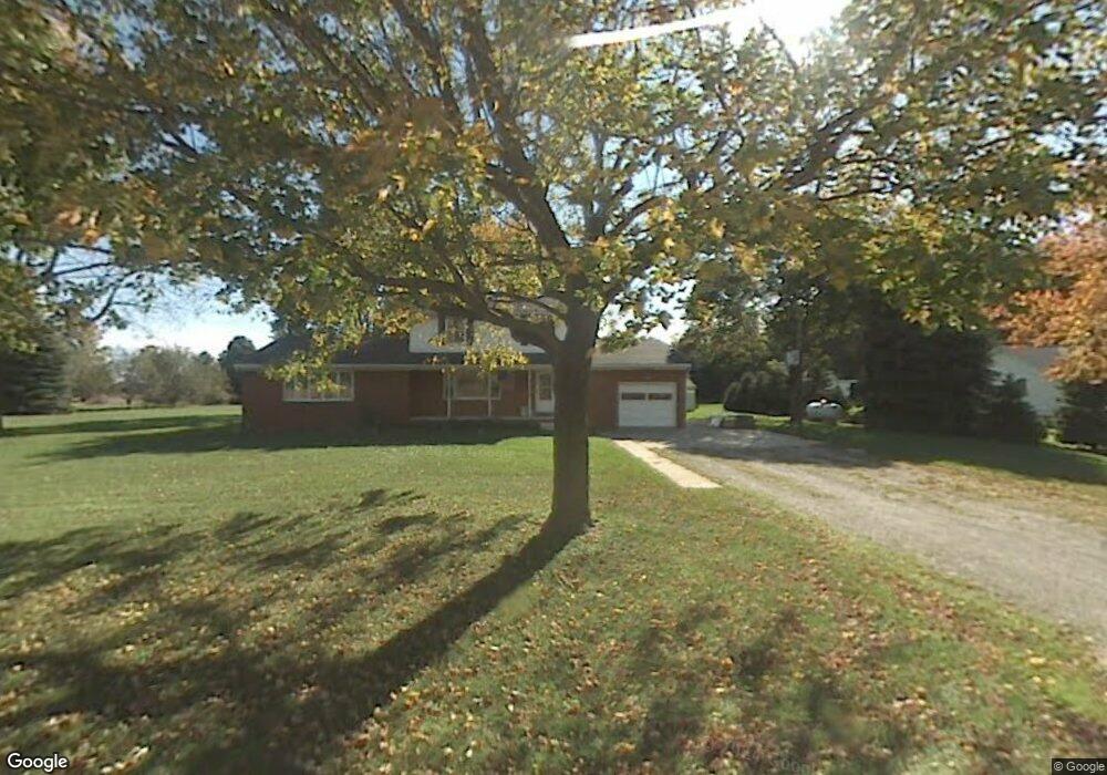
12499 Eggert Rd Dundee, MI 48131
Estimated Value: $311,339 - $406,000
4
Beds
2
Baths
2,016
Sq Ft
$179/Sq Ft
Est. Value
About This Home
This home is located at 12499 Eggert Rd, Dundee, MI 48131 and is currently estimated at $360,085, approximately $178 per square foot. 12499 Eggert Rd is a home located in Monroe County with nearby schools including Ida Elementary School, Ida Middle School, and Ida High School.
Ownership History
Date
Name
Owned For
Owner Type
Purchase Details
Closed on
Apr 12, 2016
Sold by
Oestrike Charles R
Bought by
Oestrike Charles R and Plumb Kelli Nicole
Current Estimated Value
Purchase Details
Closed on
Mar 31, 1997
Sold by
Beaufait Russell D
Bought by
Yensch Gerald B and Yensch Kelly J
Home Financials for this Owner
Home Financials are based on the most recent Mortgage that was taken out on this home.
Original Mortgage
$102,950
Outstanding Balance
$10,418
Interest Rate
7.65%
Mortgage Type
New Conventional
Estimated Equity
$349,667
Create a Home Valuation Report for This Property
The Home Valuation Report is an in-depth analysis detailing your home's value as well as a comparison with similar homes in the area
Home Values in the Area
Average Home Value in this Area
Purchase History
| Date | Buyer | Sale Price | Title Company |
|---|---|---|---|
| Oestrike Charles R | -- | Attorney | |
| Yensch Gerald B | $147,900 | -- |
Source: Public Records
Mortgage History
| Date | Status | Borrower | Loan Amount |
|---|---|---|---|
| Open | Yensch Gerald B | $102,950 |
Source: Public Records
Tax History
| Year | Tax Paid | Tax Assessment Tax Assessment Total Assessment is a certain percentage of the fair market value that is determined by local assessors to be the total taxable value of land and additions on the property. | Land | Improvement |
|---|---|---|---|---|
| 2025 | $1,012 | $138,810 | $49,380 | $89,430 |
| 2024 | $981 | $138,240 | $0 | $0 |
| 2023 | $2,392 | $106,180 | $0 | $0 |
| 2022 | $890 | $106,180 | $0 | $0 |
| 2021 | $2,319 | $112,700 | $0 | $0 |
| 2020 | $2,275 | $93,700 | $0 | $0 |
| 2019 | $834 | $93,700 | $0 | $0 |
| 2018 | $1,945 | $77,530 | $0 | $0 |
| 2017 | $1,849 | $76,610 | $0 | $0 |
| 2016 | $1,745 | $76,610 | $0 | $0 |
| 2015 | $2,666 | $63,990 | $0 | $0 |
| 2014 | $2,677 | $63,990 | $0 | $0 |
| 2013 | $2,832 | $59,620 | $0 | $0 |
Source: Public Records
Map
Nearby Homes
- Parcel 5 Nieman Rd
- 11075 S Custer Rd
- 11140 S Custer Rd
- 11080 S Custer Rd
- 11020 S Custer Rd
- 13493 Dixon Rd
- 11135 S Custer (Lot H)
- 10960 S Custer (Lot O)
- 835 Henning St
- 2761 Lowe Rd
- 8257 Ida West Rd
- 8344 Westwood St
- 8066 Ida St
- 439 E Monroe St
- 14844 Ida West Rd
- 3925 Douglas Rd
- 190 Sidney St
- 0 Wells Rd Unit 50196085
- 232 Dundee Ridge Dr
- 0 Ida W Unit 50167558
Your Personal Tour Guide
Ask me questions while you tour the home.