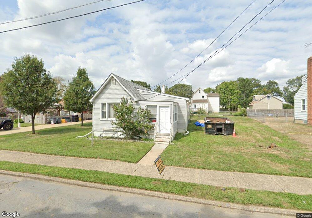
125 6th Ave Glendora, NJ 08029
Estimated Value: $216,258 - $243,000
1
Bed
1
Bath
660
Sq Ft
$347/Sq Ft
Est. Value
About This Home
This home is located at 125 6th Ave, Glendora, NJ 08029 and is currently estimated at $229,315, approximately $347 per square foot. 125 6th Ave is a home located in Camden County with nearby schools including Glen Landing Middle School, Triton High School, and St. Teresa Regional School.
Ownership History
Date
Name
Owned For
Owner Type
Purchase Details
Closed on
Apr 14, 2008
Sold by
Federal National Mortgage Association
Bought by
Fesi Robert
Current Estimated Value
Home Financials for this Owner
Home Financials are based on the most recent Mortgage that was taken out on this home.
Original Mortgage
$93,532
Outstanding Balance
$59,310
Interest Rate
5.99%
Mortgage Type
FHA
Estimated Equity
$170,005
Purchase Details
Closed on
Jan 15, 2008
Sold by
Mason Stephen
Bought by
Federal National Mortgage Association
Purchase Details
Closed on
May 15, 2006
Sold by
Bel Grace F
Bought by
Mason Stephen
Home Financials for this Owner
Home Financials are based on the most recent Mortgage that was taken out on this home.
Original Mortgage
$129,000
Interest Rate
6.62%
Create a Home Valuation Report for This Property
The Home Valuation Report is an in-depth analysis detailing your home's value as well as a comparison with similar homes in the area
Home Values in the Area
Average Home Value in this Area
Purchase History
| Date | Buyer | Sale Price | Title Company |
|---|---|---|---|
| Fesi Robert | $95,000 | -- | |
| Federal National Mortgage Association | $131,114 | -- | |
| Mason Stephen | $129,000 | -- |
Source: Public Records
Mortgage History
| Date | Status | Borrower | Loan Amount |
|---|---|---|---|
| Open | Fesi Robert | $93,532 | |
| Previous Owner | Mason Stephen | $129,000 |
Source: Public Records
Tax History
| Year | Tax Paid | Tax Assessment Tax Assessment Total Assessment is a certain percentage of the fair market value that is determined by local assessors to be the total taxable value of land and additions on the property. | Land | Improvement |
|---|---|---|---|---|
| 2025 | $5,505 | $128,000 | $51,900 | $76,100 |
| 2024 | $5,229 | $128,000 | $51,900 | $76,100 |
| 2023 | $5,229 | $128,000 | $51,900 | $76,100 |
| 2022 | $5,201 | $128,000 | $51,900 | $76,100 |
| 2021 | $5,092 | $128,000 | $51,900 | $76,100 |
| 2020 | $5,096 | $128,000 | $51,900 | $76,100 |
| 2019 | $4,983 | $128,000 | $51,900 | $76,100 |
| 2018 | $4,961 | $128,000 | $51,900 | $76,100 |
| 2017 | $5,780 | $128,000 | $51,900 | $76,100 |
| 2016 | $4,314 | $117,600 | $51,900 | $65,700 |
| 2015 | $4,004 | $117,600 | $51,900 | $65,700 |
| 2014 | $3,981 | $117,600 | $51,900 | $65,700 |
Source: Public Records
Map
Nearby Homes
- 810 Central Ave
- 902 Glendora Ave
- 1000 Central Ave
- 30 12th Ave
- 300 3rd Ave
- 535 Main St
- 516 Huntington Ave
- 230 E Evesham Rd Unit C15
- 1105 Huntington Ave
- 211 Chestnut St
- 2301 Hartford Dr
- 18 E Front St
- 324 Huntington Ave
- 200 Lake Ave
- 32 Lake Ave
- 1050 Woodland Ave
- 50 Haverford Rd
- 2400 Hartford Dr
- 9 Whaler Ave
- 5 Whaler Ave
Your Personal Tour Guide
Ask me questions while you tour the home.