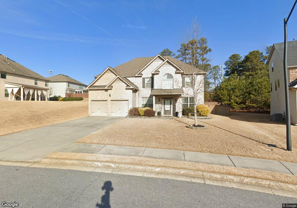
125 Allgood Trace Acworth, GA 30101
Cedarcrest NeighborhoodEstimated Value: $496,779 - $549,000
5
Beds
4
Baths
3,484
Sq Ft
$152/Sq Ft
Est. Value
About This Home
This home is located at 125 Allgood Trace, Acworth, GA 30101 and is currently estimated at $529,945, approximately $152 per square foot. 125 Allgood Trace is a home with nearby schools including Floyd L. Shelton Elementary School at Crossroad, Sammy Mcclure Sr. Middle School, and North Paulding High School.
Ownership History
Date
Name
Owned For
Owner Type
Purchase Details
Closed on
Dec 31, 2015
Sold by
Century Communities Of Georgia Llc
Bought by
Wilson Joshua Douglas
Current Estimated Value
Create a Home Valuation Report for This Property
The Home Valuation Report is an in-depth analysis detailing your home's value as well as a comparison with similar homes in the area
Home Values in the Area
Average Home Value in this Area
Purchase History
| Date | Buyer | Sale Price | Title Company |
|---|---|---|---|
| Wilson Joshua Douglas | $260,655 | -- |
Source: Public Records
Tax History Compared to Growth
Tax History
| Year | Tax Paid | Tax Assessment Tax Assessment Total Assessment is a certain percentage of the fair market value that is determined by local assessors to be the total taxable value of land and additions on the property. | Land | Improvement |
|---|---|---|---|---|
| 2024 | $4,635 | $189,552 | $18,000 | $171,552 |
| 2023 | $5,459 | $211,920 | $18,000 | $193,920 |
| 2022 | $4,211 | $163,388 | $18,000 | $145,388 |
| 2021 | $4,135 | $144,160 | $18,000 | $126,160 |
| 2020 | $3,833 | $130,920 | $18,000 | $112,920 |
| 2019 | $3,780 | $127,320 | $18,000 | $109,320 |
| 2018 | $3,532 | $119,080 | $16,000 | $103,080 |
| 2017 | $3,263 | $108,680 | $16,000 | $92,680 |
| 2016 | $2,952 | $99,480 | $16,000 | $83,480 |
Source: Public Records
Map
Nearby Homes
- 9 Little Ct
- 148 Carlton Ct
- 103 Gray Trail
- 262 Lilyfield Ln
- 17 Carlton Ct
- 217 Hydrangea Ct
- 217 Hydrangea Ct Unit 30
- 266 Cedar Hill Dr Unit 79
- 266 Cedar Hill Dr
- 207 Hydrangea Ct
- 35 Primrose Dr
- 35 Primrose Dr Unit 60
- Primrose Plan at Villages at Cedar Hill
- Orchard Plan at Villages at Cedar Hill
- Waterford Plan at Villages at Cedar Hill
- 17 Cedar Hill Dr Unit 2
- Augusta Plan at Villages at Cedar Hill
- 17 Cedar Hill Dr
- Chatham Plan at Villages at Cedar Hill
- 27 Rosebud Ln Unit 37
- 137 Allgood Trace
- 111 Allgood Trace
- 26 Denton Way
- 149 Allgood Trace
- 40 Denton Way Unit 9
- 40 Denton Way
- 40 Denton Way
- 140 Allgood Trace
- 15 Denton Ct
- 163 Allgood Trace
- 154 Allgood Trace
- 107 Westbrook Creek Rd
- 0 Denton Ct Unit 8585543
- 0 Denton Ct Unit 8749118
- 0 Denton Ct Unit 8887805
- 107 Westbrook Creek Rd
- 79 Allgood Trace Unit 4
- 79 Allgood Trace
- 46 Denton Way
- 27 Denton Ct