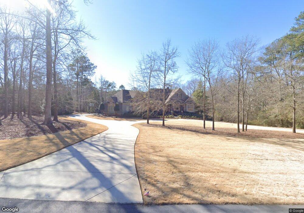
125 Brookhaven Way Athens, GA 30606
Skyline NeighborhoodEstimated Value: $1,062,000 - $1,481,000
--
Bed
1
Bath
7,479
Sq Ft
$178/Sq Ft
Est. Value
About This Home
This home is located at 125 Brookhaven Way, Athens, GA 30606 and is currently estimated at $1,329,157, approximately $177 per square foot. 125 Brookhaven Way is a home with nearby schools including Timothy Elementary School, Clarke Middle School, and Clarke Central High School.
Ownership History
Date
Name
Owned For
Owner Type
Purchase Details
Closed on
Jun 29, 2011
Sold by
Gautreaux Michael S
Bought by
Alliston Asa C
Current Estimated Value
Purchase Details
Closed on
Dec 31, 2003
Sold by
Mcnutt Creek Development Co L L C
Bought by
Gautreaux Michael S
Create a Home Valuation Report for This Property
The Home Valuation Report is an in-depth analysis detailing your home's value as well as a comparison with similar homes in the area
Home Values in the Area
Average Home Value in this Area
Purchase History
| Date | Buyer | Sale Price | Title Company |
|---|---|---|---|
| Alliston Asa C | $125,000 | -- | |
| Alliston Asa C | $125,000 | -- | |
| Gautreaux Michael S | -- | -- |
Source: Public Records
Tax History Compared to Growth
Tax History
| Year | Tax Paid | Tax Assessment Tax Assessment Total Assessment is a certain percentage of the fair market value that is determined by local assessors to be the total taxable value of land and additions on the property. | Land | Improvement |
|---|---|---|---|---|
| 2025 | $14,848 | $502,428 | $50,646 | $451,782 |
| 2024 | $14,848 | $481,374 | $50,646 | $430,728 |
| 2023 | $14,544 | $460,527 | $50,646 | $409,882 |
| 2022 | $12,606 | $405,168 | $50,646 | $354,522 |
| 2021 | $12,042 | $367,333 | $50,646 | $316,687 |
| 2020 | $11,979 | $365,453 | $50,646 | $314,807 |
| 2019 | $11,800 | $357,566 | $50,646 | $306,920 |
| 2018 | $11,441 | $346,995 | $43,579 | $303,416 |
| 2017 | $11,186 | $339,475 | $43,579 | $295,896 |
| 2016 | $11,068 | $336,008 | $43,578 | $292,429 |
| 2015 | $11,109 | $336,719 | $43,578 | $293,140 |
| 2014 | $11,164 | $337,833 | $43,579 | $294,254 |
Source: Public Records
Map
Nearby Homes
- 155 Ridgeview Dr
- 1720 Timothy Rd
- 140 Cypress Manor Ln
- 137 Timothy Park Ln
- 173 Timothy Park Ln
- 381 Township Ln
- 190 Kirkwood Dr
- 1842 Olympus Ct
- 1845 Olympus Ct
- 461 Oglethorpe Ave
- 1847 Olympus Ct
- 132 Branford Place
- 835 Timothy Rd
- 114 Telfair Place
- 125 Wood Lake Dr Unit 310
- 1340 Old Epps Bridge Rd
- 1771 Timothy Rd
- 107 Tamara Ct
- 115 Brookhaven Way
- Lot 6 Brookhaven Way
- Lot 5 Brookhaven Way
- 135 Brookhaven Way
- 195 Tipperary Rd
- 130 Brookhaven Way
- 1010 Tanglebrook Dr
- 110 Tipperary Rd
- 1120 Tanglebrook Dr
- 110 Tipperary Ct
- 1100 Tanglebrook Dr
- 275 Skyline Pkwy
- 100 Tipperary Ct
- 135 Tipperary Rd
- 283 Skyline Pkwy
- 285 Skyline Pkwy
- 265 Skyline Pkwy
- 110 Brookhaven Way
- 293 Skyline Pkwy
- 885 Saint Ives Ln