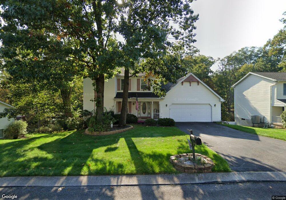
125 Byron Nelson Cir Etters, PA 17319
Estimated Value: $367,482 - $398,000
4
Beds
3
Baths
2,048
Sq Ft
$190/Sq Ft
Est. Value
About This Home
This home is located at 125 Byron Nelson Cir, Etters, PA 17319 and is currently estimated at $389,121, approximately $190 per square foot. 125 Byron Nelson Cir is a home located in York County with nearby schools including Red Mill Elementary School, Crossroads Middle School, and Red Land Senior High School.
Ownership History
Date
Name
Owned For
Owner Type
Purchase Details
Closed on
Jan 8, 2025
Sold by
Wojtysiak Jeanne S and Wojtysiak Joseph R
Bought by
Wojtysiak Joseph R
Current Estimated Value
Home Financials for this Owner
Home Financials are based on the most recent Mortgage that was taken out on this home.
Original Mortgage
$106,000
Outstanding Balance
$105,264
Interest Rate
6.81%
Mortgage Type
New Conventional
Estimated Equity
$283,857
Purchase Details
Closed on
Jun 1, 1994
Sold by
Carroll William M and Carroll Michelle M
Bought by
Wojtysiak Joseph R and Wojtysiak Jeanne S
Purchase Details
Closed on
Sep 6, 1991
Bought by
Carroll William M and Carroll Michelle M
Create a Home Valuation Report for This Property
The Home Valuation Report is an in-depth analysis detailing your home's value as well as a comparison with similar homes in the area
Home Values in the Area
Average Home Value in this Area
Purchase History
| Date | Buyer | Sale Price | Title Company |
|---|---|---|---|
| Wojtysiak Joseph R | -- | Fidelity National Title | |
| Wojtysiak Joseph R | $135,000 | -- | |
| Carroll William M | $136,900 | -- |
Source: Public Records
Mortgage History
| Date | Status | Borrower | Loan Amount |
|---|---|---|---|
| Open | Wojtysiak Joseph R | $106,000 |
Source: Public Records
Tax History Compared to Growth
Tax History
| Year | Tax Paid | Tax Assessment Tax Assessment Total Assessment is a certain percentage of the fair market value that is determined by local assessors to be the total taxable value of land and additions on the property. | Land | Improvement |
|---|---|---|---|---|
| 2025 | $5,055 | $182,470 | $38,600 | $143,870 |
| 2024 | $6,607 | $182,470 | $38,600 | $143,870 |
| 2023 | $4,518 | $182,470 | $38,600 | $143,870 |
| 2022 | $4,504 | $182,470 | $38,600 | $143,870 |
| 2021 | $4,245 | $182,470 | $38,600 | $143,870 |
| 2020 | $4,195 | $182,470 | $38,600 | $143,870 |
| 2019 | $4,088 | $182,470 | $38,600 | $143,870 |
| 2018 | $4,055 | $182,470 | $38,600 | $143,870 |
| 2017 | $3,946 | $182,470 | $38,600 | $143,870 |
| 2016 | $0 | $182,470 | $38,600 | $143,870 |
| 2015 | -- | $182,470 | $38,600 | $143,870 |
| 2014 | -- | $182,470 | $38,600 | $143,870 |
Source: Public Records
Map
Nearby Homes
- 60 S Ben Hogan Dr
- 10 Fargreen Ct Unit 1E
- 25 Mulligan Dr
- Lot 50 Scarlet Oak Dr
- Lot 49 Scarlet Oak Dr
- Lot 48 Scarlet Oak Dr
- Lot 47 Scarlet Oak Dr
- Lot 46 Scarlet Oak Dr
- Lot 29 Scarlet Oak Dr
- Lot 45 Scarlet Oak Dr
- 15 Winterberry Ln
- 5 Winterberry Ln
- 244 Juniper Dr
- 200 Juniper Dr
- 300 Juniper Dr
- 30 Black Walnut Dr
- 30 Highland Cir
- 0 Pines Rd Unit 1002665639
- 25 Killinger Rd
- 5 Turnout Ln
- 135 Byron Nelson Cir
- 115 Byron Nelson Cir
- 105 Byron Nelson Cir
- 110 Byron Nelson Cir
- 120 Byron Nelson Cir
- 145 Byron Nelson Cir
- 100 Byron Nelson Cir
- 130 Byron Nelson Cir
- 95 Byron Nelson Cir
- 98 Byron Nelson Cir
- 24 N Ben Hogan Dr
- 20 N Ben Hogan Dr
- 28 N Ben Hogan Dr
- 155 Byron Nelson Cir
- 10 N Ben Hogan Dr
- 32 N Ben Hogan Dr
- 175 Byron Nelson Cir
- 165 Byron Nelson Cir
- 15 N Ben Hogan Dr
- 2 S Ben Hogan Dr