Estimated Value: $116,105 - $157,000
3
Beds
2
Baths
1,219
Sq Ft
$109/Sq Ft
Est. Value
About This Home
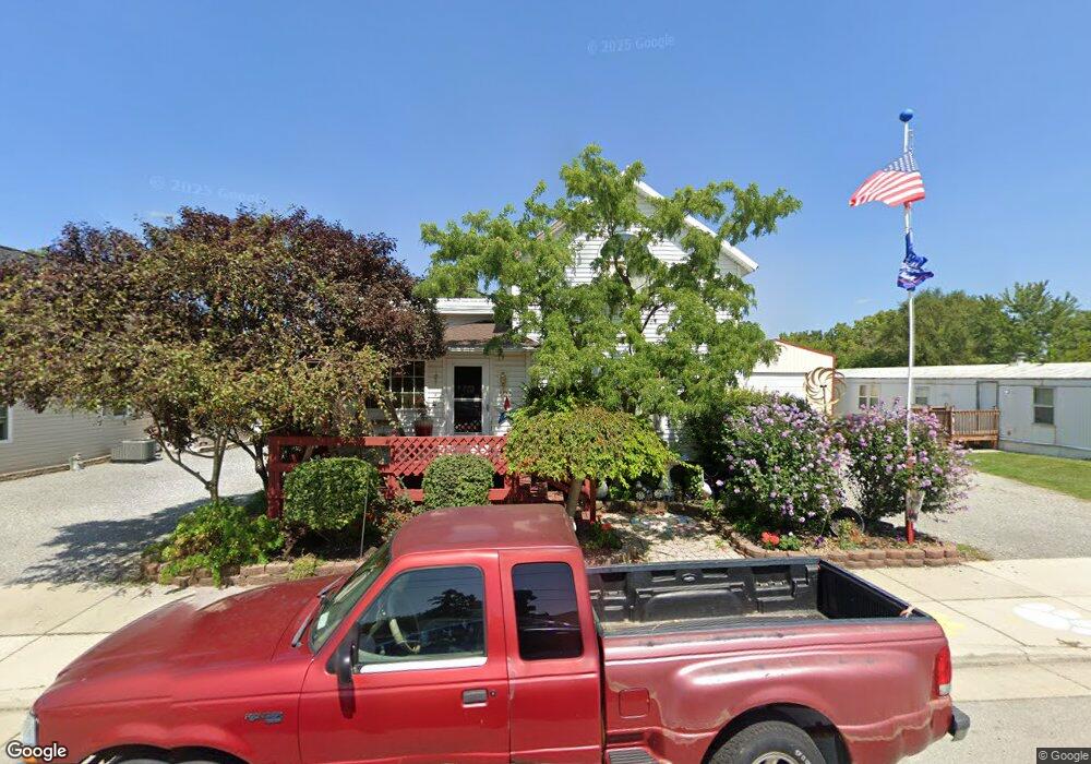
This home is located at 125 E Main St, Cairo, OH 45820 and is currently estimated at $132,776, approximately $108 per square foot. 125 E Main St is a home with nearby schools including Bath Elementary School, Bath Middle School, and Bath High School.
Ownership History
Date
Name
Owned For
Owner Type
Purchase Details
Closed on
Dec 21, 1998
Sold by
A H A Realty Inc
Bought by
Parsons Randall and Parsons Marsha
Current Estimated Value
Home Financials for this Owner
Home Financials are based on the most recent Mortgage that was taken out on this home.
Original Mortgage
$34,125
Outstanding Balance
$10,514
Interest Rate
10.85%
Mortgage Type
New Conventional
Estimated Equity
$122,262
Purchase Details
Closed on
Jun 22, 1993
Sold by
Bowersock Clara Jane
Bought by
A H A Realty Inc
Purchase Details
Closed on
May 28, 1993
Sold by
Cline Leola M
Bought by
Bowersock Clara Jane
Purchase Details
Closed on
Oct 17, 1990
Bought by
Cline Leola M
Create a Home Valuation Report for This Property
The Home Valuation Report is an in-depth analysis detailing your home's value as well as a comparison with similar homes in the area
Purchase History
| Date | Buyer | Sale Price | Title Company |
|---|---|---|---|
| Parsons Randall | $14,500 | -- | |
| A H A Realty Inc | $12,000 | -- | |
| Bowersock Clara Jane | -- | -- | |
| Cline Leola M | -- | -- |
Source: Public Records
Mortgage History
| Date | Status | Borrower | Loan Amount |
|---|---|---|---|
| Open | Parsons Randall | $34,125 |
Source: Public Records
Tax History Compared to Growth
Tax History
| Year | Tax Paid | Tax Assessment Tax Assessment Total Assessment is a certain percentage of the fair market value that is determined by local assessors to be the total taxable value of land and additions on the property. | Land | Improvement |
|---|---|---|---|---|
| 2024 | $2,115 | $30,000 | $3,150 | $26,850 |
| 2023 | $1,873 | $21,280 | $2,240 | $19,040 |
| 2022 | $1,877 | $21,280 | $2,240 | $19,040 |
| 2021 | $1,908 | $21,280 | $2,240 | $19,040 |
| 2020 | $1,806 | $17,470 | $2,140 | $15,330 |
| 2019 | $1,806 | $17,470 | $2,140 | $15,330 |
| 2018 | $1,731 | $17,470 | $2,140 | $15,330 |
| 2017 | $1,676 | $15,130 | $2,140 | $12,990 |
| 2016 | $1,820 | $15,130 | $2,140 | $12,990 |
| 2015 | $1,636 | $15,130 | $2,140 | $12,990 |
| 2014 | $1,636 | $15,860 | $2,000 | $13,860 |
| 2013 | $1,608 | $15,860 | $2,000 | $13,860 |
Source: Public Records
Map
Nearby Homes
- 102 W Main St
- 201 Wall St
- 513 W Main St
- 815 Lutz Rd
- 3270 Bonnieview Dr
- 4050 Brookshore Dr
- 108 Highland Lakes Dr
- 3252 Stewart Rd
- 0 Fraunfelter Unit 307817
- 0 N Eastown Rd Unit 1034495
- 2525 W Lincoln Hwy
- 4619 N Thayer Rd
- 0 N Dixie Hwy Unit 308796
- 0 N Dixie Hwy Unit 300253
- 520 Kenmore St
- 5025 N Cool Rd
- 13347 Ohio 12
- 2718 Carolyn Dr
- 11059 Ottawa Rd
- 105 Watt Ave