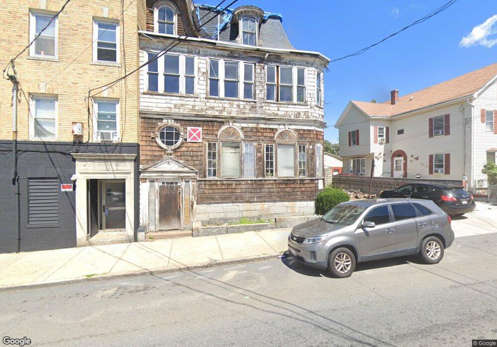
125 Haverhill St Lawrence, MA 01840
Downtown Lawrence NeighborhoodEstimated Value: $352,000 - $394,000
9
Beds
3
Baths
4,672
Sq Ft
$78/Sq Ft
Est. Value
About This Home
This home is located at 125 Haverhill St, Lawrence, MA 01840 and is currently estimated at $366,724, approximately $78 per square foot. 125 Haverhill St is a home located in Essex County with nearby schools including Olive Branch Elementary School, Hawkins Elementary SMART School, and School For Exceptional Studies.
Ownership History
Date
Name
Owned For
Owner Type
Purchase Details
Closed on
Mar 28, 2025
Sold by
Tomaselli Joyce A and Tomaselli Gracemarie R
Bought by
Esperanza Realty Corp
Current Estimated Value
Purchase Details
Closed on
Jun 2, 2017
Sold by
Tomaselli Joyce A
Bought by
Tomaselli Joyce A and Tomaselli Gracemarie
Purchase Details
Closed on
May 3, 2010
Sold by
Tomaselli Joyce A
Bought by
Tomaselli Joyce A Est and Tomaselli
Purchase Details
Closed on
Apr 13, 2007
Sold by
Tomaselli Mary T
Bought by
Tomaselli Joyce A
Create a Home Valuation Report for This Property
The Home Valuation Report is an in-depth analysis detailing your home's value as well as a comparison with similar homes in the area
Home Values in the Area
Average Home Value in this Area
Purchase History
| Date | Buyer | Sale Price | Title Company |
|---|---|---|---|
| Esperanza Realty Corp | $345,000 | None Available | |
| Esperanza Realty Corp | $345,000 | None Available | |
| Tomaselli Joyce A | -- | -- | |
| Tomaselli Joyce A | -- | -- | |
| Tomaselli Joyce A Est | -- | -- | |
| Tomaselli Joyce A Est | -- | -- | |
| Tomaselli Joyce A | -- | -- | |
| Tomaselli Joyce A | -- | -- |
Source: Public Records
Mortgage History
| Date | Status | Borrower | Loan Amount |
|---|---|---|---|
| Previous Owner | Tomaselli Joyce A | $18,000 |
Source: Public Records
Tax History Compared to Growth
Tax History
| Year | Tax Paid | Tax Assessment Tax Assessment Total Assessment is a certain percentage of the fair market value that is determined by local assessors to be the total taxable value of land and additions on the property. | Land | Improvement |
|---|---|---|---|---|
| 2025 | $3,080 | $350,000 | $102,100 | $247,900 |
| 2024 | $3,545 | $383,200 | $107,200 | $276,000 |
| 2023 | $3,680 | $362,200 | $103,500 | $258,700 |
| 2022 | $3,422 | $299,100 | $97,700 | $201,400 |
| 2021 | $3,302 | $269,100 | $97,700 | $171,400 |
| 2020 | $3,141 | $252,700 | $81,400 | $171,300 |
| 2019 | $2,966 | $216,800 | $60,500 | $156,300 |
| 2018 | $2,817 | $196,700 | $54,800 | $141,900 |
| 2017 | $2,588 | $168,700 | $51,900 | $116,800 |
| 2016 | $2,447 | $157,800 | $40,500 | $117,300 |
| 2015 | $2,351 | $155,500 | $40,500 | $115,000 |
Source: Public Records
Map
Nearby Homes
- 89 Newbury St Unit 89B
- 32 Orchard St
- 6 Brook St
- 42 Union St
- 192 Union St
- 65 Brook St
- 11 Lawrence St Unit 606
- 131A Lawrence St Unit 40
- 46 Amesbury St Unit 2B
- 46 Amesbury St Unit 4D
- 100-102 E Haverhill St
- 19-21 Pleasant Terrace
- 24 Bennington St
- 32 Alma St Unit 32
- 7 Stevens Ct
- 52 Howard St
- 35 Kendall St
- 80 Ferry St Unit 80A
- 129-131 Lexington St
- 20 Knox St Unit 43
- 127 E Haverhill St Unit 129
- 121 Haverhill St
- 71 Jackson St
- 83 Jackson St Unit 3
- 83 Jackson St Unit 4
- 83 Jackson St
- 119 E Haverhill St Unit 121
- 126 -128 Haverhill St
- 119 Haverhill St
- 12 Oak St Unit 14
- 117 Haverhill St
- 124 Haverhill St
- 124 Haverhill St Unit 2
- 124 Haverhill St Unit 3
- 80 Jackson St Unit 82
- 72 Jackson St Unit 74
- 118 Haverhill St Unit 120
- 65 Jackson St
- 113 Haverhill St
- 118-120 Haverhill St