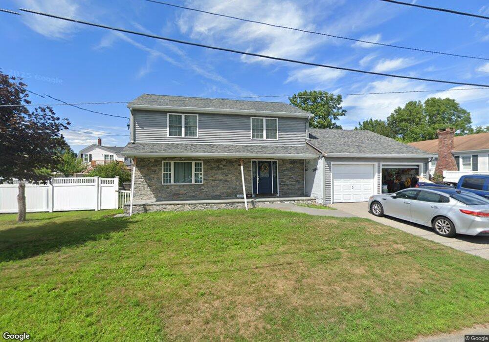
125 Hazard Ave East Providence, RI 02914
Outer East Bay NeighborhoodEstimated Value: $462,000 - $585,000
4
Beds
2
Baths
2,044
Sq Ft
$268/Sq Ft
Est. Value
About This Home
This home is located at 125 Hazard Ave, East Providence, RI 02914 and is currently estimated at $548,769, approximately $268 per square foot. 125 Hazard Ave is a home located in Providence County with nearby schools including East Providence High School, The Gordon School, and St Mary Academy-Bay View.
Ownership History
Date
Name
Owned For
Owner Type
Purchase Details
Closed on
Dec 31, 1997
Sold by
Hazard Philip C and Hazard Julie
Bought by
Smith Susan
Current Estimated Value
Home Financials for this Owner
Home Financials are based on the most recent Mortgage that was taken out on this home.
Original Mortgage
$90,000
Outstanding Balance
$15,065
Interest Rate
7.11%
Mortgage Type
Purchase Money Mortgage
Estimated Equity
$533,704
Create a Home Valuation Report for This Property
The Home Valuation Report is an in-depth analysis detailing your home's value as well as a comparison with similar homes in the area
Home Values in the Area
Average Home Value in this Area
Purchase History
| Date | Buyer | Sale Price | Title Company |
|---|---|---|---|
| Smith Susan | $136,000 | -- | |
| Smith Susan | $136,000 | -- |
Source: Public Records
Mortgage History
| Date | Status | Borrower | Loan Amount |
|---|---|---|---|
| Open | Smith Susan | $90,000 | |
| Closed | Smith Susan | $90,000 |
Source: Public Records
Tax History Compared to Growth
Tax History
| Year | Tax Paid | Tax Assessment Tax Assessment Total Assessment is a certain percentage of the fair market value that is determined by local assessors to be the total taxable value of land and additions on the property. | Land | Improvement |
|---|---|---|---|---|
| 2025 | $7,081 | $541,800 | $130,000 | $411,800 |
| 2024 | $7,207 | $470,100 | $108,400 | $361,700 |
| 2023 | $6,939 | $470,100 | $108,400 | $361,700 |
| 2022 | $7,741 | $354,100 | $61,500 | $292,600 |
| 2021 | $7,613 | $354,100 | $59,400 | $294,700 |
| 2020 | $7,291 | $354,100 | $59,400 | $294,700 |
| 2019 | $7,089 | $354,100 | $59,400 | $294,700 |
| 2018 | $6,372 | $278,500 | $52,100 | $226,400 |
| 2017 | $6,230 | $278,500 | $52,100 | $226,400 |
| 2016 | $6,199 | $278,500 | $52,100 | $226,400 |
| 2015 | $6,635 | $289,100 | $53,600 | $235,500 |
| 2014 | $6,635 | $289,100 | $53,600 | $235,500 |
Source: Public Records
Map
Nearby Homes
- 87 Vincent Ave
- 82 Martin St
- 180 Grassmere Ave
- 34 Ridge Dr
- 1402 S Broadway
- 74 Brookhaven Dr
- 1463 S Broadway
- 93 Crown Ave
- 10 Fairfield Ave
- 10 Kettle Point Ave
- 53 Wampanoag Trail
- 50 Kettle Point Ave Unit 50
- 83 Mountain Ave
- 25 Fairview Ave
- 164 Brightridge Ave
- 25 Ide Ave
- 109 Bliss St
- 108 Bliss St
- 108 Ivan Ave
- 59 Merritt Rd
- 121 Hazard Ave
- 131 Hazard Ave
- 136 Hazard Ave
- 132 Martin St
- 134 Martin St
- 132 Hazard Ave
- 120 Hazard Ave
- 128 Martin St
- 128 Martin St Unit second
- 140 Hazard Ave
- 138 Martin St
- 128 Hazard Ave
- 135 Hazard Ave
- 105 Hazard Ave
- 144 Hazard Ave
- 144 Hazard Ave Unit 2
- 124 Hazard Ave
- 280 Dodge St
- 140 Vincent Ave
- 146 Martin St