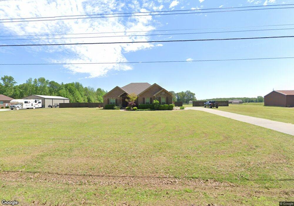
125 Heffner Rd Austin, AR 72007
Estimated Value: $380,904 - $462,000
Studio
2
Baths
2,372
Sq Ft
$179/Sq Ft
Est. Value
About This Home
This home is located at 125 Heffner Rd, Austin, AR 72007 and is currently estimated at $425,226, approximately $179 per square foot. 125 Heffner Rd is a home located in Lonoke County with nearby schools including Stagecoach Elementary School, Cabot Junior High South, and Cabot Middle School South.
Ownership History
Date
Name
Owned For
Owner Type
Purchase Details
Closed on
Mar 31, 2017
Sold by
Faith Enterprises Of Arkansas Inc
Bought by
Bland Katy M
Current Estimated Value
Home Financials for this Owner
Home Financials are based on the most recent Mortgage that was taken out on this home.
Original Mortgage
$262,163
Outstanding Balance
$215,563
Interest Rate
3.87%
Mortgage Type
FHA
Estimated Equity
$209,663
Create a Home Valuation Report for This Property
The Home Valuation Report is an in-depth analysis detailing your home's value as well as a comparison with similar homes in the area
Purchase History
| Date | Buyer | Sale Price | Title Company |
|---|---|---|---|
| Bland Katy M | $267,000 | Waco Title Company |
Source: Public Records
Mortgage History
| Date | Status | Borrower | Loan Amount |
|---|---|---|---|
| Open | Bland Katy M | $262,163 |
Source: Public Records
Tax History
| Year | Tax Paid | Tax Assessment Tax Assessment Total Assessment is a certain percentage of the fair market value that is determined by local assessors to be the total taxable value of land and additions on the property. | Land | Improvement |
|---|---|---|---|---|
| 2025 | $2,053 | $53,000 | $1,790 | $51,210 |
| 2024 | $2,053 | $53,000 | $1,790 | $51,210 |
| 2023 | $2,053 | $53,000 | $1,790 | $51,210 |
| 2022 | $2,010 | $53,000 | $1,790 | $51,210 |
| 2021 | $1,904 | $53,000 | $1,790 | $51,210 |
| 2020 | $1,797 | $46,350 | $1,790 | $44,560 |
| 2019 | $1,797 | $46,350 | $1,790 | $44,560 |
| 2018 | $1,777 | $46,350 | $1,790 | $44,560 |
| 2017 | $3 | $80 | $80 | $0 |
| 2016 | $4 | $80 | $80 | $0 |
Source: Public Records
Map
Nearby Homes
- 250 Saddle Brook Cove
- 160 Oak Grove Rd
- 152 Whitetail Ridge Rd
- 164 Whitetail Ridge Rd
- 236 Bear Dr
- 344 Mcfadden Rd
- 6622 Hwy
- 234 Candy Ln
- 1443 Oak Grove Rd
- 882 Patty Rd
- 215 & 225 Lemay Loop
- 635 S Oak Grove Rd
- 10340 Highway 31 N
- 182 Harvest Ln
- 288 Woodlawn Rd
- 102 Bethlehem Rd
- 10340 Hwy 31 N
- 373 Heather Loop
- Tract 3 Bethlehem Rd
- Tract 2 Bethlehem Rd
- 155 Heffner Rd
- 55 Heffner Rd
- 99 Heffner Rd
- 185 Heffner Rd
- 25 Saddlebrook Rd
- 25 Saddlebrook Cir
- 55 Saddlebrook Rd
- 25 Saddle Brook Cove
- Lot 37 Saddle Brook Cir
- 105 Saddlebrook Rd
- Lot 28 Saddle Brook Cir
- 00 Oak Grove Rd
- 0 Lagable Crest Unit 21002326
- 0 Lagable Crest Unit 20038539
- 145 Saddlebrook Rd
- 5662 Highway 321 E
- 5535 Highway 321 E
- 5535 Highway 321 E Unit 61 Oak Grove Rd
- 5535 Highway 321 E Unit 61 Oak Grove Rd
- 5535 Highway 321 E
Your Personal Tour Guide
Ask me questions while you tour the home.