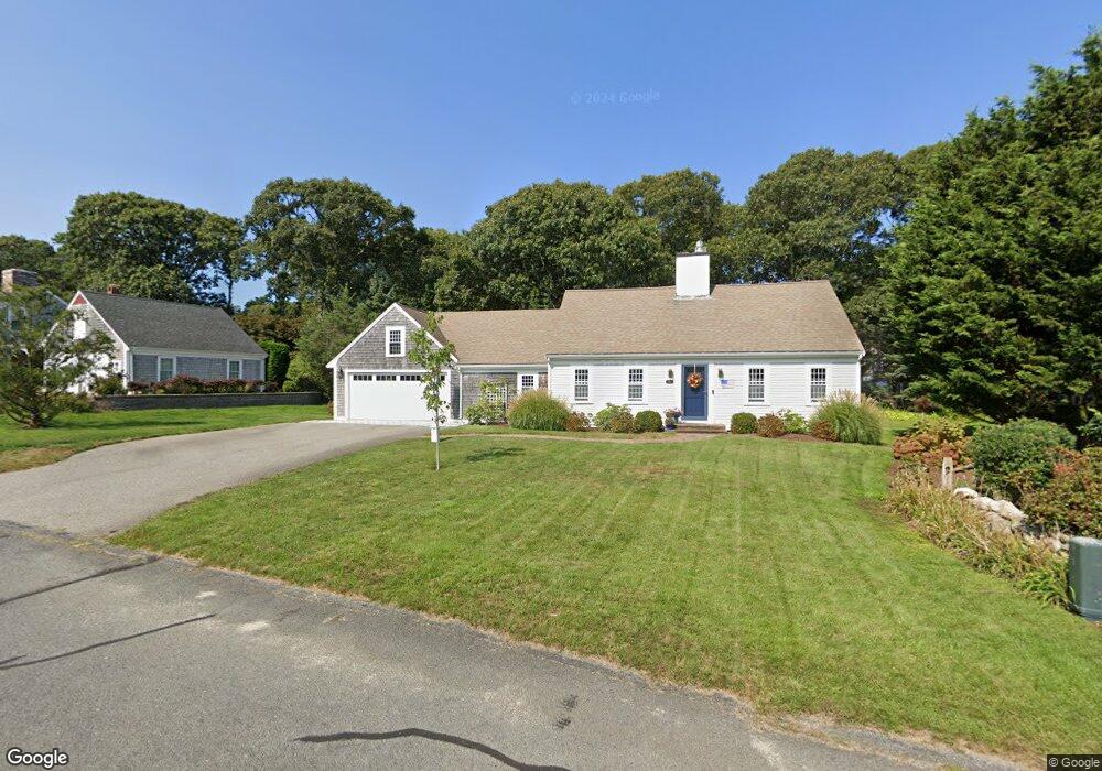
125 Homers Dock Rd Yarmouth Port, MA 02675
Yarmouth Port NeighborhoodEstimated Value: $886,005 - $1,028,000
3
Beds
2
Baths
1,775
Sq Ft
$539/Sq Ft
Est. Value
About This Home
This home is located at 125 Homers Dock Rd, Yarmouth Port, MA 02675 and is currently estimated at $956,251, approximately $538 per square foot. 125 Homers Dock Rd is a home located in Barnstable County with nearby schools including Dennis-Yarmouth Regional High School and Trinity Christian Academy of Cape Cod.
Ownership History
Date
Name
Owned For
Owner Type
Purchase Details
Closed on
Apr 11, 2005
Sold by
Runyon Lynn J
Bought by
Martin Joseph M and Martin Linda L
Current Estimated Value
Purchase Details
Closed on
Dec 10, 1999
Sold by
Macklin Marcia R
Bought by
Runyon Lynn J
Purchase Details
Closed on
Aug 24, 1989
Sold by
Nickerson Douglas E
Bought by
Macklin Marcia R
Create a Home Valuation Report for This Property
The Home Valuation Report is an in-depth analysis detailing your home's value as well as a comparison with similar homes in the area
Home Values in the Area
Average Home Value in this Area
Purchase History
| Date | Buyer | Sale Price | Title Company |
|---|---|---|---|
| Martin Joseph M | $545,000 | -- | |
| Runyon Lynn J | $265,000 | -- | |
| Macklin Marcia R | $198,000 | -- |
Source: Public Records
Mortgage History
| Date | Status | Borrower | Loan Amount |
|---|---|---|---|
| Open | Macklin Marcia R | $346,282 | |
| Closed | Macklin Marcia R | $358,000 | |
| Previous Owner | Macklin Marcia R | $25,000 |
Source: Public Records
Tax History Compared to Growth
Tax History
| Year | Tax Paid | Tax Assessment Tax Assessment Total Assessment is a certain percentage of the fair market value that is determined by local assessors to be the total taxable value of land and additions on the property. | Land | Improvement |
|---|---|---|---|---|
| 2025 | $5,799 | $819,000 | $225,900 | $593,100 |
| 2024 | $5,376 | $728,500 | $196,500 | $532,000 |
| 2023 | $5,440 | $670,800 | $185,200 | $485,600 |
| 2022 | $5,712 | $622,200 | $210,300 | $411,900 |
| 2021 | $5,523 | $577,700 | $200,700 | $377,000 |
| 2020 | $5,316 | $531,600 | $200,200 | $331,400 |
| 2019 | $4,962 | $491,300 | $200,200 | $291,100 |
| 2018 | $4,964 | $482,400 | $191,300 | $291,100 |
| 2017 | $4,619 | $461,000 | $191,300 | $269,700 |
| 2016 | $4,601 | $461,000 | $191,300 | $269,700 |
| 2015 | $4,451 | $443,300 | $191,300 | $252,000 |
Source: Public Records
Map
Nearby Homes
- 30 W Woods
- 30 W Woods Cir Unit 30
- 2 Pine Grove
- 23 Dauphine Dr
- 158 Kates Path
- 25 Oak Glen Village Unit 25
- 25 Oak Glen
- 28 Oak Glen
- 19 John Hall Cartway Unit E
- 50 John Hall Cartway
- 50 John Hall Cartway Unit 50
- 19 John Halls Cartpath Village Unit E
- 42 John Hall Cartway Unit 42
- 228 Kates Path
- 17 Kates Path Unit A
- 64 Kates Path
- 17 Nottingham Dr
- 24 Minnetuxet Way
- 21 Boxwood Cir
- 49 Rodoalph's Way
- 119 Homers Dock Rd
- 9 Pheasant Cove Cir
- 15 Whippoorwill Ln
- 7 Whippoorwill Ln
- 19 Pheasant Cove Cir
- 23 Whippoorwill Ln
- 120 Homers Dock Rd
- 2 Gaslight Dr
- 10 Gaslight Dr
- 14 Pheasant Cove Cir
- 8 Pheasant Cove Cir
- 1 Whippoorwill Ln
- 110 Homers Dock Rd
- 20 Whippoorwill Ln
- 2 Pheasant Cove Cir
- 2 Shell Dr
- 30 Pheasant Cove Cir
- 9 Gaslight Dr
- 1 Gaslight Dr
- 9 Loch Rannoch Way