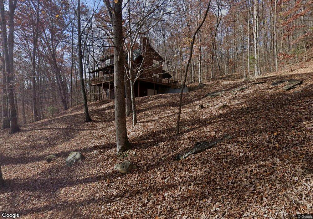
125 Locust Rd Blairsville, GA 30512
Estimated Value: $375,782 - $446,000
3
Beds
2
Baths
1,464
Sq Ft
$272/Sq Ft
Est. Value
About This Home
This home is located at 125 Locust Rd, Blairsville, GA 30512 and is currently estimated at $398,696, approximately $272 per square foot. 125 Locust Rd is a home with nearby schools including Union County Primary School, Union County Elementary School, and Union County Middle School.
Ownership History
Date
Name
Owned For
Owner Type
Purchase Details
Closed on
Jul 24, 2025
Sold by
Rosenthal Steven J
Bought by
Rosenthal Family Trust and Rosenthal Lisa Tr
Current Estimated Value
Purchase Details
Closed on
Jan 21, 2010
Sold by
Allen Ruenelle H
Bought by
United Community Bank
Purchase Details
Closed on
Apr 25, 2005
Sold by
D & B Development Llc
Bought by
Rosenthal Steven J and Rosenthal Lisa
Home Financials for this Owner
Home Financials are based on the most recent Mortgage that was taken out on this home.
Original Mortgage
$139,600
Interest Rate
5.99%
Mortgage Type
New Conventional
Purchase Details
Closed on
Mar 12, 2004
Sold by
Mid Ohio Securities Custodian
Bought by
D & B Development Llc
Purchase Details
Closed on
Jun 26, 2002
Sold by
Lecroy Mildred H
Bought by
Mid Ohio Securities Custodian
Purchase Details
Closed on
Oct 18, 1996
Bought by
Lecroy Mildred H
Purchase Details
Closed on
Aug 1, 1995
Bought by
Blue Ridge Mtn Estat
Create a Home Valuation Report for This Property
The Home Valuation Report is an in-depth analysis detailing your home's value as well as a comparison with similar homes in the area
Home Values in the Area
Average Home Value in this Area
Purchase History
| Date | Buyer | Sale Price | Title Company |
|---|---|---|---|
| Rosenthal Family Trust | -- | -- | |
| United Community Bank | -- | -- | |
| Rosenthal Steven J | $174,500 | -- | |
| D & B Development Llc | $26,000 | -- | |
| Mid Ohio Securities Custodian | $13,000 | -- | |
| Lecroy Mildred H | -- | -- | |
| Blue Ridge Mtn Estat | -- | -- |
Source: Public Records
Mortgage History
| Date | Status | Borrower | Loan Amount |
|---|---|---|---|
| Previous Owner | Rosenthal Steven J | $139,600 |
Source: Public Records
Tax History Compared to Growth
Tax History
| Year | Tax Paid | Tax Assessment Tax Assessment Total Assessment is a certain percentage of the fair market value that is determined by local assessors to be the total taxable value of land and additions on the property. | Land | Improvement |
|---|---|---|---|---|
| 2024 | $1,626 | $137,680 | $16,600 | $121,080 |
| 2023 | $1,789 | $134,360 | $16,600 | $117,760 |
| 2022 | $1,452 | $109,080 | $16,600 | $92,480 |
| 2021 | $1,373 | $87,120 | $12,360 | $74,760 |
| 2020 | $1,527 | $80,717 | $29,376 | $51,341 |
| 2019 | $1,444 | $80,717 | $29,376 | $51,341 |
| 2018 | $1,418 | $80,717 | $29,376 | $51,341 |
| 2017 | $1,126 | $64,091 | $12,750 | $51,341 |
| 2016 | $1,126 | $64,091 | $12,750 | $51,341 |
| 2015 | $1,136 | $64,091 | $12,750 | $51,341 |
| 2013 | -- | $64,090 | $12,750 | $51,340 |
Source: Public Records
Map
Nearby Homes
- 303 Butternut Creek Rd
- 64 Town View Cir
- 3 A Moss Cove Rd
- 9.36A Hwy 515 Thomas Cir
- 43 Diane St
- 534 Doc Thomas Ridge Rd
- L 48C Byron St
- 1837 Deep South Farm Rd
- 34 Travadens Way
- 315 Dosier Dr
- 8 Firefly Ridge Rd
- 198 Butternut Ln
- 5.7 ac Butternut Grove Rd
- LOT 34 the Overlook at Young Harris
- Lot 35 Overlook Dr
- Lot #5 Overlook Dr
- 5 Overlook Dr
- 8 Overlook Dr
- LOT 40 Overlook Dr
- Lot #40 Overlook Dr
- 1930 Locust Dr
- 69 Locust Dr
- 52 Locust Rd
- 588 Smokey Estates Rd
- 558 Smokey Estates Rd
- 558 Smokey Estates Rd Unit 14B
- 632 Smokey Estates Rd
- 0 Smokey Estates Rd Unit 7295379
- 0 Smokey Estates Rd
- 671 Smokey Estates Rd
- 516 Smokey Estates Rd
- 69 Flakes Ln
- 563 Smokey Estates Rd
- Lot12 Hemlock Ridge Subd
- Lot28 Hemlock Dr
- 635 Smokey Estates Rd
- 23 Locust Rd
- 601 Smokey Estates Rd
- 1061 Madeline Way
- 1009 Madeline Way