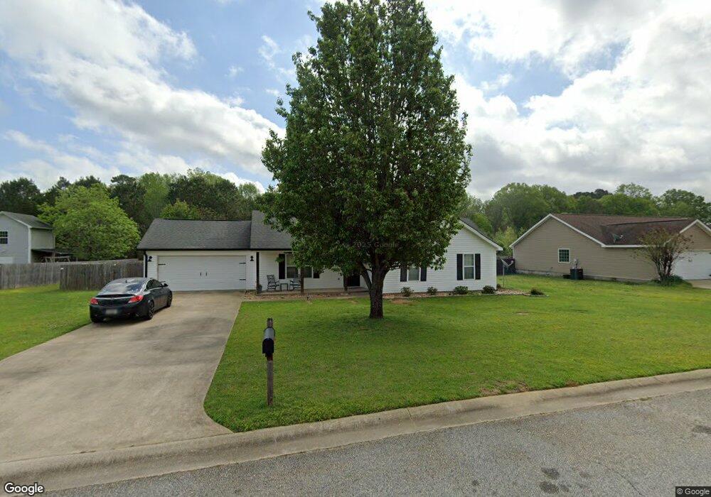
125 Lonesome Doe Cir Kathleen, GA 31047
Estimated Value: $239,000 - $247,000
3
Beds
2
Baths
1,534
Sq Ft
$159/Sq Ft
Est. Value
About This Home
This home is located at 125 Lonesome Doe Cir, Kathleen, GA 31047 and is currently estimated at $243,783, approximately $158 per square foot. 125 Lonesome Doe Cir is a home located in Houston County with nearby schools including Matthew Arthur Elementary School, Perry Middle School, and Veterans High School.
Ownership History
Date
Name
Owned For
Owner Type
Purchase Details
Closed on
Mar 27, 2020
Sold by
Hunnicutt Malcom C and Hunnicutt Cheryl R
Bought by
Johnson Zachary and Johnson Logan
Current Estimated Value
Home Financials for this Owner
Home Financials are based on the most recent Mortgage that was taken out on this home.
Original Mortgage
$147,283
Outstanding Balance
$130,475
Interest Rate
3.4%
Mortgage Type
FHA
Estimated Equity
$113,308
Purchase Details
Closed on
Apr 24, 2006
Sold by
Malcolm C Danielle
Bought by
Malcolm C Danielle and Hunnicutt Cheryl R
Home Financials for this Owner
Home Financials are based on the most recent Mortgage that was taken out on this home.
Original Mortgage
$74,600
Interest Rate
6.08%
Mortgage Type
New Conventional
Purchase Details
Closed on
Feb 24, 2006
Sold by
Smithfield Chase Developers Inc
Bought by
Malcom C Danielle
Home Financials for this Owner
Home Financials are based on the most recent Mortgage that was taken out on this home.
Original Mortgage
$74,600
Interest Rate
6.08%
Mortgage Type
New Conventional
Create a Home Valuation Report for This Property
The Home Valuation Report is an in-depth analysis detailing your home's value as well as a comparison with similar homes in the area
Home Values in the Area
Average Home Value in this Area
Purchase History
| Date | Buyer | Sale Price | Title Company |
|---|---|---|---|
| Johnson Zachary | $150,000 | None Available | |
| Malcolm C Danielle | -- | None Available | |
| Malcom C Danielle | $124,600 | None Available |
Source: Public Records
Mortgage History
| Date | Status | Borrower | Loan Amount |
|---|---|---|---|
| Open | Johnson Zachary | $147,283 | |
| Previous Owner | Malcom C Danielle | $74,600 |
Source: Public Records
Tax History Compared to Growth
Tax History
| Year | Tax Paid | Tax Assessment Tax Assessment Total Assessment is a certain percentage of the fair market value that is determined by local assessors to be the total taxable value of land and additions on the property. | Land | Improvement |
|---|---|---|---|---|
| 2024 | $1,671 | $69,840 | $12,000 | $57,840 |
| 2023 | $1,693 | $70,040 | $12,000 | $58,040 |
| 2022 | $1,549 | $64,080 | $12,000 | $52,080 |
| 2021 | $1,427 | $58,720 | $12,000 | $46,720 |
| 2020 | $1,336 | $56,720 | $12,000 | $44,720 |
| 2019 | $1,160 | $49,520 | $12,000 | $37,520 |
| 2018 | $1,160 | $49,520 | $12,000 | $37,520 |
| 2017 | $1,161 | $49,520 | $12,000 | $37,520 |
| 2016 | $1,163 | $49,520 | $12,000 | $37,520 |
| 2015 | $1,165 | $49,520 | $12,000 | $37,520 |
| 2014 | -- | $49,520 | $12,000 | $37,520 |
| 2013 | -- | $49,520 | $12,000 | $37,520 |
Source: Public Records
Map
Nearby Homes
- 106 Planter's Ridge Trail
- 531 Bristleleaf Path
- 529 Bristleleaf Path
- 521 Bristleleaf Path
- 202 Emberwood Way
- 525 Bristleleaf Path
- 533 Bristleleaf Path
- 523 Bristleleaf Path
- 315 Willowbrook Ln
- 109 Black Birch Ln
- 101 Black Birch Ln
- 205 Emberwood Way
- 102 Black Birch Ln
- 105 Black Birch Ln
- 321 Willowbrook Ln
- 313 Willowbrook Ln
- 319 Willowbrook Run
- 323 Willowbrook Ln
- 107 Black Birch Ln
- 605 Bristleleaf Path
- 125 Lonesome Doe Cir
- 127 Lonesome Doe Cir
- 123 Lonesome Doe Cir
- 116 Lonesome Doe Cir
- 114 Lonesome Doe Cir
- 121 Lonesome Doe Cir
- 129 Lonesome Doe Cir
- 118 Lonesome Doe Cir
- 131 Lonesome Doe Cir
- 0 Lonesome Doe Cir Unit 8412267
- 0 Lonesome Doe Cir Unit 8291903
- 0 Lonesome Doe Cir
- 133 Lonesome Doe Cir
- 303 Sambar Way
- 119 Lonesome Doe Cir
- 112 Lonesome Doe Cir
- 135 Lonesome Doe Cir
- 120 Lonesome Doe Cir
- 305 Sambar Way
- 110 Lonesome Doe Cir