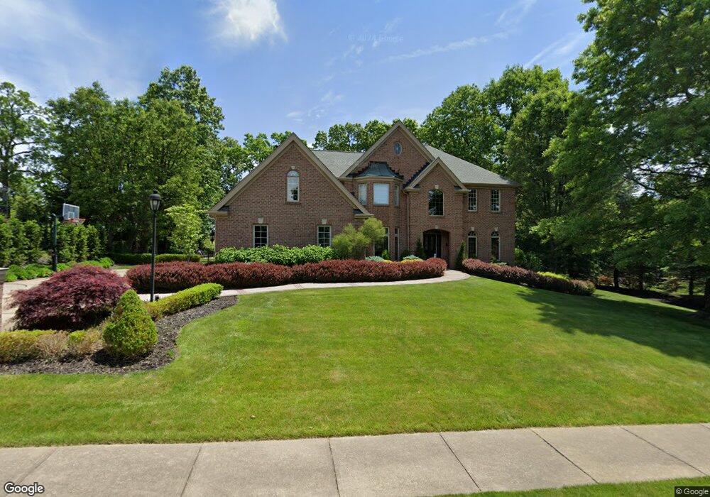
125 Lyndhurst Cir Wexford, PA 15090
Pine Township NeighborhoodEstimated Value: $999,000 - $1,152,000
4
Beds
5
Baths
4,770
Sq Ft
$227/Sq Ft
Est. Value
About This Home
This home is located at 125 Lyndhurst Cir, Wexford, PA 15090 and is currently estimated at $1,085,072, approximately $227 per square foot. 125 Lyndhurst Cir is a home located in Allegheny County with nearby schools including Wexford Elementary School, Eden Hall Upper Elementary, and Pine-Richland Middle School.
Ownership History
Date
Name
Owned For
Owner Type
Purchase Details
Closed on
May 21, 2021
Sold by
William J Leone J and William Marny G
Bought by
Eichenlaub David M and Eichenlaub Nancy M
Current Estimated Value
Purchase Details
Closed on
Dec 20, 2017
Sold by
Leone William J and Leone Marny G
Bought by
Leone William J and Leone Marny G
Purchase Details
Closed on
May 29, 2002
Sold by
Battin William M and Battin Maureen S
Bought by
Leone William J and Leone Marny G
Create a Home Valuation Report for This Property
The Home Valuation Report is an in-depth analysis detailing your home's value as well as a comparison with similar homes in the area
Home Values in the Area
Average Home Value in this Area
Purchase History
| Date | Buyer | Sale Price | Title Company |
|---|---|---|---|
| Eichenlaub David M | $800,000 | -- | |
| Eichenlaub David M | $800,000 | None Available | |
| Leone William J | -- | None Available | |
| Leone William J | $630,000 | -- |
Source: Public Records
Tax History Compared to Growth
Tax History
| Year | Tax Paid | Tax Assessment Tax Assessment Total Assessment is a certain percentage of the fair market value that is determined by local assessors to be the total taxable value of land and additions on the property. | Land | Improvement |
|---|---|---|---|---|
| 2025 | $14,943 | $590,300 | $100,100 | $490,200 |
| 2024 | $14,943 | $590,300 | $100,100 | $490,200 |
| 2023 | $17,156 | $677,700 | $100,100 | $577,600 |
| 2022 | $17,156 | $677,700 | $100,100 | $577,600 |
| 2021 | $17,146 | $677,700 | $100,100 | $577,600 |
| 2020 | $17,156 | $677,700 | $100,100 | $577,600 |
| 2019 | $17,156 | $677,700 | $100,100 | $577,600 |
| 2018 | $3,206 | $677,700 | $100,100 | $577,600 |
| 2017 | $16,899 | $677,700 | $100,100 | $577,600 |
| 2016 | $3,206 | $677,700 | $100,100 | $577,600 |
| 2015 | $3,206 | $677,700 | $100,100 | $577,600 |
| 2014 | $16,902 | $677,700 | $100,100 | $577,600 |
Source: Public Records
Map
Nearby Homes
- 115 Lyndhurst Cir
- 890 Pearce Mill Rd
- 120 Hill Rd
- 210 Scotch Pine Ct
- 253 Whetherburn Dr
- 805 Chapel Hill Ct
- 532 Salem Heights Dr
- 114 Kestler Dr
- 106 Kestler Dr
- 124 Fox Meadow Dr
- 305 Ivy Dr
- 602 Fairgate Dr
- 190 S Chapel Dr
- 429 Fox Meadow Dr
- 411 Fairgate Dr
- 10998 Babcock Blvd
- 503 Cambridge Ct
- 947 Park Plaza
- 307 Georgetowne Ct
- Aspen Plan at Pine Valley Estates
- 123 Lyndhurst Cir
- 120 Lyndhurst Cir
- 122 Lyndhurst Cir
- 121 Lyndhurst Cir
- 124 Lyndhurst Cir
- 118 Lyndhurst Cir
- 116 Lyndhurst Cir
- 119 Lyndhurst Cir
- 114 Lyndhurst Cir
- 117 Lyndhurst Cir
- 961 Pearce Mill Rd
- 112 Lyndhurst Cir
- 112 Lyndhurst Cr
- 961 Pearce Mill Rd
- 3101 Wexford Rd
- 113 Lyndhurst Cir
- 110 Lyndhurst Cir
- 111 Lyndhurst Cir
- 108 Lyndhurst Cir
- AR Pond Pearce Mill Rd