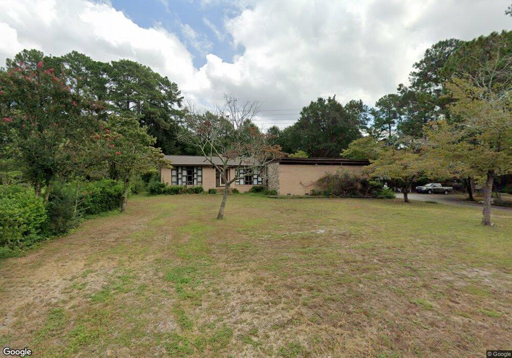
125 Manning Dr West Columbia, SC 29169
Estimated Value: $306,000 - $375,000
3
Beds
2
Baths
2,624
Sq Ft
$132/Sq Ft
Est. Value
About This Home
This home is located at 125 Manning Dr, West Columbia, SC 29169 and is currently estimated at $347,055, approximately $132 per square foot. 125 Manning Dr is a home located in Lexington County with nearby schools including Riverbank Elementary, Cyril B. Busbee Creative Arts Academy, and Brookland-Cayce High School.
Ownership History
Date
Name
Owned For
Owner Type
Purchase Details
Closed on
Jul 24, 2025
Sold by
Lynch Fowler Doris
Bought by
Fowler Eric L and Fowler Allison C
Current Estimated Value
Purchase Details
Closed on
Nov 12, 2021
Sold by
Fowler Doris L and Estate Of Eric Lindsey Fowler
Bought by
Fowler Doris L
Purchase Details
Closed on
Oct 15, 2021
Sold by
Fowler Doris L and Estate Of Eric Lindsey Fowler
Bought by
Fowler Doris L
Purchase Details
Closed on
Aug 26, 2004
Sold by
Fowler Eric L
Bought by
Fowler Doris L
Create a Home Valuation Report for This Property
The Home Valuation Report is an in-depth analysis detailing your home's value as well as a comparison with similar homes in the area
Home Values in the Area
Average Home Value in this Area
Purchase History
| Date | Buyer | Sale Price | Title Company |
|---|---|---|---|
| Fowler Eric L | -- | None Listed On Document | |
| Fowler Doris L | -- | None Available | |
| Fowler Doris L | -- | None Available | |
| Fowler Doris L | -- | -- | |
| Fowler Doris L | -- | -- |
Source: Public Records
Tax History Compared to Growth
Tax History
| Year | Tax Paid | Tax Assessment Tax Assessment Total Assessment is a certain percentage of the fair market value that is determined by local assessors to be the total taxable value of land and additions on the property. | Land | Improvement |
|---|---|---|---|---|
| 2024 | $922 | $7,435 | $1,600 | $5,835 |
| 2023 | $922 | $7,435 | $1,600 | $5,835 |
| 2022 | $942 | $7,435 | $1,600 | $5,835 |
| 2020 | $898 | $7,435 | $1,600 | $5,835 |
| 2019 | $875 | $7,212 | $1,752 | $5,460 |
| 2018 | $889 | $7,212 | $1,752 | $5,460 |
| 2017 | $843 | $7,212 | $1,752 | $5,460 |
| 2016 | $877 | $7,209 | $1,752 | $5,457 |
| 2014 | $686 | $7,471 | $1,750 | $5,721 |
| 2013 | -- | $7,470 | $1,750 | $5,720 |
Source: Public Records
Map
Nearby Homes
- 212 Alexandria St
- 1802 D Ave
- 309 Hammond Ave
- 116 Silver Run Place
- 135 Silver Run Place
- 224 17th St
- 1734 C Ave
- 339 Gum Swamp Trail
- 1608 Crapps Ave
- 349 Gum Swamp Trail
- 1628 C Ave
- 207 Woodhaven Dr
- 215 Sandel Ln
- 1610 D Ave
- 2004 Dew Ave
- 1452 C Ave
- 153 Cavendish Dr
- 151 Cavendish Dr
- 157 Cavendish Dr
- 415 Graham St
- 127 Manning Dr
- 123 Manning Dr
- 126 Manning Dr
- 130 Manning Dr
- 124 Manning Dr
- 121 Manning Dr
- 138 Manning Dr
- 125 Carlin Dr
- 153 Alexandria St
- 120 Manning Dr
- 157 Alexandria St
- 144 Carlin Dr
- 147 Alexandria St
- 159 Alexandria St
- 2021 Merry Dr
- 163 Alexandria St
- 110 Carlin Dr
- 139 Alexandria St
- 109 Manning Dr
- 135 Alexandria St Unit A