Estimated Value: $909,000 - $2,140,000
3
Beds
2
Baths
1,400
Sq Ft
$1,051/Sq Ft
Est. Value
About This Home
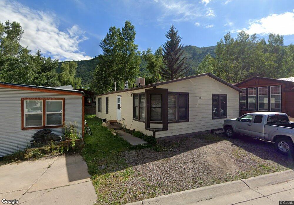
This home is located at 125 Maple Ln, Aspen, CO 81611 and is currently estimated at $1,471,650, approximately $1,051 per square foot. 125 Maple Ln is a home located in Pitkin County with nearby schools including Aspen Elementary School, Aspen Middle School, and Aspen High School.
Ownership History
Date
Name
Owned For
Owner Type
Purchase Details
Closed on
Jun 27, 2023
Sold by
John J Cain Trust
Bought by
Decarlo Mark and Eastwood Todd
Current Estimated Value
Home Financials for this Owner
Home Financials are based on the most recent Mortgage that was taken out on this home.
Original Mortgage
$720,000
Outstanding Balance
$699,222
Interest Rate
6.79%
Mortgage Type
New Conventional
Estimated Equity
$772,428
Purchase Details
Closed on
Sep 29, 2000
Bought by
Cain John J Trust
Create a Home Valuation Report for This Property
The Home Valuation Report is an in-depth analysis detailing your home's value as well as a comparison with similar homes in the area
Home Values in the Area
Average Home Value in this Area
Purchase History
| Date | Buyer | Sale Price | Title Company |
|---|---|---|---|
| Decarlo Mark | $900,000 | Land Title | |
| Cain John J Trust | -- | -- |
Source: Public Records
Mortgage History
| Date | Status | Borrower | Loan Amount |
|---|---|---|---|
| Open | Decarlo Mark | $720,000 |
Source: Public Records
Tax History
| Year | Tax Paid | Tax Assessment Tax Assessment Total Assessment is a certain percentage of the fair market value that is determined by local assessors to be the total taxable value of land and additions on the property. | Land | Improvement |
|---|---|---|---|---|
| 2025 | $3,133 | $84,720 | $53,130 | $31,590 |
| 2024 | $3,133 | $82,370 | $51,300 | $31,070 |
| 2023 | $2,708 | $85,870 | $53,490 | $32,380 |
| 2022 | $2,188 | $59,670 | $43,440 | $16,230 |
| 2021 | $2,178 | $61,390 | $44,690 | $16,700 |
| 2020 | $1,653 | $46,270 | $33,610 | $12,660 |
| 2019 | $1,653 | $46,270 | $33,610 | $12,660 |
| 2018 | $1,492 | $46,580 | $33,840 | $12,740 |
| 2017 | $1,317 | $43,160 | $32,400 | $10,760 |
| 2016 | $1,490 | $45,870 | $35,820 | $10,050 |
| 2015 | $1,470 | $45,870 | $35,820 | $10,050 |
| 2014 | $1,502 | $44,780 | $35,820 | $8,960 |
Source: Public Records
Map
Nearby Homes
- 227 Cottonwood Ln Unit 227
- 117 Neale Ave
- 306 Oak Ln
- 425 Park Cir Unit A2
- 515 Park Cir
- 534 & 536 Spruce St
- 523 Walnut St Unit A
- 990 E Hopkins Ave
- 566 Race St
- 322 Park Ave Unit 1
- 322 Park Ave Unit 2
- 800 E Hopkins Ave Unit A3
- 800 E Hopkins Ave Unit A1
- 935 E Hopkins Ave
- 935 E Hopkins Ave Unit 4
- 725 E Main St Unit 309
- 1041 Vine St Unit 1041
- 326 Midland Ave Unit 302
- 326 Midland Ave Unit 308
- 326 Midland Ave Unit 306
- 127 Maple Ln Unit 127
- 123 Maple Ln Unit 123
- 226 Cottonwood Ln Unit 226
- 224 Cottonwood Ln Unit 224
- 129 Maple Ln Unit 129
- 121 Maple Ln Unit 121
- 228 Cottonwood Ln Unit 228
- 222 Cottonwood Ln Unit 222
- 124 Maple Ln Unit 124
- 122 Maple Ln Unit 122
- 126 Maple Ln Unit 126
- 119 Maple Ln Unit 119
- 220 Cottonwood Ln Unit 220
- 118 Maple Ln Unit 118
- 130 Maple Ln Unit 130
- 117 Maple Ln
- 142 Maple Ln
- 225 Cottonwood Ln Unit 225
- 138 Maple Ln
- 140 Maple Ln Unit 140
Your Personal Tour Guide
Ask me questions while you tour the home.