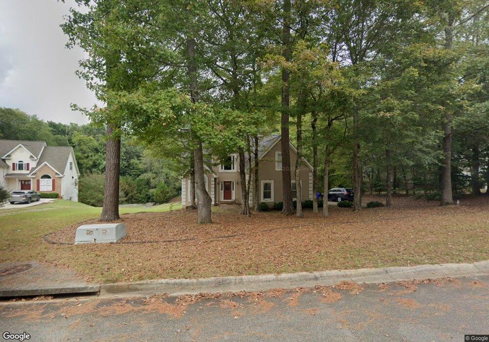
125 Michael Ct Fayetteville, GA 30215
Estimated Value: $367,000 - $394,000
--
Bed
--
Bath
2,017
Sq Ft
$190/Sq Ft
Est. Value
About This Home
This home is located at 125 Michael Ct, Fayetteville, GA 30215 and is currently estimated at $382,598, approximately $189 per square foot. 125 Michael Ct is a home located in Fayette County with nearby schools including Cleveland Elementary School, Bennett's Mill Middle School, and Fayette County High School.
Ownership History
Date
Name
Owned For
Owner Type
Purchase Details
Closed on
Aug 7, 1998
Sold by
Reese Thomas D
Bought by
Norman Neil G and Norman Jeanette R
Current Estimated Value
Home Financials for this Owner
Home Financials are based on the most recent Mortgage that was taken out on this home.
Original Mortgage
$112,625
Outstanding Balance
$23,577
Interest Rate
6.96%
Mortgage Type
New Conventional
Estimated Equity
$359,021
Create a Home Valuation Report for This Property
The Home Valuation Report is an in-depth analysis detailing your home's value as well as a comparison with similar homes in the area
Home Values in the Area
Average Home Value in this Area
Purchase History
| Date | Buyer | Sale Price | Title Company |
|---|---|---|---|
| Norman Neil G | $112,500 | -- |
Source: Public Records
Mortgage History
| Date | Status | Borrower | Loan Amount |
|---|---|---|---|
| Open | Norman Neil G | $112,625 |
Source: Public Records
Tax History Compared to Growth
Tax History
| Year | Tax Paid | Tax Assessment Tax Assessment Total Assessment is a certain percentage of the fair market value that is determined by local assessors to be the total taxable value of land and additions on the property. | Land | Improvement |
|---|---|---|---|---|
| 2024 | $3,443 | $156,708 | $22,000 | $134,708 |
| 2023 | $2,926 | $150,120 | $22,000 | $128,120 |
| 2022 | $3,163 | $129,760 | $22,000 | $107,760 |
| 2021 | $2,839 | $102,160 | $22,000 | $80,160 |
| 2020 | $2,556 | $84,720 | $9,600 | $75,120 |
| 2019 | $2,944 | $96,320 | $9,600 | $86,720 |
| 2018 | $2,771 | $89,840 | $9,600 | $80,240 |
| 2017 | $2,474 | $84,920 | $9,600 | $75,320 |
| 2016 | $1,931 | $65,400 | $9,600 | $55,800 |
| 2015 | $1,812 | $60,480 | $9,600 | $50,880 |
| 2014 | $1,685 | $55,440 | $9,600 | $45,840 |
| 2013 | -- | $55,440 | $0 | $0 |
Source: Public Records
Map
Nearby Homes
- 140 Rockglen Ct
- 155 Cottage Cir
- 0 Hwy 54 West of Yorktown Dr Unit 10463188
- 140 Ridgecrest Dr Unit 2
- 155 Mine Run
- 322 Hambrick Park
- 230 Hidden Brook Trail
- 220 Rehobeth Way
- 265 Rehobeth Way
- 262 Otter Cir
- 275 Rehobeth Way
- 165 Blackjack Ct
- 105 Rehobeth Way
- 155 Butterton Ct
- 490 Grand Teton Cir
- 180 Sunderland Cir
- 470 Grand Teton Cir
- 2051 Forest Dr
- 115 Monte Ridge Way
- 120 Deep Forest Ln Unit 1
- 115 Michael Ct
- 135 Michael Ct
- 0 Michael Ct Unit 7305147
- 0 Michael Ct Unit 7345446
- 0 Michael Ct Unit 7133973
- 0 Michael Ct Unit 7117699
- 0 Michael Ct Unit 8056309
- 0 Michael Ct Unit 7625537
- 0 Michael Ct Unit 8681499
- 0 Michael Ct Unit 8601090
- 0 Michael Ct Unit 7142839
- 140 Michael Ct
- 105 Michael Ct
- 360 Burch Rd
- 360 Burch Rd
- 360 Burch Rd Unit 15
- 120 Michael Ct
- 145 Michael Ct
- 110 Michael Ct
- 110 Michael Ct Unit 110