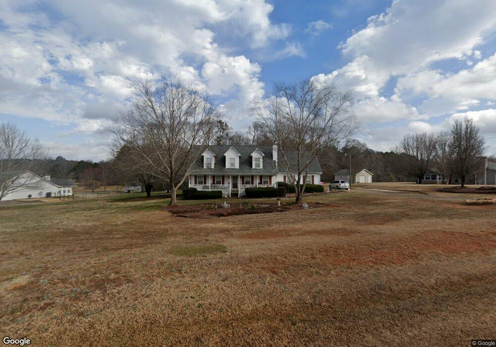
125 Michael Ln McDonough, GA 30252
Estimated Value: $306,000 - $328,000
3
Beds
3
Baths
2,344
Sq Ft
$135/Sq Ft
Est. Value
About This Home
This home is located at 125 Michael Ln, McDonough, GA 30252 and is currently estimated at $315,298, approximately $134 per square foot. 125 Michael Ln is a home located in Henry County with nearby schools including New Hope Elementary School, Locust Grove Middle School, and Locust Grove High School.
Ownership History
Date
Name
Owned For
Owner Type
Purchase Details
Closed on
Jun 26, 1997
Sold by
Homebuilders Chamlee
Bought by
Herrin Jerry J and Herrin Barbara A
Current Estimated Value
Home Financials for this Owner
Home Financials are based on the most recent Mortgage that was taken out on this home.
Original Mortgage
$114,059
Outstanding Balance
$16,237
Interest Rate
7.92%
Mortgage Type
FHA
Estimated Equity
$299,061
Create a Home Valuation Report for This Property
The Home Valuation Report is an in-depth analysis detailing your home's value as well as a comparison with similar homes in the area
Home Values in the Area
Average Home Value in this Area
Purchase History
| Date | Buyer | Sale Price | Title Company |
|---|---|---|---|
| Herrin Jerry J | $116,900 | -- |
Source: Public Records
Mortgage History
| Date | Status | Borrower | Loan Amount |
|---|---|---|---|
| Open | Herrin Jerry J | $114,059 |
Source: Public Records
Tax History Compared to Growth
Tax History
| Year | Tax Paid | Tax Assessment Tax Assessment Total Assessment is a certain percentage of the fair market value that is determined by local assessors to be the total taxable value of land and additions on the property. | Land | Improvement |
|---|---|---|---|---|
| 2025 | $848 | $125,640 | $14,000 | $111,640 |
| 2024 | $848 | $123,600 | $14,000 | $109,600 |
| 2023 | $606 | $118,440 | $14,000 | $104,440 |
| 2022 | $751 | $106,120 | $14,000 | $92,120 |
| 2021 | $752 | $80,040 | $14,000 | $66,040 |
| 2020 | $753 | $75,400 | $12,000 | $63,400 |
| 2019 | $753 | $71,160 | $12,000 | $59,160 |
| 2018 | $754 | $66,640 | $10,800 | $55,840 |
| 2016 | $699 | $59,760 | $10,000 | $49,760 |
| 2015 | $679 | $55,240 | $8,000 | $47,240 |
| 2014 | $674 | $53,920 | $10,000 | $43,920 |
Source: Public Records
Map
Nearby Homes
- S S Laney Rd
- 376 Cattlemans Cir
- 690 Laney Rd
- 125 Karen Dr
- 125 Laney Ct
- 328 Cattlemans Cir
- 175 Laney Ct Unit 1
- 976 S Laney Rd
- 225 Laney Ct
- 121 Ducati Dr
- 215 Laney Rd
- 888 Laney Rd
- 290 New Hope Rd
- 732 New Hope Rd
- 100 Harbin Trail
- 1126 Old Jackson Rd
- 0 S Ola Rd Unit 10563258
- 813 S Ola Rd
- 995 Old Jackson Rd
- 845 Graeme Dr
- 129 Michael Ln
- 119 Michael Ln
- 130 Michaels Dr
- 124 Michael Ln
- 130 Michael Ln
- 133 Michael Ln
- 120 Michael Ln
- 535 Laney Rd
- 115 Michael Ln
- 134 Michael Ln
- 116 Michael Ln
- 525 Laney Rd
- 543 Laney Rd
- 137 Michael Ln Unit 24
- 137 Michael Ln
- 138 Michael Ln
- 111 Michael Ln
- 0 Michael Ln Unit 8599032
- 0 Michael Ln Unit 8541374
- 0 Michael Ln Unit 7579309