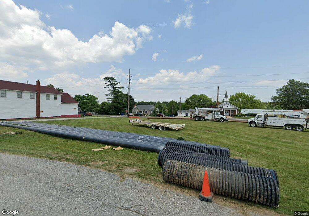
125 N Main St Foristell, MO 63348
Estimated Value: $12,492 - $457,000
3
Beds
1
Bath
2,323
Sq Ft
$120/Sq Ft
Est. Value
About This Home
This home is located at 125 N Main St, Foristell, MO 63348 and is currently estimated at $278,497, approximately $119 per square foot. 125 N Main St is a home located in St. Charles County with nearby schools including STONE CREEK ELEMENTARY and Liberty Christian Academy.
Ownership History
Date
Name
Owned For
Owner Type
Purchase Details
Closed on
Apr 10, 2014
Sold by
Bw Real Estate Llc
Bought by
The Janet S Karrenbrock Revocable Living
Current Estimated Value
Purchase Details
Closed on
Mar 21, 2013
Sold by
Schaper David and Schaper Veronika
Bought by
Bw Real Estate Llc
Purchase Details
Closed on
Feb 21, 2002
Sold by
Fairbanks Capital Corp
Bought by
Schaper David and Schaper Veronika
Purchase Details
Closed on
Dec 20, 2001
Sold by
Mantro Lisa and American Equity Mtg Inc
Bought by
Fairbanks Capital Corp
Create a Home Valuation Report for This Property
The Home Valuation Report is an in-depth analysis detailing your home's value as well as a comparison with similar homes in the area
Home Values in the Area
Average Home Value in this Area
Purchase History
| Date | Buyer | Sale Price | Title Company |
|---|---|---|---|
| The Janet S Karrenbrock Revocable Living | $6,000 | Ust | |
| Bw Real Estate Llc | $45,000 | None Available | |
| Schaper David | -- | Emmons Title Company | |
| Fairbanks Capital Corp | $57,349 | -- |
Source: Public Records
Tax History Compared to Growth
Tax History
| Year | Tax Paid | Tax Assessment Tax Assessment Total Assessment is a certain percentage of the fair market value that is determined by local assessors to be the total taxable value of land and additions on the property. | Land | Improvement |
|---|---|---|---|---|
| 2025 | $301 | $4,750 | -- | -- |
| 2023 | $301 | $4,750 | $0 | $0 |
| 2022 | $323 | $4,750 | $0 | $0 |
| 2021 | $323 | $4,750 | $0 | $0 |
| 2020 | $202 | $2,850 | $0 | $0 |
| 2019 | $188 | $2,850 | $0 | $0 |
| 2018 | $197 | $2,850 | $0 | $0 |
| 2017 | $197 | $2,850 | $0 | $0 |
| 2016 | $205 | $2,850 | $0 | $0 |
| 2015 | $203 | $2,850 | $0 | $0 |
| 2014 | $195 | $2,945 | $0 | $0 |
Source: Public Records
Map
Nearby Homes
- 105 Lonesome Dove Way
- 101 Lonesome Dove Way
- 130 Lonesome Dove Way Unit Lot 15
- 136 Lonesome Dove Way Unit Lot 14
- 121 Lonesome Dove Way Unit Lot 6
- 117 Lonesome Dove Way Unit Lot 5
- 109 Lonesome Dove Way Unit Lot 3
- 141 Lonesome Dove Way Unit Lot 11
- 140 Lonesome Dove Way Unit Lot 13
- 144 Liberty Valley Dr
- 2 Maple at Liberty Manors
- 2 Ashford at Liberty Manors
- 2 Aspen II at Liberty Manors
- 183 Liberty Valley Dr
- 2 Berwick at Liberty Manors
- 2 Aspen at Liberty Manors
- 189 Liberty Valley Dr
- 262 Liberty Valley Dr
- 708 Celebration Dr
- 810 Colony Ridge Ct
- 22840 Veterans Memorial Pkwy
- 4 Pkwy
- 129 N Main St
- 117 N Main St
- 22790 Veterans Memorial Pkwy
- 22760 Veterans Memorial Pkwy
- 135 N Main St
- 124 S Main St
- 22730 Veterans Memorial Pkwy
- 136 S Main St
- 128 S Main St
- 22985 Veterans Memorial Pkwy
- 22985 Veterans Memorial Pkwy
- 22700 Veterans Memorial Pkwy
- 100 S Main St
- 22995 Veterans Memorial Pkwy
- 145 N Main St
- 5 Highway T
- 140 S Main St
- 5 Highway T
