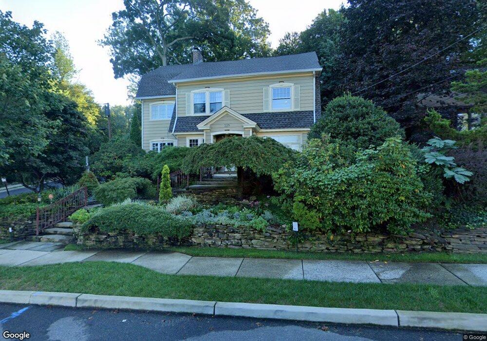
125 Paulin Blvd Leonia, NJ 07605
Estimated Value: $918,189 - $1,286,000
--
Bed
--
Bath
3,240
Sq Ft
$323/Sq Ft
Est. Value
About This Home
This home is located at 125 Paulin Blvd, Leonia, NJ 07605 and is currently estimated at $1,046,547, approximately $323 per square foot. 125 Paulin Blvd is a home located in Bergen County with nearby schools including Anna C. Scott Elementary School, Leonia Middle School, and Leonia High School.
Ownership History
Date
Name
Owned For
Owner Type
Purchase Details
Closed on
Mar 15, 1999
Sold by
Afshar Michael M and Afshar Margaret E Spaniolo
Bought by
Coyne Marilyn and Cummins Cenovia
Current Estimated Value
Home Financials for this Owner
Home Financials are based on the most recent Mortgage that was taken out on this home.
Original Mortgage
$360,000
Outstanding Balance
$87,351
Interest Rate
6.78%
Mortgage Type
Stand Alone First
Estimated Equity
$959,196
Purchase Details
Closed on
Mar 3, 1998
Sold by
Joyce Jeffrey A and Joyce Jill M
Bought by
Afshar Michael M and Afshar Margaret E Spaniolo
Home Financials for this Owner
Home Financials are based on the most recent Mortgage that was taken out on this home.
Original Mortgage
$336,000
Interest Rate
6.93%
Create a Home Valuation Report for This Property
The Home Valuation Report is an in-depth analysis detailing your home's value as well as a comparison with similar homes in the area
Home Values in the Area
Average Home Value in this Area
Purchase History
| Date | Buyer | Sale Price | Title Company |
|---|---|---|---|
| Coyne Marilyn | $495,000 | -- | |
| Afshar Michael M | $420,000 | -- |
Source: Public Records
Mortgage History
| Date | Status | Borrower | Loan Amount |
|---|---|---|---|
| Open | Coyne Marilyn | $360,000 | |
| Previous Owner | Afshar Michael M | $336,000 |
Source: Public Records
Tax History Compared to Growth
Tax History
| Year | Tax Paid | Tax Assessment Tax Assessment Total Assessment is a certain percentage of the fair market value that is determined by local assessors to be the total taxable value of land and additions on the property. | Land | Improvement |
|---|---|---|---|---|
| 2025 | $18,992 | $557,100 | $285,600 | $271,500 |
| 2024 | $18,724 | $557,100 | $285,600 | $271,500 |
| 2023 | $17,738 | $557,100 | $285,600 | $271,500 |
| 2022 | $17,738 | $557,100 | $285,600 | $271,500 |
| 2021 | $17,833 | $557,100 | $285,600 | $271,500 |
| 2020 | $17,214 | $557,100 | $285,600 | $271,500 |
| 2019 | $16,613 | $557,100 | $285,600 | $271,500 |
| 2018 | $16,412 | $557,100 | $285,600 | $271,500 |
| 2017 | $16,217 | $557,100 | $285,600 | $271,500 |
| 2016 | $15,515 | $557,100 | $285,600 | $271,500 |
| 2015 | $15,549 | $557,100 | $285,600 | $271,500 |
| 2014 | $15,298 | $557,100 | $285,600 | $271,500 |
Source: Public Records
Map
Nearby Homes
- 435 Park Ave
- 85 Paulin Blvd
- 450 Fort Lee Rd
- 428 Washington Terrace
- 250 Broad Ave Unit 4B
- 250 Broad Ave Unit 3C
- 32 Linden Terrace
- 105 Reldyes Ave
- 218 Broad Ave Unit 2F
- 1585 Bergen Blvd
- 1670 Maple St
- 1627 Ponsi St Unit B
- 115 High St
- 555 North Ave Unit 19W
- 555 North Ave Unit 12A
- 555 North Ave Unit 11L
- 555 North Ave Unit 23G
- 555 North Ave Unit 23C
- 555 North Ave Unit 6F
- 555 North Ave Unit 22D
- 119 Paulin Blvd
- 388 Allaire Ave
- 141 Paulin Blvd
- 119 Knapp Terrace
- 115 Paulin Blvd
- 373 Allaire Ave
- 396 Allaire Ave
- 360 Allaire Ave
- 123 Knapp Terrace
- 395 Allaire Ave
- 145 Paulin Blvd
- 369 Allaire Ave
- 140 Paulin Blvd
- 134 Paulin Blvd
- 116 Knapp Terrace
- 112 Knapp Terrace
- 149 Paulin Blvd
- 144 Paulin Blvd
- 403 Allaire Ave
- 469 Park Ave