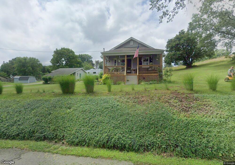
125 Ralston Rd Sarver, PA 16055
Buffalo Township NeighborhoodEstimated Value: $81,760 - $271,000
2
Beds
2
Baths
936
Sq Ft
$221/Sq Ft
Est. Value
About This Home
This home is located at 125 Ralston Rd, Sarver, PA 16055 and is currently estimated at $206,440, approximately $220 per square foot. 125 Ralston Rd is a home located in Butler County with nearby schools including Buffalo Elementary School, Freeport Area Senior High School, and Harvest Baptist Academy.
Ownership History
Date
Name
Owned For
Owner Type
Purchase Details
Closed on
Jun 25, 2010
Sold by
Murphy Administrator John F
Bought by
Dunlap Allen D
Current Estimated Value
Home Financials for this Owner
Home Financials are based on the most recent Mortgage that was taken out on this home.
Original Mortgage
$122,694
Outstanding Balance
$82,585
Interest Rate
4.98%
Mortgage Type
New Conventional
Estimated Equity
$123,855
Create a Home Valuation Report for This Property
The Home Valuation Report is an in-depth analysis detailing your home's value as well as a comparison with similar homes in the area
Home Values in the Area
Average Home Value in this Area
Purchase History
| Date | Buyer | Sale Price | Title Company |
|---|---|---|---|
| Dunlap Allen D | $118,500 | -- |
Source: Public Records
Mortgage History
| Date | Status | Borrower | Loan Amount |
|---|---|---|---|
| Open | Dunlap Allen D | $122,694 |
Source: Public Records
Tax History Compared to Growth
Tax History
| Year | Tax Paid | Tax Assessment Tax Assessment Total Assessment is a certain percentage of the fair market value that is determined by local assessors to be the total taxable value of land and additions on the property. | Land | Improvement |
|---|---|---|---|---|
| 2025 | $2,479 | $11,400 | $1,260 | $10,140 |
| 2024 | $2,342 | $11,400 | $1,260 | $10,140 |
| 2023 | $2,144 | $11,400 | $1,260 | $10,140 |
| 2022 | $2,082 | $11,400 | $1,260 | $10,140 |
| 2021 | $2,087 | $11,400 | $0 | $0 |
| 2020 | $2,075 | $11,400 | $1,260 | $10,140 |
| 2019 | $2,037 | $11,400 | $1,260 | $10,140 |
| 2018 | $1,991 | $11,400 | $1,260 | $10,140 |
| 2017 | $1,991 | $11,400 | $1,260 | $10,140 |
| 2016 | $412 | $11,400 | $1,260 | $10,140 |
| 2015 | $231 | $11,400 | $1,260 | $10,140 |
| 2014 | $231 | $11,400 | $1,260 | $10,140 |
Source: Public Records
Map
Nearby Homes
- 128 Buffalo Trail Dr
- 102 Pioneer Ct
- 103 Cherokee Ct
- 118 Washington St
- 255 2nd St
- 1071 Sandy Ridge Dr
- 1174 Sandy Ridge Dr
- Abbey II Plan at Heritage Crossings
- Canterbury II Plan at Heritage Crossings
- Lot #2 Woodhaven Dr
- Lot #1 Woodhaven Dr
- 1263 Sandy Ridge Dr
- 1282 Sandy Ridge Dr
- 147 Woodbury Dr
- 117 Route 908
- 136 Stratford Dr
- 129 Ridgecrest Dr
- 115 Rambler Dr
- 105 Burd Dr
- 182 Beale Rd Unit A