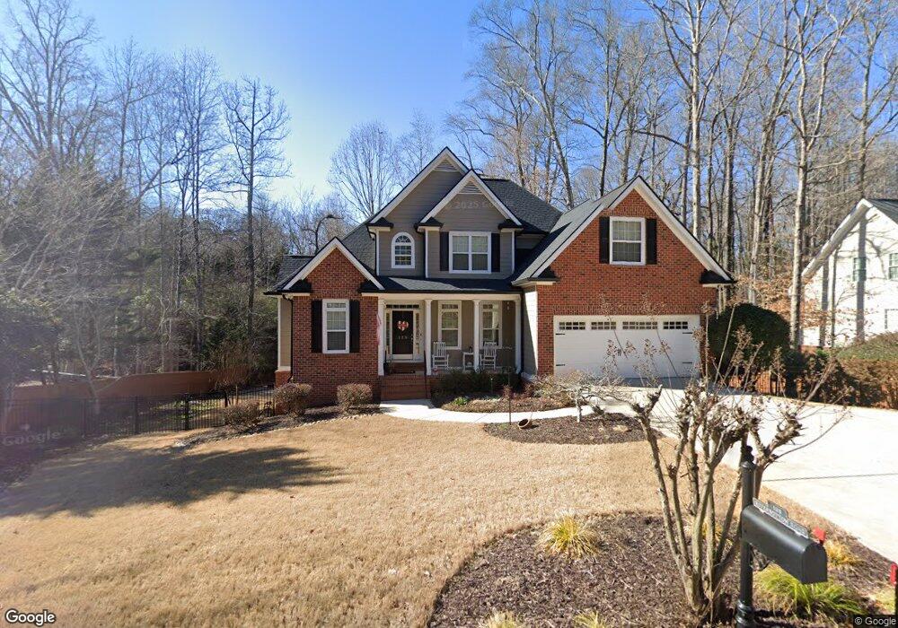
125 River Bottom Rd Athens, GA 30606
Estimated Value: $413,000 - $472,000
3
Beds
3
Baths
2,103
Sq Ft
$210/Sq Ft
Est. Value
About This Home
This home is located at 125 River Bottom Rd, Athens, GA 30606 and is currently estimated at $441,235, approximately $209 per square foot. 125 River Bottom Rd is a home located in Clarke County with nearby schools including Cleveland Road Elementary School, Burney-Harris-Lyons Middle School, and Clarke Central High School.
Ownership History
Date
Name
Owned For
Owner Type
Purchase Details
Closed on
Jun 29, 2005
Sold by
Gilbert Linton
Bought by
Gilbert Linton and Gilbert Ingrid
Current Estimated Value
Home Financials for this Owner
Home Financials are based on the most recent Mortgage that was taken out on this home.
Original Mortgage
$206,400
Outstanding Balance
$105,537
Interest Rate
5.54%
Mortgage Type
New Conventional
Estimated Equity
$335,698
Purchase Details
Closed on
Jul 9, 2004
Sold by
Creative Abundance Llc
Bought by
Mcelhannon Ben
Create a Home Valuation Report for This Property
The Home Valuation Report is an in-depth analysis detailing your home's value as well as a comparison with similar homes in the area
Purchase History
| Date | Buyer | Sale Price | Title Company |
|---|---|---|---|
| Gilbert Linton | $258,000 | -- | |
| Mcelhannon Ben | $36,000 | -- |
Source: Public Records
Mortgage History
| Date | Status | Borrower | Loan Amount |
|---|---|---|---|
| Open | Gilbert Linton | $206,400 | |
| Closed | Gilbert Linton | $51,600 |
Source: Public Records
Tax History
| Year | Tax Paid | Tax Assessment Tax Assessment Total Assessment is a certain percentage of the fair market value that is determined by local assessors to be the total taxable value of land and additions on the property. | Land | Improvement |
|---|---|---|---|---|
| 2025 | $5,028 | $181,386 | $24,000 | $157,386 |
| 2024 | $5,028 | $172,414 | $24,000 | $148,414 |
| 2023 | $4,889 | $161,180 | $24,000 | $137,180 |
| 2022 | $3,891 | $131,974 | $24,000 | $107,974 |
| 2021 | $3,757 | $121,488 | $24,000 | $97,488 |
| 2020 | $3,707 | $119,986 | $24,000 | $95,986 |
| 2019 | $3,663 | $117,888 | $24,000 | $93,888 |
| 2018 | $3,447 | $111,528 | $24,000 | $87,528 |
| 2017 | $3,225 | $105,002 | $24,000 | $81,002 |
| 2016 | $3,145 | $102,647 | $24,000 | $78,647 |
| 2015 | $3,180 | $103,511 | $24,000 | $79,511 |
| 2014 | $3,139 | $102,159 | $24,000 | $78,159 |
Source: Public Records
Map
Nearby Homes
- 175 New Haven Dr
- 256 Cherokee Ridge
- 170 Huntington Ct
- 470 Huntington Rd Unit 5
- 460 Huntington Rd
- 306 Providence Rd
- 637 Huntington Rd Unit C2
- 637 Huntington Rd Unit 2
- 637 Huntington Rd Unit B1
- 150 The Preserve Dr Unit H2
- 860 Mitchell Bridge Rd Unit 8
- 400 Providence Rd
- 212 Huntington Shoals Dr
- 118 Woodhaven Terrace
- 284 Meeler Cir
- 212 Westpark Dr
- 164 Lucy Ln
- 376 Summerville Ln
- 372 Summerville Ln
- 157 Kittle Ln
- 135 River Bottom Rd
- 115 River Bottom Rd
- 290 Cavalier Rd
- 286 Cavalier Rd
- 120 River Bottom Rd
- 298 Cavalier Rd
- 115 Providence Rd
- 145 River Bottom Rd
- 278 Cavalier Rd
- 300 Cavalier Rd
- 130 River Bottom Rd
- 272 Cavalier Rd
- 155 River Bottom Rd
- 125 Providence Rd
- 310 Cavalier Rd
- 120 Norman Way
- 185 Saint Paul Dr
- 185 St Pauls Dr
- 185 St Pausl Dr
- 299 Cavalier Rd
Your Personal Tour Guide
Ask me questions while you tour the home.