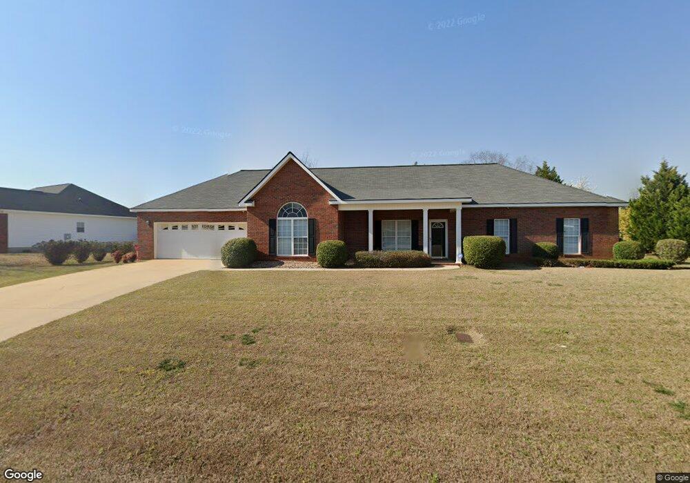
125 Sarakay Cir Unit 65 Macon, GA 31216
Estimated Value: $280,000 - $294,000
3
Beds
3
Baths
2,091
Sq Ft
$136/Sq Ft
Est. Value
About This Home
This home is located at 125 Sarakay Cir Unit 65, Macon, GA 31216 and is currently estimated at $284,733, approximately $136 per square foot. 125 Sarakay Cir Unit 65 is a home located in Bibb County with nearby schools including Heard Elementary School, Rutland Middle School, and Rutland High School.
Ownership History
Date
Name
Owned For
Owner Type
Purchase Details
Closed on
Jan 4, 2013
Sold by
Pitts Roland A
Bought by
Pitts Roland A and Pitts Wannetta Marqui
Current Estimated Value
Purchase Details
Closed on
Aug 31, 2012
Sold by
Seatcy Theron Michael
Bought by
Pitts Roland A
Home Financials for this Owner
Home Financials are based on the most recent Mortgage that was taken out on this home.
Original Mortgage
$122,900
Interest Rate
3.58%
Mortgage Type
VA
Purchase Details
Closed on
Jun 8, 2004
Bought by
Searcy Theron M and Searcy Charlotte
Purchase Details
Closed on
Nov 8, 2002
Create a Home Valuation Report for This Property
The Home Valuation Report is an in-depth analysis detailing your home's value as well as a comparison with similar homes in the area
Home Values in the Area
Average Home Value in this Area
Purchase History
| Date | Buyer | Sale Price | Title Company |
|---|---|---|---|
| Pitts Roland A | -- | None Available | |
| Pitts Roland A | $122,900 | None Available | |
| Searcy Theron M | -- | -- | |
| Searcy Theron Michael | $149,000 | -- | |
| -- | $142,000 | -- |
Source: Public Records
Mortgage History
| Date | Status | Borrower | Loan Amount |
|---|---|---|---|
| Previous Owner | Pitts Roland A | $122,900 |
Source: Public Records
Tax History Compared to Growth
Tax History
| Year | Tax Paid | Tax Assessment Tax Assessment Total Assessment is a certain percentage of the fair market value that is determined by local assessors to be the total taxable value of land and additions on the property. | Land | Improvement |
|---|---|---|---|---|
| 2025 | -- | $103,658 | $10,000 | $93,658 |
| 2024 | -- | $103,412 | $10,000 | $93,412 |
| 2023 | $0 | $91,228 | $10,000 | $81,228 |
| 2022 | $3,020 | $79,474 | $9,900 | $69,574 |
| 2021 | $2,334 | $61,410 | $8,000 | $53,410 |
| 2020 | $2,454 | $61,410 | $8,000 | $53,410 |
| 2019 | $2,454 | $61,410 | $8,000 | $53,410 |
| 2018 | $2,002 | $61,410 | $8,000 | $53,410 |
| 2017 | $2,002 | $61,410 | $8,000 | $53,410 |
| 2016 | $0 | $63,399 | $12,800 | $50,599 |
| 2015 | -- | $63,399 | $12,800 | $50,599 |
| 2014 | $2,498 | $63,399 | $12,800 | $50,599 |
Source: Public Records
Map
Nearby Homes
- 411 Bob White Rd
- 436 Joseph Chandler Dr
- 428 Bob White Rd
- 708 Coopers Lnd
- 465 Bob White Rd
- DUPONT Plan at Quail Ridge
- GARDNER Plan at Quail Ridge
- KINGSTON Plan at Quail Ridge
- ESSEX Plan at Quail Ridge
- 813 Ocala National Trail
- 408 Resting Fawn Place
- 405 Stonecrest Ct
- 326 Thoroughbred Ln
- 330 Cody Dr
- 328 Cody Dr
- 102 Haylie Ct
- 104 Alayna Ct
- 361 Thoroughbred Ln
- 125 Sarakay Cir
- N Sarakay Cir
- 220 Mason Philip Dr
- 119 Sarakay Cir
- 119 Sarakay Cir Unit 64
- 216 Mason Philip Dr
- 128 Sarakay Cir
- 128 Sarakay Cir Unit 73
- 146 Sarakay Cir Unit 70
- 124 Sarakay Cir
- 132 Sarakay Cir
- 115 Sarakay Cir
- 115 Sarakay Cir Unit 63
- 212 Mason Philip Dr
- 120 Sarakay Cir
- 136 Sarakay Cir
- 116 Sarakay Cir
- 221 Mason Philip Dr
- 217 Mason Philip Dr
- 225 Mason Philip Dr