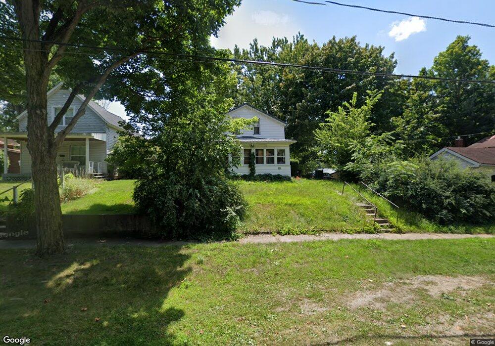
125 School St Hudson, MI 49247
Estimated Value: $109,000 - $142,000
3
Beds
2
Baths
1,384
Sq Ft
$93/Sq Ft
Est. Value
About This Home
This home is located at 125 School St, Hudson, MI 49247 and is currently estimated at $128,293, approximately $92 per square foot. 125 School St is a home located in Lenawee County with nearby schools including Lincoln Elementary School, Southern Michigan Center For Science & Industry (SMCSI), and Hudson Middle School.
Ownership History
Date
Name
Owned For
Owner Type
Purchase Details
Closed on
Aug 19, 2016
Sold by
Barnard Eleanor
Bought by
Barnard Eleanor
Current Estimated Value
Purchase Details
Closed on
Oct 20, 2011
Sold by
Barnard Frank F and Barnard Elenor D
Bought by
Barnard Frank F and The Frank F Barnard Trust No 1
Purchase Details
Closed on
Jun 28, 2010
Sold by
Wells Fargo Bank N A
Bought by
Barnard Frank F and Barnard Eleanor
Purchase Details
Closed on
Oct 29, 2009
Sold by
Cobb Vicky L
Bought by
Wells Fargo Bank N A
Create a Home Valuation Report for This Property
The Home Valuation Report is an in-depth analysis detailing your home's value as well as a comparison with similar homes in the area
Home Values in the Area
Average Home Value in this Area
Purchase History
| Date | Buyer | Sale Price | Title Company |
|---|---|---|---|
| Barnard Eleanor | -- | None Available | |
| Barnard Eleanor | -- | None Available | |
| Barnard Frank F | -- | None Available | |
| Barnard Frank F | $11,000 | None Available | |
| Wells Fargo Bank N A | $87,540 | None Available |
Source: Public Records
Tax History
| Year | Tax Paid | Tax Assessment Tax Assessment Total Assessment is a certain percentage of the fair market value that is determined by local assessors to be the total taxable value of land and additions on the property. | Land | Improvement |
|---|---|---|---|---|
| 2025 | $1,674 | $44,400 | $0 | $0 |
| 2023 | $12 | $37,300 | $0 | $0 |
| 2021 | $1,449 | $32,300 | $0 | $0 |
| 2020 | $1,436 | $29,100 | $0 | $0 |
| 2019 | $73,566 | $27,000 | $0 | $0 |
| 2018 | $1,379 | $41,703 | $0 | $0 |
| 2017 | $1,369 | $41,970 | $0 | $0 |
| 2016 | $1,321 | $25,470 | $0 | $0 |
Source: Public Records
Map
Nearby Homes
- 310 School St
- 437 Mckenzie St
- 324 Railroad St
- 143 Lafayette St
- 200 Grove St
- 422 Railroad St
- 111 & 115 N Market St
- 4675 Munson Hwy
- 14700 Hudson Rd
- 645 S Meridian Rd
- 14300 Union Rd
- 18430 Forrister Rd
- 1785 N Rollin Hwy
- 18000 blk #1 Forrister Rd
- 18000 blk #2 Forrister Rd
- 18000 blk #3 Forrister Rd
- 7100 S Waldron Rd
- 18000 blk Forrister Rd
- 2507 S Waldron Rd
- 7025 Tuttle Rd
- 129 School St
- 131 School St
- 119 School St
- 113 School St
- 109 School St
- 127 S Maple Grove Ave
- 120 School St
- 124 School St
- 126 School St
- 130 School St
- 116 School St
- 119 S Maple Grove Ave
- 119 S Maple Grove Ave Unit MAPLEGROVE
- 112 School St
- 108 School St
- 130 S Maple Grove Ave
- 126 S Maple Grove Ave
- 122 S Maple Grove Ave
- 118 S Maple Grove Ave
- 115 S Maple Grove Ave
Your Personal Tour Guide
Ask me questions while you tour the home.