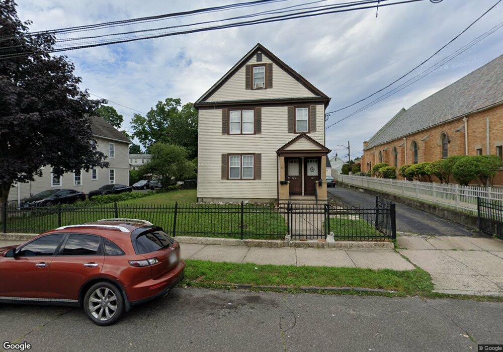
125 Scofield Ave Unit 1 Bridgeport, CT 06605
Black Rock NeighborhoodEstimated Value: $510,000 - $685,000
2
Beds
1
Bath
900
Sq Ft
$678/Sq Ft
Est. Value
About This Home
This home is located at 125 Scofield Ave Unit 1, Bridgeport, CT 06605 and is currently estimated at $609,837, approximately $677 per square foot. 125 Scofield Ave Unit 1 is a home located in Fairfield County with nearby schools including Black Rock School, Bassick High School, and Great Oaks Charter School Bridgeport.
Ownership History
Date
Name
Owned For
Owner Type
Purchase Details
Closed on
Nov 24, 1998
Sold by
Ainty Mark and Ainty Diane
Bought by
Ahad Mohammad A
Current Estimated Value
Home Financials for this Owner
Home Financials are based on the most recent Mortgage that was taken out on this home.
Original Mortgage
$137,750
Outstanding Balance
$29,804
Interest Rate
6.49%
Estimated Equity
$580,033
Purchase Details
Closed on
Dec 1, 1995
Sold by
Mesic John and Mesic John
Bought by
Ginty Mark and Ginty Diane
Home Financials for this Owner
Home Financials are based on the most recent Mortgage that was taken out on this home.
Original Mortgage
$122,808
Interest Rate
7.37%
Mortgage Type
Unknown
Create a Home Valuation Report for This Property
The Home Valuation Report is an in-depth analysis detailing your home's value as well as a comparison with similar homes in the area
Home Values in the Area
Average Home Value in this Area
Purchase History
| Date | Buyer | Sale Price | Title Company |
|---|---|---|---|
| Ahad Mohammad A | $145,000 | -- | |
| Ahad Mohammad A | $145,000 | -- | |
| Ginty Mark | $125,000 | -- | |
| Ginty Mark | $125,000 | -- |
Source: Public Records
Mortgage History
| Date | Status | Borrower | Loan Amount |
|---|---|---|---|
| Open | Ginty Mark | $137,750 | |
| Closed | Ginty Mark | $137,750 | |
| Previous Owner | Ginty Mark | $122,808 |
Source: Public Records
Tax History Compared to Growth
Tax History
| Year | Tax Paid | Tax Assessment Tax Assessment Total Assessment is a certain percentage of the fair market value that is determined by local assessors to be the total taxable value of land and additions on the property. | Land | Improvement |
|---|---|---|---|---|
| 2025 | $10,653 | $245,180 | $110,860 | $134,320 |
| 2024 | $10,653 | $245,180 | $110,860 | $134,320 |
| 2023 | $10,653 | $245,180 | $110,860 | $134,320 |
| 2022 | $10,653 | $245,180 | $110,860 | $134,320 |
| 2021 | $10,653 | $245,180 | $110,860 | $134,320 |
| 2020 | $9,619 | $178,160 | $71,950 | $106,210 |
| 2019 | $9,619 | $178,160 | $71,950 | $106,210 |
| 2018 | $9,687 | $178,160 | $71,950 | $106,210 |
| 2017 | $9,687 | $178,160 | $71,950 | $106,210 |
| 2016 | $9,687 | $178,160 | $71,950 | $106,210 |
| 2015 | $8,388 | $198,770 | $60,470 | $138,300 |
| 2014 | $8,388 | $198,770 | $60,470 | $138,300 |
Source: Public Records
Map
Nearby Homes
- 167 Scofield Ave
- 166 Alfred St
- 51 Princeton St
- 82 Waldorf Ave
- 855 Brewster St Unit 857
- 37 Rowsley St Unit 6
- 135 Whittier St
- 26 Rowsley St Unit 3
- 20 Haddon St Unit 5
- 31 Whittier St
- 25 Whittier St
- 554 Brewster St Unit 4
- 165 Bennett St
- 39 Jetland Place Unit 41
- 105 Fox St Unit 107
- 450 Davidson St
- 75 Homestead Ave Unit 77
- 317 Brewster St
- 130 Brentwood Ave
- 118 Berwick Ave
- 125 Scofield Ave
- 127 Scofield Ave Unit 2nd
- 127 Scofield Ave
- 115 Scofield Ave
- 48 Flower St
- 107 Scofield Ave
- 42 Flower St Unit 44
- 53 Flower St
- 53 Flower St Unit 2
- 99 Scofield Ave
- 95 Scofield Ave
- 161 Scofield Ave
- 37 Short St
- 30 Flower St Unit 34
- 30-34 Flower St
- 45 Flower St
- 116 Scofield Ave
- 116 Scofield Ave Unit 1
- 35 Short St
- 89 Scofield Ave Unit 3