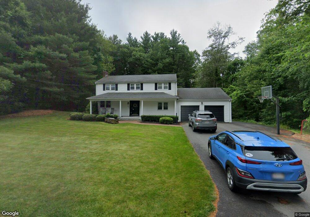
125 Stanford Dr Westwood, MA 02090
Estimated Value: $1,147,424 - $1,258,000
4
Beds
3
Baths
1,987
Sq Ft
$605/Sq Ft
Est. Value
About This Home
This home is located at 125 Stanford Dr, Westwood, MA 02090 and is currently estimated at $1,202,856, approximately $605 per square foot. 125 Stanford Dr is a home located in Norfolk County with nearby schools including Westwood High School and Norwood Montessori School.
Ownership History
Date
Name
Owned For
Owner Type
Purchase Details
Closed on
Jan 27, 2006
Sold by
Krumsiek Julie M
Bought by
Blomquist Scott P and Blomquist Sheila L
Current Estimated Value
Home Financials for this Owner
Home Financials are based on the most recent Mortgage that was taken out on this home.
Original Mortgage
$400,000
Outstanding Balance
$227,047
Interest Rate
6.34%
Mortgage Type
Purchase Money Mortgage
Estimated Equity
$975,809
Purchase Details
Closed on
Oct 18, 2002
Sold by
Nye Elaine F and Nye Jeffrey L
Bought by
Krumsiek Julie M
Home Financials for this Owner
Home Financials are based on the most recent Mortgage that was taken out on this home.
Original Mortgage
$300,700
Interest Rate
6.18%
Mortgage Type
Purchase Money Mortgage
Create a Home Valuation Report for This Property
The Home Valuation Report is an in-depth analysis detailing your home's value as well as a comparison with similar homes in the area
Home Values in the Area
Average Home Value in this Area
Purchase History
| Date | Buyer | Sale Price | Title Company |
|---|---|---|---|
| Blomquist Scott P | $570,000 | -- | |
| Krumsiek Julie M | $530,000 | -- |
Source: Public Records
Mortgage History
| Date | Status | Borrower | Loan Amount |
|---|---|---|---|
| Open | Blomquist Scott P | $400,000 | |
| Previous Owner | Krumsiek Julie M | $300,700 |
Source: Public Records
Tax History Compared to Growth
Tax History
| Year | Tax Paid | Tax Assessment Tax Assessment Total Assessment is a certain percentage of the fair market value that is determined by local assessors to be the total taxable value of land and additions on the property. | Land | Improvement |
|---|---|---|---|---|
| 2025 | $12,503 | $976,000 | $569,600 | $406,400 |
| 2024 | $12,503 | $976,000 | $569,600 | $406,400 |
| 2023 | $11,221 | $784,700 | $474,900 | $309,800 |
| 2022 | $10,589 | $714,000 | $420,000 | $294,000 |
| 2021 | $10,413 | $704,550 | $400,000 | $304,550 |
| 2020 | $10,147 | $699,300 | $400,000 | $299,300 |
| 2019 | $9,706 | $662,550 | $380,800 | $281,750 |
| 2018 | $9,762 | $646,900 | $380,800 | $266,100 |
| 2017 | $9,251 | $634,950 | $380,800 | $254,150 |
| 2016 | $9,061 | $618,050 | $380,800 | $237,250 |
| 2015 | $8,874 | $582,300 | $380,800 | $201,500 |
Source: Public Records
Map
Nearby Homes
- 144 Fensview Dr
- 42 Tamarack Rd
- 9 Stonegate Dr
- 11 Stonegate Dr
- 303 Oak St
- 140 Burgess Ave
- 1080 North St
- 10 Pettees Pond Ln
- 95 Arcadia Rd
- 14 Ruel Dr
- 52 Yarmouth Rd
- 152 Albemarle Rd
- 42 Hartford St
- 144 Devon Rd
- 18 Tisdale Dr Unit 18
- 29 Hartford St
- 145 Walpole St
- 11 Schaffner Ln
- 9 Schaffner Ln
- 48 Lakeshore Dr
- 115 Stanford Dr
- 110 Stanford Dr
- 133 Stanford Dr
- 105 Stanford Dr
- 142 Stanford Dr
- 95 Stanford Dr
- 145 Stanford Dr
- 90 Stanford Dr
- 162 Stanford Dr
- 85 Stanford Dr
- 155 Stanford Dr
- 74 Stanford Dr
- 165 Stanford Dr
- 172 Stanford Dr
- 75 Stanford Dr
- 155 Beechnut Rd
- 147 Beechnut Rd
- 137 Beechnut Rd
- 175 Stanford Dr
- 182 Stanford Dr