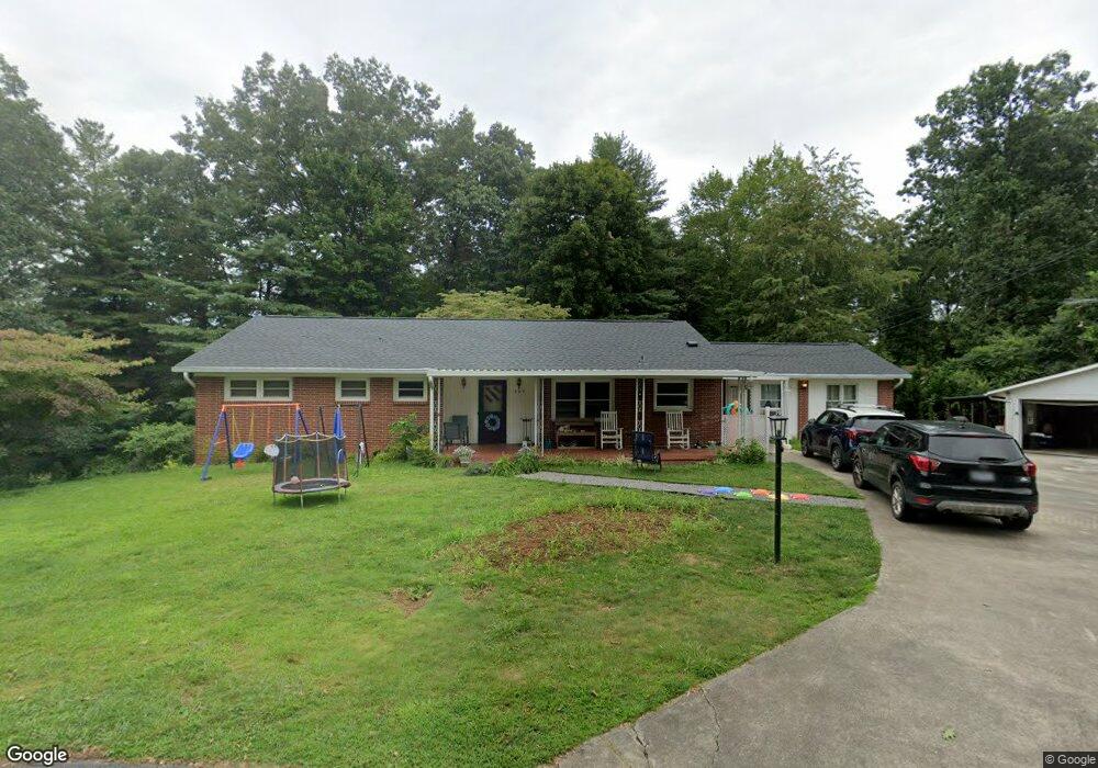
125 Sutherland Dr Canton, NC 28716
Estimated Value: $338,000 - $429,000
3
Beds
3
Baths
2,229
Sq Ft
$179/Sq Ft
Est. Value
About This Home
This home is located at 125 Sutherland Dr, Canton, NC 28716 and is currently estimated at $398,691, approximately $178 per square foot. 125 Sutherland Dr is a home located in Haywood County with nearby schools including North Canton Elementary School, Canton Middle, and Pisgah High School.
Ownership History
Date
Name
Owned For
Owner Type
Purchase Details
Closed on
Aug 30, 2023
Sold by
Brookshire Joe H
Bought by
Brookshire Donna Carol and Floyd Hunter B
Current Estimated Value
Home Financials for this Owner
Home Financials are based on the most recent Mortgage that was taken out on this home.
Original Mortgage
$210,000
Outstanding Balance
$204,594
Interest Rate
6.81%
Mortgage Type
New Conventional
Estimated Equity
$194,097
Create a Home Valuation Report for This Property
The Home Valuation Report is an in-depth analysis detailing your home's value as well as a comparison with similar homes in the area
Home Values in the Area
Average Home Value in this Area
Purchase History
| Date | Buyer | Sale Price | Title Company |
|---|---|---|---|
| Brookshire Donna Carol | $175,000 | None Listed On Document |
Source: Public Records
Mortgage History
| Date | Status | Borrower | Loan Amount |
|---|---|---|---|
| Open | Brookshire Donna Carol | $210,000 |
Source: Public Records
Tax History
| Year | Tax Paid | Tax Assessment Tax Assessment Total Assessment is a certain percentage of the fair market value that is determined by local assessors to be the total taxable value of land and additions on the property. | Land | Improvement |
|---|---|---|---|---|
| 2025 | -- | $252,100 | $37,500 | $214,600 |
| 2024 | $17 | $252,100 | $37,500 | $214,600 |
| 2023 | $1,722 | $252,100 | $37,500 | $214,600 |
| 2022 | $1,684 | $252,100 | $37,500 | $214,600 |
| 2021 | $1,684 | $252,100 | $37,500 | $214,600 |
| 2020 | $1,248 | $166,200 | $25,800 | $140,400 |
| 2019 | $1,253 | $166,200 | $25,800 | $140,400 |
| 2018 | $1,253 | $166,200 | $25,800 | $140,400 |
| 2017 | $1,253 | $166,200 | $0 | $0 |
| 2016 | $1,260 | $172,300 | $0 | $0 |
| 2015 | $1,243 | $172,300 | $0 | $0 |
| 2014 | $1,128 | $172,300 | $0 | $0 |
Source: Public Records
Map
Nearby Homes
- 13 Eastwood Dr
- 00 Beaverdam Rd
- 1389 Newfound Rd
- 761 N Main St
- 83 Flint St
- 622 N Main St
- 412 Trammell Ave
- 112 Hy Vu Dr
- 145 Keener Rd
- 3 Elizabeth St
- 91 Star Ridge Rd
- 1261 Asheville Hwy
- 99999 Allen St
- 303 Johnson Farm Rd
- 223 N Main St
- 228 Chestnut Mountain Rd
- 492 Scruggs Cir
- 28 Plemmons St
- 118 Mitchell St
- 695 Chestnut Mountain Rd
Your Personal Tour Guide
Ask me questions while you tour the home.