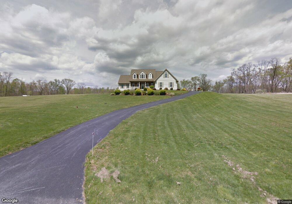
125 Thundergust Mill Rd Wellsville, PA 17365
Warrington Township NeighborhoodEstimated Value: $434,000 - $701,264
4
Beds
4
Baths
4,123
Sq Ft
$152/Sq Ft
Est. Value
About This Home
This home is located at 125 Thundergust Mill Rd, Wellsville, PA 17365 and is currently estimated at $626,066, approximately $151 per square foot. 125 Thundergust Mill Rd is a home located in York County with nearby schools including Northern Middle School and Northern High School.
Ownership History
Date
Name
Owned For
Owner Type
Purchase Details
Closed on
Aug 22, 2006
Sold by
Ressler Glenn E and Ressler Sandra C
Bought by
Wrightson Brian W and Wrightson Melissa D
Current Estimated Value
Home Financials for this Owner
Home Financials are based on the most recent Mortgage that was taken out on this home.
Original Mortgage
$332,000
Outstanding Balance
$199,652
Interest Rate
6.79%
Mortgage Type
Purchase Money Mortgage
Estimated Equity
$426,414
Purchase Details
Closed on
Oct 19, 2004
Sold by
Fox Harry H and Fox Ann G
Bought by
Ressler Glenn E
Create a Home Valuation Report for This Property
The Home Valuation Report is an in-depth analysis detailing your home's value as well as a comparison with similar homes in the area
Home Values in the Area
Average Home Value in this Area
Purchase History
| Date | Buyer | Sale Price | Title Company |
|---|---|---|---|
| Wrightson Brian W | $415,000 | First American Title Ins Co | |
| Ressler Glenn E | $54,900 | -- |
Source: Public Records
Mortgage History
| Date | Status | Borrower | Loan Amount |
|---|---|---|---|
| Open | Wrightson Brian W | $332,000 |
Source: Public Records
Tax History Compared to Growth
Tax History
| Year | Tax Paid | Tax Assessment Tax Assessment Total Assessment is a certain percentage of the fair market value that is determined by local assessors to be the total taxable value of land and additions on the property. | Land | Improvement |
|---|---|---|---|---|
| 2025 | $11,284 | $414,170 | $41,520 | $372,650 |
| 2024 | $11,160 | $414,170 | $41,520 | $372,650 |
| 2023 | $10,937 | $414,170 | $41,520 | $372,650 |
| 2022 | $10,704 | $414,170 | $41,520 | $372,650 |
| 2021 | $10,006 | $414,170 | $41,520 | $372,650 |
| 2020 | $9,767 | $414,170 | $41,520 | $372,650 |
| 2019 | $9,521 | $414,170 | $41,520 | $372,650 |
| 2018 | $9,317 | $414,170 | $41,520 | $372,650 |
| 2017 | $9,317 | $414,170 | $41,520 | $372,650 |
| 2016 | $0 | $414,170 | $41,520 | $372,650 |
| 2015 | -- | $414,170 | $41,520 | $372,650 |
| 2014 | -- | $414,170 | $41,520 | $372,650 |
Source: Public Records
Map
Nearby Homes
- 480 Mount Airy Rd Unit 13
- 1967 Pinetown Rd
- 329 Mount Airy Rd
- 450 Stone Jug Rd
- 0 W Camping Area Rd
- Tract #1 Carlisle Rd
- 6520 Old Carlisle Rd
- 375 Mount Zion Rd
- 859 Pinetown Rd
- 6200 Old Carlisle Rd
- 814 Moores Mountain Rd
- 200 Mountain Rd
- 6031 Mountain Rd
- 910 Emanuel Rd
- 270 S Winding Rd
- 6 Glencarron Ct
- 5 Glencarron Ct
- 708 Bencru Ave
- 833 Stonybrook Ln
- 5840 Old Carlisle Rd
- 175 Thundergust Mill Rd
- 205 Thundergust Mill Rd
- 245 Thundergust Mill Rd
- 105 Thundergust Mill Rd
- 255 Thundergust Mill Rd
- 295 Thundergust Mill Rd
- 265 Thundergust Mill Rd
- 305 Thundergust Mill Rd
- 315 Thundergust Mill Rd
- 325 Thundergust Mill Rd
- 118 Buttercup Ln
- 275 Thundergust Mill Rd
- 120 Buttercup Ln
- 45 Thundergust Mill Rd
- 395 Thunder Gust Mill Rd
- 116 Buttercup Ln
- 126 Buttercup Ln
- 122 Buttercup Ln
- 0 Squire Gratz Rd
- 420 Thundergust Mill Rd