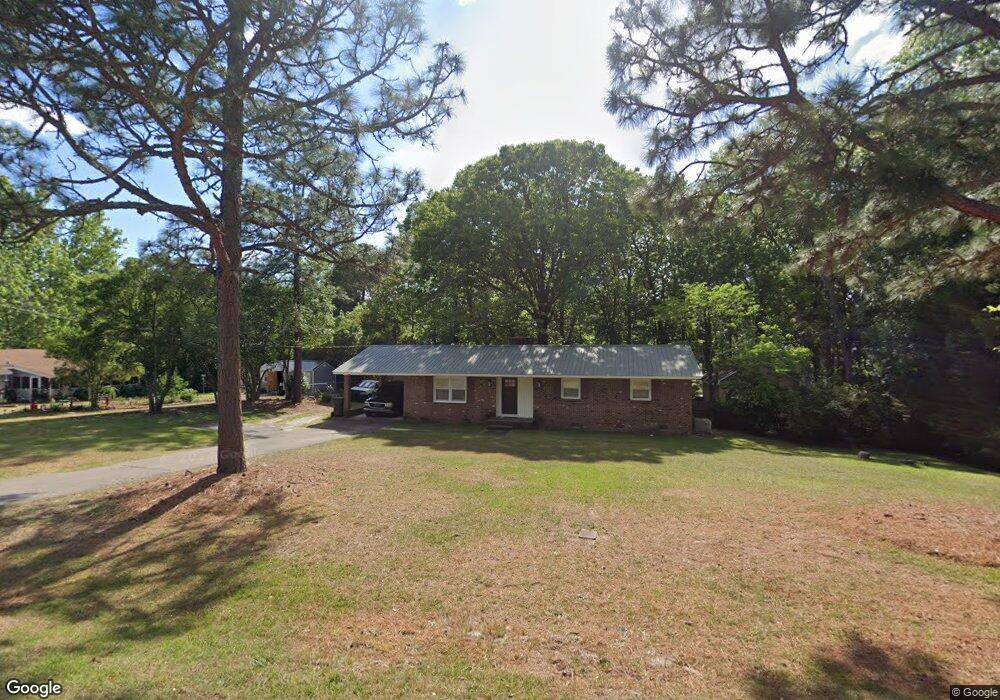
125 Timothy St Southern Pines, NC 28387
Estimated Value: $213,000 - $377,000
3
Beds
2
Baths
1,296
Sq Ft
$230/Sq Ft
Est. Value
About This Home
This home is located at 125 Timothy St, Southern Pines, NC 28387 and is currently estimated at $298,639, approximately $230 per square foot. 125 Timothy St is a home located in Moore County with nearby schools including Southern Pines Elementary, Southern Middle School, and Pinecrest High School.
Ownership History
Date
Name
Owned For
Owner Type
Purchase Details
Closed on
Jun 25, 2019
Sold by
Davis Matthew Edwin and Davis Elizabeth J
Bought by
Farris Joe L
Current Estimated Value
Purchase Details
Closed on
Oct 28, 2015
Sold by
Farris Wanda R
Bought by
Farris Joe L
Purchase Details
Closed on
Nov 22, 2013
Sold by
Farris James R
Bought by
Farris Joe L and Farris Wanda R
Home Financials for this Owner
Home Financials are based on the most recent Mortgage that was taken out on this home.
Original Mortgage
$97,959
Interest Rate
4.26%
Mortgage Type
New Conventional
Create a Home Valuation Report for This Property
The Home Valuation Report is an in-depth analysis detailing your home's value as well as a comparison with similar homes in the area
Home Values in the Area
Average Home Value in this Area
Purchase History
| Date | Buyer | Sale Price | Title Company |
|---|---|---|---|
| Farris Joe L | $35,000 | None Available | |
| Farris Joe L | -- | None Available | |
| Farris Joe L | $96,000 | None Available |
Source: Public Records
Mortgage History
| Date | Status | Borrower | Loan Amount |
|---|---|---|---|
| Previous Owner | Farris Joe L | $97,959 |
Source: Public Records
Tax History Compared to Growth
Tax History
| Year | Tax Paid | Tax Assessment Tax Assessment Total Assessment is a certain percentage of the fair market value that is determined by local assessors to be the total taxable value of land and additions on the property. | Land | Improvement |
|---|---|---|---|---|
| 2024 | $1,358 | $176,920 | $35,000 | $141,920 |
| 2023 | $1,393 | $176,920 | $35,000 | $141,920 |
| 2022 | $1,321 | $130,110 | $24,000 | $106,110 |
| 2021 | $1,353 | $130,110 | $24,000 | $106,110 |
| 2020 | $1,366 | $118,490 | $24,000 | $94,490 |
| 2019 | $1,366 | $130,110 | $24,000 | $106,110 |
| 2018 | $1,180 | $121,070 | $18,500 | $102,570 |
| 2017 | $1,168 | $121,070 | $18,500 | $102,570 |
| 2015 | $1,108 | $121,070 | $18,500 | $102,570 |
| 2014 | $1,069 | $116,780 | $18,500 | $98,280 |
| 2013 | -- | $116,780 | $18,500 | $98,280 |
Source: Public Records
Map
Nearby Homes
- TBD Stephanie St
- 0 Stephanie St
- 24 Cypress Cir
- 1710 N Poplar St
- 1709 N Poplar St
- 822 Ducks Landing
- 1608 Crest Dr
- 161 Kensington Way
- 305 3rd St
- 901 Heather Trail
- 110 Cliff Ct
- 624 Chambers
- 612 Chambers Dr
- 608 Chambers Dr
- 140 One Down St
- 532 Burgundy Dr
- 613 Chambers Dr
- 509 Burgundy Dr
- Camargue Plan at Shaw Landing
- Grenoble Plan at Shaw Landing
- 220 Bronwyn St
- 235 Stephanie St
- 230 Bronwyn St
- 140 Wayland St
- 245 Stephanie St
- 130 Timothy St
- 150 Wayland St
- 240 Bronwyn St
- 120 Timothy St
- 150 Timothy St
- 190 Bronwyn St
- 225 Bronwyn St
- 135 Wayland St
- 235 Bronwyn St
- 240 Stephanie St
- 145 Wayland St
- 220 Stephanie St
- 125 Wayland St
- 260 Stephanie St
- 195 Bronwyn St