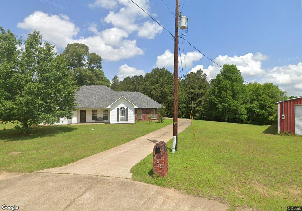
125 W Carroll Dr Pollock, LA 71467
Estimated Value: $242,000 - $287,000
3
Beds
2
Baths
2,455
Sq Ft
$109/Sq Ft
Est. Value
About This Home
This home is located at 125 W Carroll Dr, Pollock, LA 71467 and is currently estimated at $266,495, approximately $108 per square foot. 125 W Carroll Dr is a home located in Grant Parish with nearby schools including Pollock Elementary School, Grant Junior High School, and Grant High School.
Ownership History
Date
Name
Owned For
Owner Type
Purchase Details
Closed on
May 17, 2011
Sold by
Lewis Ragan Scott and Lewis Ronald Wayne
Bought by
Bailey Aubrey Neil
Current Estimated Value
Home Financials for this Owner
Home Financials are based on the most recent Mortgage that was taken out on this home.
Original Mortgage
$243,523
Outstanding Balance
$169,003
Interest Rate
4.85%
Estimated Equity
$97,492
Create a Home Valuation Report for This Property
The Home Valuation Report is an in-depth analysis detailing your home's value as well as a comparison with similar homes in the area
Purchase History
| Date | Buyer | Sale Price | Title Company |
|---|---|---|---|
| Bailey Aubrey Neil | $240,000 | -- |
Source: Public Records
Mortgage History
| Date | Status | Borrower | Loan Amount |
|---|---|---|---|
| Open | Bailey Aubrey Neil | $243,523 |
Source: Public Records
Tax History
| Year | Tax Paid | Tax Assessment Tax Assessment Total Assessment is a certain percentage of the fair market value that is determined by local assessors to be the total taxable value of land and additions on the property. | Land | Improvement |
|---|---|---|---|---|
| 2024 | $31 | $20,606 | $2,888 | $17,718 |
| 2023 | $3,008 | $19,426 | $3,200 | $16,226 |
| 2022 | $3,005 | $19,426 | $3,200 | $16,226 |
| 2021 | $3,004 | $19,426 | $3,200 | $16,226 |
| 2020 | $2,999 | $19,426 | $3,200 | $16,226 |
| 2019 | $3,011 | $18,866 | $3,200 | $15,666 |
| 2018 | $3,011 | $18,866 | $3,200 | $15,666 |
| 2017 | $2,776 | $18,866 | $3,200 | $15,666 |
| 2015 | $3,166 | $18,120 | $3,200 | $14,920 |
| 2014 | $3,166 | $18,120 | $3,200 | $14,920 |
| 2013 | $3,166 | $18,120 | $3,200 | $14,920 |
Source: Public Records
Map
Nearby Homes
- 8032 Ridge St
- 0 Hwy 165 Unit 2455384
- 0 Hwy 165 Unit 2535602
- 0 Hwy 165 Unit 2455393
- 2219 North St
- 000 U S 165
- 0000 U S 165
- 0 Pollock Cemetery Rd
- 204 Holt Rd
- 130 Holt Rd
- 512 Dyson Creek Rd
- 0 Homer St
- 1620 Homer St
- 888 Dyson Creek Rd
- 00 Dyson Creek Rd
- 236 Hughart Rd
- 208 E Meade Rd
- 220 E Meade Rd
- 4494 Louisiana 8
- 291 Price Rd
- 114 W Carroll Dr
- 117 W Carroll Dr
- 213 George Davidson Rd
- 0 W Carroll Dr
- 113 W Carroll Dr
- 217 George Davidson Rd
- 109 W Carroll Dr
- 101 W Carroll Dr
- 0 George Davidson Rd
- 0 Highway 165 Unit CNC118358
- 0 Highway 165 Unit C118358
- 0 Highway 165 Unit 152992
- 0 Highway 165 Unit CN161098
- 130 George Davidson Rd
- 140 George Davidson Rd
- 8109 Ridge St
- 8109 Ridge St
- 3414 Louisiana 8
- 4677 Louisiana 8
- 00 Louisiana 8
Your Personal Tour Guide
Ask me questions while you tour the home.