Estimated Value: $267,884 - $307,000
3
Beds
2
Baths
1,304
Sq Ft
$220/Sq Ft
Est. Value
About This Home
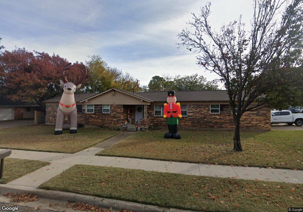
This home is located at 125 W Cheryl Ave, Hurst, TX 76053 and is currently estimated at $287,442, approximately $220 per square foot. 125 W Cheryl Ave is a home located in Tarrant County with nearby schools including Harrison Lane Elementary School, Hurst J High School, and L.D. Bell High School.
Ownership History
Date
Name
Owned For
Owner Type
Purchase Details
Closed on
Aug 22, 2024
Sold by
Guthrie Meredith Rae and Guthrie Amanda Austin
Bought by
Guthrie Amanda Austin and Luna Saul Torres
Current Estimated Value
Home Financials for this Owner
Home Financials are based on the most recent Mortgage that was taken out on this home.
Original Mortgage
$150,000
Outstanding Balance
$148,270
Interest Rate
6.77%
Mortgage Type
Credit Line Revolving
Estimated Equity
$139,172
Purchase Details
Closed on
Dec 5, 2018
Sold by
Guthrie Amanda Austin
Bought by
Estate Of Margaret Austin Guthrie
Purchase Details
Closed on
Oct 30, 2013
Sold by
Guthrie Margaret Austin
Bought by
Guthrie Margaret A
Purchase Details
Closed on
Jun 27, 2002
Sold by
Farrar Kent M and Farrar Karen
Bought by
Dickard Cory and Dickard Bernice
Home Financials for this Owner
Home Financials are based on the most recent Mortgage that was taken out on this home.
Original Mortgage
$95,842
Interest Rate
6.78%
Mortgage Type
FHA
Create a Home Valuation Report for This Property
The Home Valuation Report is an in-depth analysis detailing your home's value as well as a comparison with similar homes in the area
Home Values in the Area
Average Home Value in this Area
Purchase History
| Date | Buyer | Sale Price | Title Company |
|---|---|---|---|
| Guthrie Amanda Austin | -- | Capital Title | |
| Estate Of Margaret Austin Guthrie | -- | None Available | |
| Guthrie Margaret A | -- | None Available | |
| Dickard Cory | -- | Lone Star Title Inc |
Source: Public Records
Mortgage History
| Date | Status | Borrower | Loan Amount |
|---|---|---|---|
| Open | Guthrie Amanda Austin | $150,000 | |
| Previous Owner | Dickard Cory | $95,842 |
Source: Public Records
Tax History Compared to Growth
Tax History
| Year | Tax Paid | Tax Assessment Tax Assessment Total Assessment is a certain percentage of the fair market value that is determined by local assessors to be the total taxable value of land and additions on the property. | Land | Improvement |
|---|---|---|---|---|
| 2025 | $2,559 | $254,275 | $55,000 | $199,275 |
| 2024 | $2,559 | $254,275 | $55,000 | $199,275 |
| 2023 | $2,280 | $241,054 | $40,000 | $201,054 |
| 2022 | $3,684 | $213,239 | $40,000 | $173,239 |
| 2021 | $3,508 | $204,424 | $40,000 | $164,424 |
| 2020 | $3,181 | $163,508 | $40,000 | $123,508 |
| 2019 | $2,942 | $157,682 | $40,000 | $117,682 |
| 2018 | $2,166 | $109,275 | $19,000 | $90,275 |
| 2017 | $2,514 | $142,583 | $19,000 | $123,583 |
| 2016 | $2,285 | $132,909 | $19,000 | $113,909 |
| 2015 | $1,778 | $82,100 | $15,000 | $67,100 |
| 2014 | $1,778 | $82,100 | $15,000 | $67,100 |
Source: Public Records
Map
Nearby Homes
- 1016 Keith Dr
- 1136 Simpson Dr
- 127 W Cedar St
- 400 Joanna Dr
- 420 Bedford Ct W
- 409 Vicki Place
- 905 Brown Trail
- 1220 Norwood Dr
- 802 Brown Trail
- 624 Harrison Ln
- 803 Glenda Dr
- 1208 Karla Dr
- 644 Caduceus Ln
- 231 Elm St
- 341 Hurst Dr
- 552 Norwood Dr
- 344 Bedford Ct E
- 1337 Harrison Ln
- 116 Oakhurst Dr
- 1208 Birch St
- 121 W Cheryl Ave
- 201 W Cheryl Ave
- 117 W Cheryl Ave
- 1100 Harrison Ln
- 1053 Keith Dr
- 205 W Cheryl Ave
- 1101 Simpson Dr
- 1101 Harrison Ln
- 113 W Cheryl Ave
- 1104 Harrison Ln
- 1049 Keith Dr
- 1105 Harrison Ln
- 1105 Simpson Dr
- 209 W Cheryl Ave
- 1037 Harrison Ln
- 1108 Harrison Ln
- 1100 Mason Dr
- 1109 Harrison Ln
- 1100 Simpson Dr
- 1109 Simpson Dr