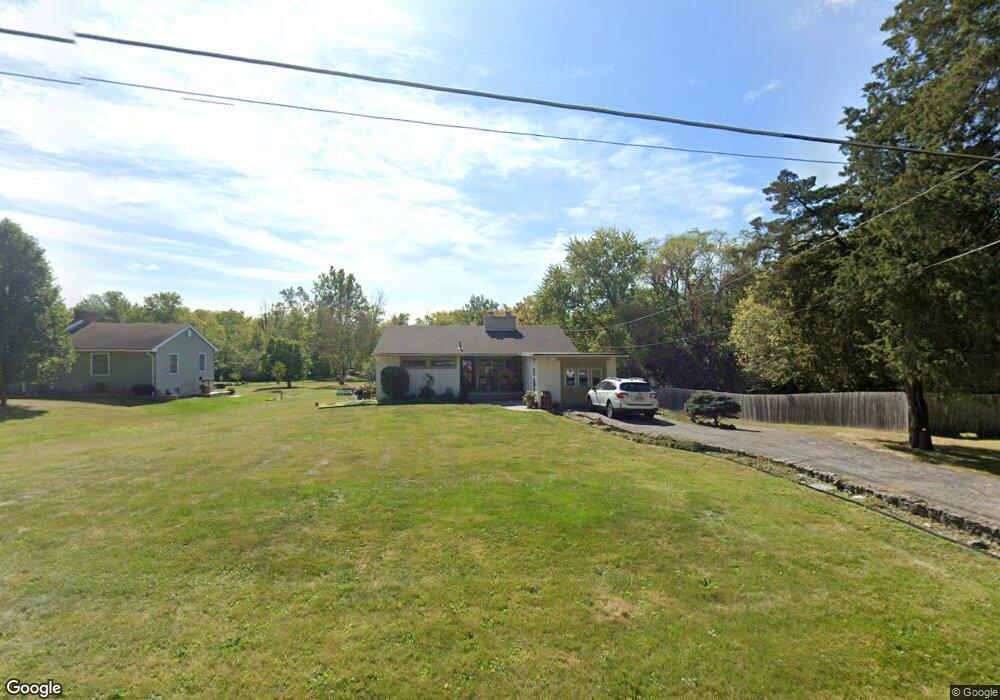
125 W Possum Rd Springfield, OH 45506
Estimated Value: $229,397 - $292,000
3
Beds
2
Baths
1,490
Sq Ft
$182/Sq Ft
Est. Value
About This Home
This home is located at 125 W Possum Rd, Springfield, OH 45506 and is currently estimated at $270,599, approximately $181 per square foot. 125 W Possum Rd is a home located in Clark County with nearby schools including Possum Elementary School, Shawnee Middle School/High School, and Risen Christ Lutheran School.
Ownership History
Date
Name
Owned For
Owner Type
Purchase Details
Closed on
Aug 28, 2014
Sold by
Valle Rigoberto and Beller Kelly
Bought by
Brown Vincent L
Current Estimated Value
Home Financials for this Owner
Home Financials are based on the most recent Mortgage that was taken out on this home.
Original Mortgage
$114,950
Interest Rate
4.1%
Mortgage Type
Purchase Money Mortgage
Purchase Details
Closed on
Dec 27, 2000
Sold by
Of Springfield Ohio Trustee Security National and Albert E Goodman Trust
Bought by
Valle Rigoberto and Valle Kelly
Home Financials for this Owner
Home Financials are based on the most recent Mortgage that was taken out on this home.
Original Mortgage
$90,250
Interest Rate
7.77%
Create a Home Valuation Report for This Property
The Home Valuation Report is an in-depth analysis detailing your home's value as well as a comparison with similar homes in the area
Home Values in the Area
Average Home Value in this Area
Purchase History
| Date | Buyer | Sale Price | Title Company |
|---|---|---|---|
| Brown Vincent L | $121,000 | Attorney | |
| Valle Rigoberto | $95,000 | -- |
Source: Public Records
Mortgage History
| Date | Status | Borrower | Loan Amount |
|---|---|---|---|
| Previous Owner | Brown Vincent L | $114,950 | |
| Previous Owner | Valle Rigoberto | $90,250 |
Source: Public Records
Tax History
| Year | Tax Paid | Tax Assessment Tax Assessment Total Assessment is a certain percentage of the fair market value that is determined by local assessors to be the total taxable value of land and additions on the property. | Land | Improvement |
|---|---|---|---|---|
| 2025 | $2,804 | $72,690 | $25,510 | $47,180 |
| 2024 | $2,646 | $55,710 | $18,500 | $37,210 |
| 2023 | $2,646 | $53,980 | $18,500 | $35,480 |
| 2022 | $2,625 | $53,980 | $18,500 | $35,480 |
| 2021 | $2,242 | $41,270 | $14,020 | $27,250 |
| 2020 | $2,260 | $41,270 | $14,020 | $27,250 |
| 2019 | $2,296 | $41,270 | $14,020 | $27,250 |
| 2018 | $2,211 | $39,210 | $17,010 | $22,200 |
| 2017 | $2,265 | $37,167 | $17,007 | $20,160 |
| 2016 | $2,044 | $37,167 | $17,007 | $20,160 |
| 2015 | $1,823 | $35,946 | $16,356 | $19,590 |
| 2014 | $1,829 | $35,946 | $16,356 | $19,590 |
| 2013 | $1,589 | $35,946 | $16,356 | $19,590 |
Source: Public Records
Map
Nearby Homes
- 703 Dorchester Dr
- 2746 Northbourne Dr
- 201 Kinnane Ave
- 505 Highview Ave
- 2775 Hemlock Dr
- 533 Highview Ave
- 711 Kinnane Ave
- 2642 Springfield Xenia Rd
- 2252 Ontario Ave
- 2170 Fairfield Pike
- 2301 Duquesne Dr
- 1730 Damascus Ave
- 1923 Portage Path
- 1823 Clay St
- 1846 Ohio Ave
- 1754 S Fountain Ave
- 1619 S Center Blvd
- 1724 Clay St
- 1618 Portage Path
- 1617 Clifton Ave
- 121 W Possum Rd
- 115 W Possum Rd
- 135 W Possum Rd
- 132 W Possum Rd
- 111 W Possum Rd
- 74 W Possum Rd
- 134 W Possum Rd
- 81 W Possum Rd
- 145 W Possum Rd
- 70 W Possum Rd
- 140 W Possum Rd
- 130 W Possum Rd
- 155 W Possum Rd
- 72 W Possum Rd
- 146 W Possum Rd
- 64 W Possum Rd
- 161 W Possum Rd
- 75 W Possum Rd
- 60 W Possum Rd
- 165 W Possum Rd