Estimated Value: $237,000 - $260,000
3
Beds
2
Baths
--
Sq Ft
6,490
Sq Ft Lot
About This Home
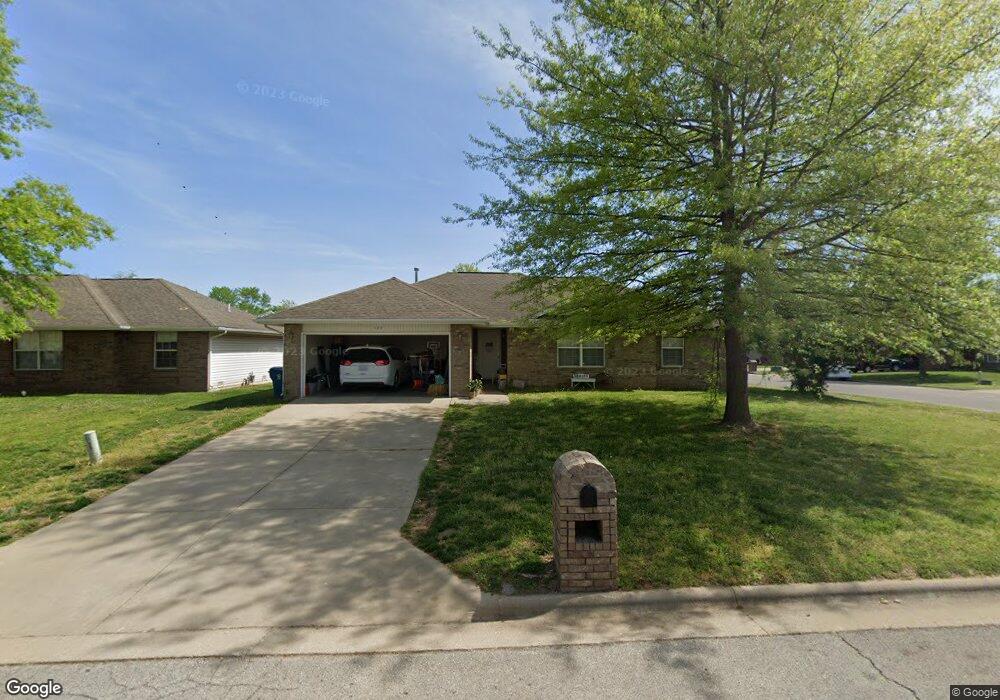
This home is located at 125 W Trail Point Dr, Nixa, MO 65714 and is currently estimated at $246,590. 125 W Trail Point Dr is a home located in Christian County with nearby schools including Deauville Gardens Elementary School, Hugh W. Gregg Elementary School, and Century Elementary School.
Ownership History
Date
Name
Owned For
Owner Type
Purchase Details
Closed on
Dec 26, 2012
Sold by
Bright Joe and Bright Vicki
Bought by
Casa Holdings Llc
Current Estimated Value
Purchase Details
Closed on
Jun 28, 2005
Sold by
Montleone Development Co Inc
Bought by
Bright Joe E and Bright Vicki L
Home Financials for this Owner
Home Financials are based on the most recent Mortgage that was taken out on this home.
Original Mortgage
$82,150
Interest Rate
5.64%
Mortgage Type
New Conventional
Create a Home Valuation Report for This Property
The Home Valuation Report is an in-depth analysis detailing your home's value as well as a comparison with similar homes in the area
Home Values in the Area
Average Home Value in this Area
Purchase History
| Date | Buyer | Sale Price | Title Company |
|---|---|---|---|
| Casa Holdings Llc | -- | None Available | |
| Bright Joe E | -- | None Available |
Source: Public Records
Mortgage History
| Date | Status | Borrower | Loan Amount |
|---|---|---|---|
| Previous Owner | Bright Joe E | $82,150 |
Source: Public Records
Tax History Compared to Growth
Tax History
| Year | Tax Paid | Tax Assessment Tax Assessment Total Assessment is a certain percentage of the fair market value that is determined by local assessors to be the total taxable value of land and additions on the property. | Land | Improvement |
|---|---|---|---|---|
| 2024 | $1,481 | $23,770 | -- | -- |
| 2023 | $1,481 | $23,770 | $0 | $0 |
| 2022 | $1,365 | $21,870 | $0 | $0 |
| 2021 | $1,365 | $21,870 | $0 | $0 |
| 2020 | $1,234 | $18,870 | $0 | $0 |
| 2019 | $1,234 | $18,870 | $0 | $0 |
| 2018 | $1,150 | $18,870 | $0 | $0 |
| 2017 | $1,150 | $18,870 | $0 | $0 |
| 2016 | $1,132 | $18,870 | $0 | $0 |
| 2015 | $1,134 | $18,870 | $18,870 | $0 |
| 2014 | $1,105 | $18,850 | $0 | $0 |
| 2013 | $11 | $18,850 | $0 | $0 |
| 2011 | $11 | $38,300 | $0 | $0 |
Source: Public Records
Map
Nearby Homes
- 104 Willow Ln
- 138 W Silver Oak St
- 000 Croley Blvd Unit Lots 12,13, 14
- 204 Gate Ln
- 705 Rice St
- 000 Old Riverdale Rd
- 617 E Gallup Hill Rd
- 404 S Patricia Ave
- 209 Shady Acres Cir
- 676 E Gallup Hill Rd
- Sw Corner Highway 160 & St S
- 111 Daleview Cir
- 316 S Market St
- 287 Sunrise Dr
- 601 Carriage Crossing
- 000 Citydel Rd W
- 573 Barn Stable
- 5848 S Canterbury Ln Unit Lot 127
- 5849 S Canterbury Ln Unit Lot 102
- 5969 S Canterbury Ln Unit Lot 98
- 127 W Trail Point Dr
- 805 S Creekwood Ct
- 0 W Trail Point Dr
- 803 S Creekwood
- 124 W Twin Oak Dr
- 129 W Trail Point Dr
- 126 W Trail Point Dr
- 124 W Trail Point Dr
- 122 W Twin Oak Dr
- 122 W Trail Point Dr
- 128 W Trail Point Dr
- 120 W Twin Oak Dr
- 801 S Creekwood
- 117 W Trail Point Dr
- 804 S Creekwood Ct
- 118 W Twin Oak Dr
- 800 S Creekwood Ct
- 812 S Southgate Dr
- 118 W Trail Point Dr
- 807 S Brookwood Ct