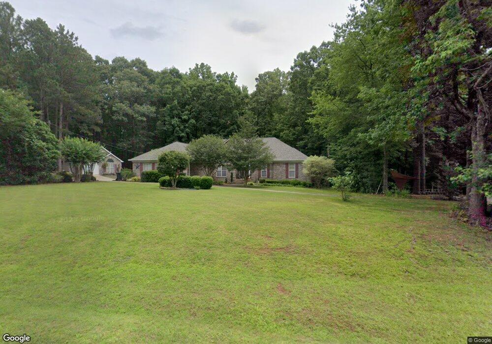
125 White Laurel Ln Covington, GA 30016
Estimated Value: $433,509 - $509,000
4
Beds
4
Baths
2,771
Sq Ft
$166/Sq Ft
Est. Value
About This Home
This home is located at 125 White Laurel Ln, Covington, GA 30016 and is currently estimated at $459,877, approximately $165 per square foot. 125 White Laurel Ln is a home located in Newton County with nearby schools including Heard-Mixon Elementary School, Liberty Middle School, and Alcovy High School.
Ownership History
Date
Name
Owned For
Owner Type
Purchase Details
Closed on
Aug 31, 2011
Sold by
White William G
Bought by
Parker Lavonda M and Parker Keith L
Current Estimated Value
Create a Home Valuation Report for This Property
The Home Valuation Report is an in-depth analysis detailing your home's value as well as a comparison with similar homes in the area
Home Values in the Area
Average Home Value in this Area
Purchase History
| Date | Buyer | Sale Price | Title Company |
|---|---|---|---|
| Parker Lavonda M | $160,000 | -- |
Source: Public Records
Tax History
| Year | Tax Paid | Tax Assessment Tax Assessment Total Assessment is a certain percentage of the fair market value that is determined by local assessors to be the total taxable value of land and additions on the property. | Land | Improvement |
|---|---|---|---|---|
| 2025 | $3,065 | $164,760 | $11,760 | $153,000 |
| 2024 | $3,105 | $164,160 | $11,760 | $152,400 |
| 2023 | $3,225 | $147,880 | $15,200 | $132,680 |
| 2022 | $2,524 | $122,040 | $12,000 | $110,040 |
| 2021 | $2,504 | $111,680 | $12,000 | $99,680 |
| 2020 | $2,272 | $96,840 | $12,000 | $84,840 |
| 2019 | $2,288 | $96,280 | $12,000 | $84,280 |
| 2018 | $2,144 | $91,680 | $12,000 | $79,680 |
| 2017 | $1,849 | $83,080 | $12,000 | $71,080 |
| 2016 | $1,226 | $64,920 | $6,000 | $58,920 |
| 2015 | $1,293 | $66,880 | $6,000 | $60,880 |
| 2014 | $1,289 | $66,880 | $0 | $0 |
Source: Public Records
Map
Nearby Homes
- 0 White Laurel Ln Unit 16
- 0 River Shoals Ct Unit 10620666
- 674 Lower River Rd
- 219 Channing Cope Rd
- 240 Harville Rd
- 220 Harville Rd
- 550 Anderson Creek Rd
- 1599 Lower River Rd
- 440 Varner St
- 185 Mountain Ridge
- 0 Stewart Rd Unit 10685542
- 125 Shelby Oaks Trail
- 0 Rocky Plains Rd Unit 18248418
- 115 Mountainview Dr
- 60 Laurie Ln
- 20 Mountainview Ct Unit 2
- 12510 Highway 36
- 25 Shady Oaks Trail
- 185 Mountain View Cir
- 30 Laurie Ln
- 105 White Laurel Ln
- 120 White Laurel Ln
- 110 White Laurel Ln
- 155 White Laurel Ln
- 135 River Shoals Run Ct
- 135 River Shoals Ct
- 75 White Laurel Ln
- 75 White Laurel Ln Unit 7
- 180 White Laurel Ln
- 145 River Shoals Ct
- 80 White Laurel Ln
- 130 River Shoals Ct
- 19 River Shoals Ct
- 85 River Shoals Ct
- 65 White Laurel Ln
- 170 White Laurel Ln
- 155 River Shoals Ct
- 110 River Shoals Ct
- 90 River Shoals Ct
- 55 White Laurel Ln
Your Personal Tour Guide
Ask me questions while you tour the home.