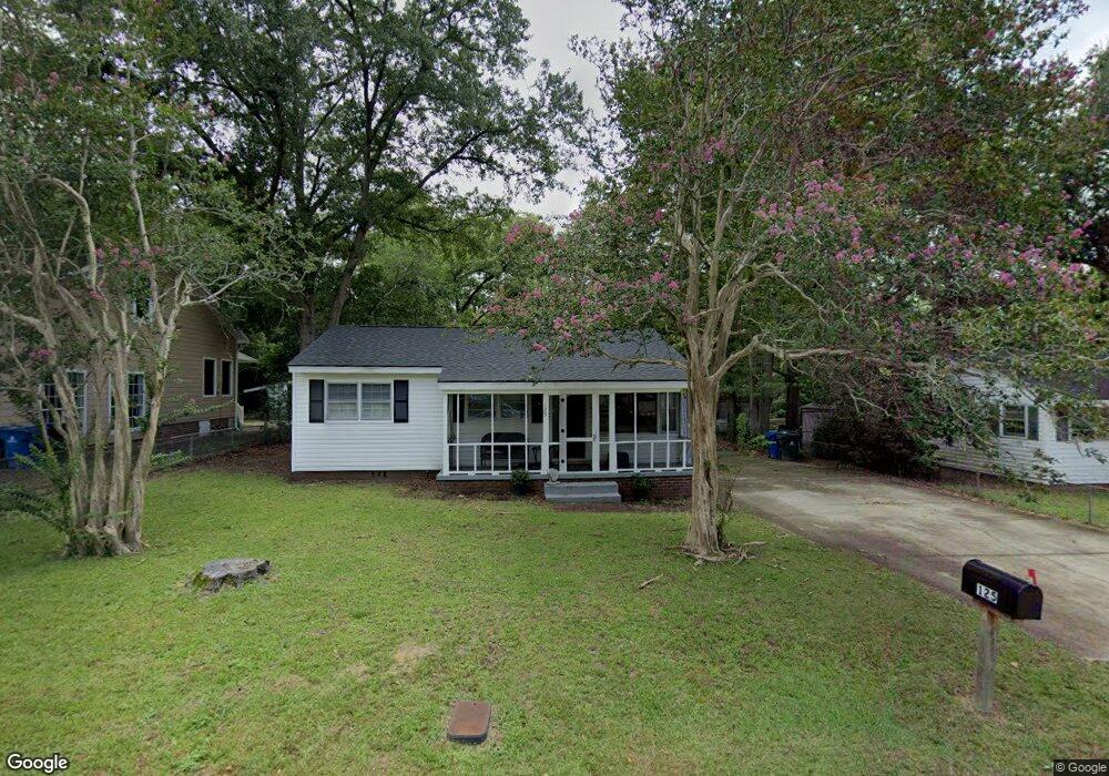
125 Whiteside Cir West Columbia, SC 29169
Estimated Value: $162,000 - $188,653
3
Beds
2
Baths
1,095
Sq Ft
$160/Sq Ft
Est. Value
About This Home
This home is located at 125 Whiteside Cir, West Columbia, SC 29169 and is currently estimated at $175,663, approximately $160 per square foot. 125 Whiteside Cir is a home located in Lexington County with nearby schools including Cayce Elementary, Cyril B. Busbee Creative Arts Academy, and Brookland-Cayce High School.
Ownership History
Date
Name
Owned For
Owner Type
Purchase Details
Closed on
Aug 2, 2021
Sold by
Drews Noah M and Drews Natosha A
Bought by
Sfr3 030 Llc
Current Estimated Value
Purchase Details
Closed on
May 26, 2020
Sold by
Drews Natosha A
Bought by
Drews Noah M and Drews Natosha A
Purchase Details
Closed on
Aug 18, 2010
Sold by
Watkins Stephen A and Drews Natosha A
Bought by
Drews Natosha A
Purchase Details
Closed on
Oct 28, 2007
Sold by
Watkins Stephen A
Bought by
Drews Natosha A
Purchase Details
Closed on
Oct 26, 2005
Sold by
Knotts Hosea E
Bought by
Watkins Stephen A
Home Financials for this Owner
Home Financials are based on the most recent Mortgage that was taken out on this home.
Original Mortgage
$67,500
Interest Rate
8.25%
Mortgage Type
Adjustable Rate Mortgage/ARM
Create a Home Valuation Report for This Property
The Home Valuation Report is an in-depth analysis detailing your home's value as well as a comparison with similar homes in the area
Home Values in the Area
Average Home Value in this Area
Purchase History
| Date | Buyer | Sale Price | Title Company |
|---|---|---|---|
| Sfr3 030 Llc | $80,000 | None Available | |
| Drews Noah M | -- | None Available | |
| Drews Natosha A | -- | -- | |
| Drews Natosha A | -- | None Available | |
| Watkins Stephen A | $67,500 | -- |
Source: Public Records
Mortgage History
| Date | Status | Borrower | Loan Amount |
|---|---|---|---|
| Previous Owner | Watkins Stephen A | $67,500 |
Source: Public Records
Tax History Compared to Growth
Tax History
| Year | Tax Paid | Tax Assessment Tax Assessment Total Assessment is a certain percentage of the fair market value that is determined by local assessors to be the total taxable value of land and additions on the property. | Land | Improvement |
|---|---|---|---|---|
| 2024 | $1,238 | $6,720 | $640 | $6,080 |
| 2023 | $1,284 | $3,200 | $640 | $2,560 |
| 2022 | $617 | $3,200 | $640 | $2,560 |
| 2020 | $1,446 | $4,083 | $960 | $3,123 |
| 2019 | $1,511 | $4,221 | $960 | $3,261 |
| 2018 | $1,499 | $4,221 | $960 | $3,261 |
| 2017 | $1,471 | $4,221 | $960 | $3,261 |
| 2016 | $1,488 | $4,220 | $960 | $3,260 |
| 2014 | $1,464 | $4,777 | $1,080 | $3,697 |
| 2013 | -- | $4,780 | $1,080 | $3,700 |
Source: Public Records
Map
Nearby Homes
- 706 Westside Dr
- 725 Brooks Ave
- 135 Silver Run Place
- 116 Silver Run Place
- 349 Gum Swamp Trail
- 339 Gum Swamp Trail
- 2312 Rainbow Dr
- 2405 Rainbow Dr
- 309 Hammond Ave
- 212 Alexandria St
- 615 Dawn Dr
- 2024 Platt Springs Rd
- 826 Jefferson St
- 1802 D Ave
- 153 Cavendish Dr
- 151 Cavendish Dr
- 157 Cavendish Dr
- 106 Stockman Dr
- 1210 Decatur St
- 215 Sandel Ln
- 123 Whiteside Cir
- 127 Whiteside Cir
- 121 Whiteside Cir
- 129 Whiteside Cir
- 163 Whiteside Cir
- 165 Whiteside Cir
- 161 Whiteside Cir
- 119 Whiteside Cir
- 131 Whiteside Cir
- 167 Whiteside Cir
- 159 Whiteside Cir
- 124 Whiteside Cir
- 126 Whiteside Cir
- 120 Whiteside Cir
- 169 Whiteside Cir
- 157 Whiteside Cir
- 133 Whiteside Cir
- 117 Whiteside Cir
- 118 Whiteside Cir
- 171 Whiteside Cir