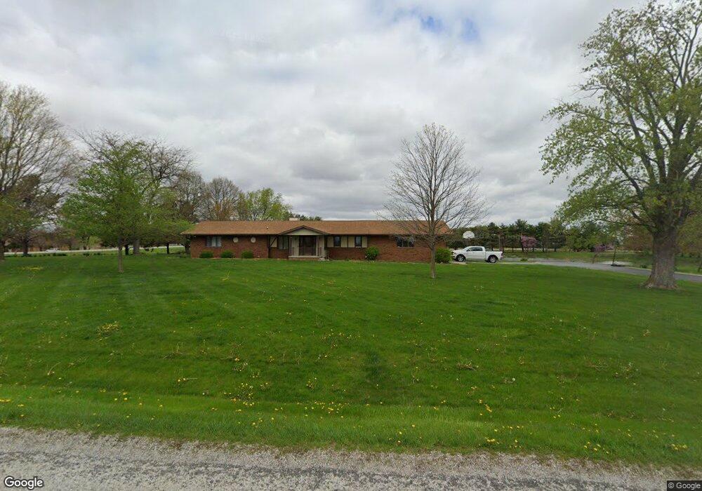
1250 1800th St Lincoln, IL 62656
Estimated Value: $252,000 - $313,246
--
Bed
--
Bath
1,596
Sq Ft
$172/Sq Ft
Est. Value
About This Home
This home is located at 1250 1800th St, Lincoln, IL 62656 and is currently estimated at $274,562, approximately $172 per square foot. 1250 1800th St is a home located in Logan County with nearby schools including Chester-East Lincoln Elementary School, Lincoln Community High School, and Carroll Catholic School.
Ownership History
Date
Name
Owned For
Owner Type
Purchase Details
Closed on
Sep 22, 2023
Sold by
Hellman Donald M and Hellman Donna J
Bought by
Young Kyle D and Young Emily J
Current Estimated Value
Home Financials for this Owner
Home Financials are based on the most recent Mortgage that was taken out on this home.
Original Mortgage
$255,000
Outstanding Balance
$249,592
Interest Rate
6.96%
Mortgage Type
New Conventional
Estimated Equity
$24,970
Purchase Details
Closed on
Apr 25, 2017
Sold by
Hellman Donald M and Hellman Donna J
Bought by
Hellman Donald M and Hellman Donna J
Purchase Details
Closed on
Feb 27, 1997
Bought by
Hellman Donna J
Create a Home Valuation Report for This Property
The Home Valuation Report is an in-depth analysis detailing your home's value as well as a comparison with similar homes in the area
Home Values in the Area
Average Home Value in this Area
Purchase History
| Date | Buyer | Sale Price | Title Company |
|---|---|---|---|
| Young Kyle D | $300,000 | None Available | |
| Hellman Donald M | -- | -- | |
| Hellman Donna J | -- | -- |
Source: Public Records
Mortgage History
| Date | Status | Borrower | Loan Amount |
|---|---|---|---|
| Open | Young Kyle D | $255,000 |
Source: Public Records
Tax History Compared to Growth
Tax History
| Year | Tax Paid | Tax Assessment Tax Assessment Total Assessment is a certain percentage of the fair market value that is determined by local assessors to be the total taxable value of land and additions on the property. | Land | Improvement |
|---|---|---|---|---|
| 2024 | $4,848 | $72,610 | $10,300 | $62,310 |
| 2023 | $4,142 | $67,230 | $9,540 | $57,690 |
| 2022 | $3,874 | $62,840 | $8,920 | $53,920 |
| 2021 | $3,699 | $60,330 | $8,560 | $51,770 |
| 2020 | $3,644 | $59,430 | $8,430 | $51,000 |
| 2019 | $3,522 | $58,260 | $8,260 | $50,000 |
| 2018 | $3,469 | $57,120 | $8,100 | $49,020 |
| 2017 | $3,484 | $57,120 | $8,100 | $49,020 |
| 2016 | $3,482 | $57,060 | $8,090 | $48,970 |
| 2015 | $3,845 | $62,820 | $7,820 | $55,000 |
| 2014 | $3,845 | $62,820 | $7,820 | $55,000 |
| 2013 | $3,845 | $59,630 | $7,420 | $52,210 |
| 2012 | $3,845 | $60,700 | $7,550 | $53,150 |
Source: Public Records
Map
Nearby Homes
- 1889 1250th Ave
- 1842 Castle Pine Place
- 1708 Rutledge Dr
- 703 Grand Ave
- 1429 Rutledge Dr
- 1354 Airport Rd
- 515 Oglesby Ave
- 135 White Ave
- 1306 N Kankakee St
- 180 Regent St
- 6 Meadow Ln
- 707 Feldman Dr Unit 49
- 707 Feldman Dr Unit 17
- 165 Mayfair Dr
- 1 Keokuk St
- 1102 N State St
- 25 Rigg Dr
- 14 Rigg Dr
- 1720 N Jefferson St
- 102 Crestwood Dr
- 1246 1800th St
- 1275 1800th St
- 1228 1800th St
- 1660 Pheasant Ridge Dr
- 1230 1800th St
- 1810 1218th Ave
- 1822 1235th Ave
- 1828 1235th Ave
- 1809 1218th Ave
- 1823 1250th Ave
- 1832 1235th Ave
- 1805 1218th Ave
- 1834 1235th Ave
- 1830 1250th Ave
- 1827 1235th Ave
- 1821 1235th Ave
- 1796 1218th Ave
- 1836 1235th Ave
- 1831 1235th Ave
- 1838 1235th Ave
