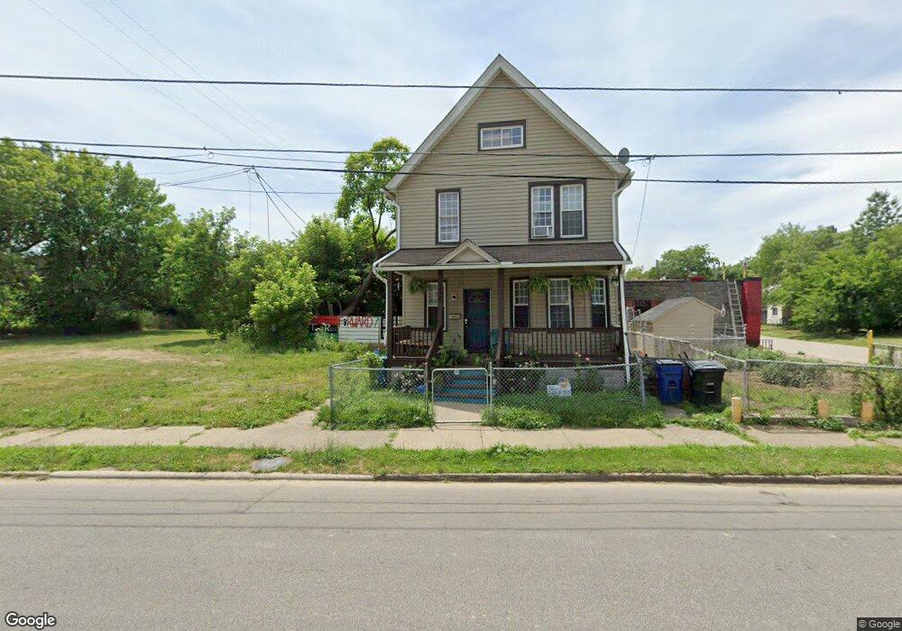
1250 Addison Rd Cleveland, OH 44103
Saint Clair-Superior NeighborhoodEstimated Value: $27,000
4
Beds
1
Bath
1,612
Sq Ft
$17/Sq Ft
Est. Value
About This Home
This home is located at 1250 Addison Rd, Cleveland, OH 44103 and is currently priced at $27,000, approximately $16 per square foot. 1250 Addison Rd is a home located in Cuyahoga County with nearby schools including St Francis School, St. Thomas Aquinas School, and St. Martin de Porres High School.
Ownership History
Date
Name
Owned For
Owner Type
Purchase Details
Closed on
Oct 4, 2022
Sold by
Sheriff Of Cuyahoga County
Bought by
City Of Cuyahoga County Land Reutilization Co
Current Estimated Value
Purchase Details
Closed on
Mar 20, 2001
Sold by
Peoples Gloria
Bought by
Manning Darrell D and Peoples Gloria
Home Financials for this Owner
Home Financials are based on the most recent Mortgage that was taken out on this home.
Original Mortgage
$60,000
Interest Rate
7.03%
Purchase Details
Closed on
Oct 26, 1998
Sold by
Estate Of Henry Peoples
Bought by
Peoples Gloria
Purchase Details
Closed on
Mar 8, 1988
Bought by
Peoples Henry
Purchase Details
Closed on
Jan 1, 1975
Bought by
Peoples Henry & Lessie Mae
Create a Home Valuation Report for This Property
The Home Valuation Report is an in-depth analysis detailing your home's value as well as a comparison with similar homes in the area
Home Values in the Area
Average Home Value in this Area
Purchase History
We collect this data history from publicly available records. To have your information removed, we recommend requesting removal directly through your county’s website.
| Date | Buyer | Sale Price | Title Company |
|---|---|---|---|
| City Of Cuyahoga County Land Reutilization Co | $2,457 | -- | |
| Manning Darrell D | -- | -- | |
| Peoples Gloria | -- | -- | |
| Peoples Henry | -- | -- | |
| Peoples Henry & Lessie Mae | -- | -- |
Source: Public Records
Mortgage History
We collect this data history from publicly available records. To have your information removed, we recommend requesting removal directly through your county’s website.
| Date | Status | Borrower | Loan Amount |
|---|---|---|---|
| Previous Owner | Manning Darrell D | $60,000 |
Source: Public Records
Tax History
| Year | Tax Paid | Tax Assessment Tax Assessment Total Assessment is a certain percentage of the fair market value that is determined by local assessors to be the total taxable value of land and additions on the property. | Land | Improvement |
|---|---|---|---|---|
| 2025 | -- | $700 | $700 | -- |
| 2024 | -- | $700 | $700 | -- |
| 2022 | $0 | $910 | $910 | $0 |
| 2021 | $68 | $910 | $910 | $0 |
| 2020 | $67 | $770 | $770 | $0 |
| 2019 | $12,851 | $2,200 | $2,200 | $0 |
| 2018 | $1,078 | $770 | $770 | $0 |
| 2017 | $721 | $4,520 | $600 | $3,920 |
| 2016 | $370 | $4,520 | $600 | $3,920 |
| 2015 | $2,317 | $4,520 | $600 | $3,920 |
| 2014 | $2,317 | $4,520 | $600 | $3,920 |
Source: Public Records
Map
Nearby Homes
- 1245 Addison Rd
- 6732 Edna Ave
- 1225 E 71st St
- 7112 Duluth Ave
- 7009 Hecker Ave
- 6618 Schaefer Ave
- 1333 E 68th St
- 6531 Schaefer Ave
- 1350 Russell Rd
- 6408 Carl Ave
- 6404 Carl Ave
- 1214 E 74th St
- 7609 Superior Ave
- 6700 Whitney Ave
- 1168 Norwood Rd
- 1101 E 66th St
- 7705 Star Ave
- 6410 Dibble Ave
- 6307 Dibble Ave
- 1068 E 68th St
- 1248 Addison Rd
- 1246 Addison Rd
- 6920 Bayliss Ave
- 1264 Addison Rd
- 6916 Bayliss Ave
- 1590 Addison Rd
- 1249 Addison Rd Unit 1251
- 1249 Addison Rd Unit Up
- 1247 Addison Rd
- 1232 Addison Rd
- 6909 Bayliss Ave
- 6900 Bayliss 10 Ave
- 6900 Bayless
- 6900 Bayliss Ave
- 1256 E 71st St
- 6836 Bayliss Ave
- 6905 Bayliss Ave
- 1250 E 71st St
- 1266 E 71st St
- 1272 E 71st St
Your Personal Tour Guide
Ask me questions while you tour the home.