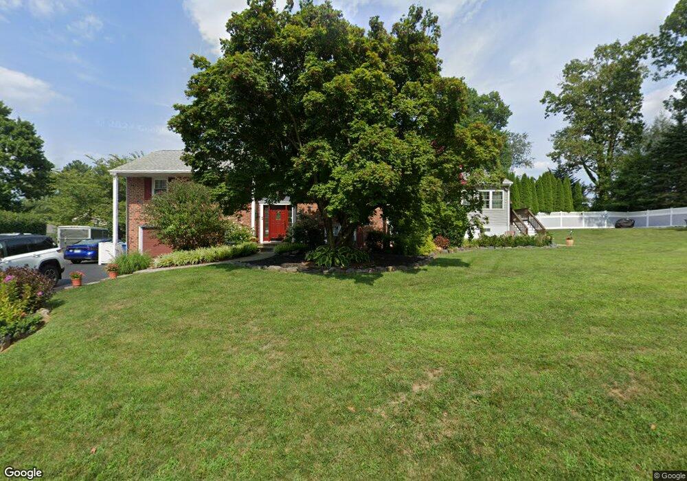
1250 Eagle Rd West Chester, PA 19382
Estimated Value: $669,000 - $742,776
4
Beds
4
Baths
2,225
Sq Ft
$320/Sq Ft
Est. Value
About This Home
This home is located at 1250 Eagle Rd, West Chester, PA 19382 and is currently estimated at $711,944, approximately $319 per square foot. 1250 Eagle Rd is a home located in Chester County with nearby schools including Glen Acres Elementary School, J.R. Fugett Middle School, and West Chester East High School.
Ownership History
Date
Name
Owned For
Owner Type
Purchase Details
Closed on
Jun 9, 2004
Sold by
Lebus William and Lebus Lori L
Bought by
Lebus William and Lebus Lori L
Current Estimated Value
Purchase Details
Closed on
Jul 8, 1994
Sold by
Demelas Mario F and Demelas Johann R
Bought by
Lebus William and Lebus Lori L
Home Financials for this Owner
Home Financials are based on the most recent Mortgage that was taken out on this home.
Original Mortgage
$158,400
Interest Rate
5.75%
Create a Home Valuation Report for This Property
The Home Valuation Report is an in-depth analysis detailing your home's value as well as a comparison with similar homes in the area
Home Values in the Area
Average Home Value in this Area
Purchase History
| Date | Buyer | Sale Price | Title Company |
|---|---|---|---|
| Lebus William | -- | -- | |
| Lebus William | $176,000 | -- |
Source: Public Records
Mortgage History
| Date | Status | Borrower | Loan Amount |
|---|---|---|---|
| Closed | Lebus William | $158,400 |
Source: Public Records
Tax History Compared to Growth
Tax History
| Year | Tax Paid | Tax Assessment Tax Assessment Total Assessment is a certain percentage of the fair market value that is determined by local assessors to be the total taxable value of land and additions on the property. | Land | Improvement |
|---|---|---|---|---|
| 2025 | $5,638 | $194,510 | $45,870 | $148,640 |
| 2024 | $5,638 | $194,510 | $45,870 | $148,640 |
| 2023 | $5,638 | $194,510 | $45,870 | $148,640 |
| 2022 | $5,565 | $194,510 | $45,870 | $148,640 |
| 2021 | $5,488 | $194,510 | $45,870 | $148,640 |
| 2020 | $5,452 | $194,510 | $45,870 | $148,640 |
| 2019 | $5,377 | $194,510 | $45,870 | $148,640 |
| 2018 | $5,262 | $194,510 | $45,870 | $148,640 |
| 2017 | $5,148 | $194,510 | $45,870 | $148,640 |
| 2016 | $4,203 | $194,510 | $45,870 | $148,640 |
| 2015 | $4,203 | $194,510 | $45,870 | $148,640 |
| 2014 | $4,203 | $194,510 | $45,870 | $148,640 |
Source: Public Records
Map
Nearby Homes
- 1106 Highspire Dr Unit 1106
- 1307 Valley Dr Unit 1307
- 521 Valley Dr Unit 521
- 3015 Valley Dr Unit 3015
- 1717 Valley Dr Unit 1717
- 503 Warren Rd
- 506 Everest Cir Unit 506
- 404 Warren Rd
- 4 New Countryside Dr
- 207 Walnut Hill Rd Unit B4
- 1114 Stoneybrook Ln
- 1220 Hawthorne Ln
- 1340 E Strasburg Rd
- 859 Empress Rd
- 1402 Timber Mill Ln
- 1401 B Timber Mill Ln
- 1403 Timber Mill Rd Unit BRN
- 1401 Timber Mill Ln
- 567 Summit House Unit 567
- 573 Summit House Unit 573