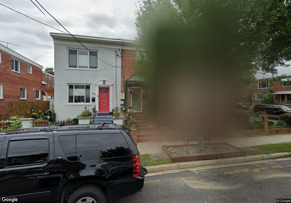
1250 Faraday Place NE Washington, DC 20017
Michigan Park NeighborhoodEstimated Value: $456,163 - $516,000
3
Beds
2
Baths
1,120
Sq Ft
$432/Sq Ft
Est. Value
About This Home
This home is located at 1250 Faraday Place NE, Washington, DC 20017 and is currently estimated at $483,721, approximately $431 per square foot. 1250 Faraday Place NE is a home located in District of Columbia with nearby schools including Bunker Hill Elementary School, Brookland Middle School, and Dunbar High School.
Ownership History
Date
Name
Owned For
Owner Type
Purchase Details
Closed on
May 18, 1994
Sold by
Faxio Mildred N
Bought by
Smith Iris P
Current Estimated Value
Home Financials for this Owner
Home Financials are based on the most recent Mortgage that was taken out on this home.
Original Mortgage
$109,254
Interest Rate
8.44%
Create a Home Valuation Report for This Property
The Home Valuation Report is an in-depth analysis detailing your home's value as well as a comparison with similar homes in the area
Home Values in the Area
Average Home Value in this Area
Purchase History
| Date | Buyer | Sale Price | Title Company |
|---|---|---|---|
| Smith Iris P | $108,000 | -- |
Source: Public Records
Mortgage History
| Date | Status | Borrower | Loan Amount |
|---|---|---|---|
| Closed | Smith Iris P | $109,254 |
Source: Public Records
Tax History
| Year | Tax Paid | Tax Assessment Tax Assessment Total Assessment is a certain percentage of the fair market value that is determined by local assessors to be the total taxable value of land and additions on the property. | Land | Improvement |
|---|---|---|---|---|
| 2025 | $3,164 | $462,140 | $276,920 | $185,220 |
| 2024 | $3,119 | $454,030 | $275,540 | $178,490 |
| 2023 | $2,988 | $442,960 | $269,060 | $173,900 |
| 2022 | $2,757 | $420,800 | $256,640 | $164,160 |
| 2021 | $2,525 | $399,430 | $252,840 | $146,590 |
| 2020 | $2,300 | $395,470 | $250,450 | $145,020 |
| 2019 | $2,098 | $378,780 | $229,620 | $149,160 |
| 2018 | $1,918 | $362,730 | $0 | $0 |
| 2017 | $1,751 | $330,230 | $0 | $0 |
| 2016 | $1,598 | $290,620 | $0 | $0 |
| 2015 | $1,455 | $248,610 | $0 | $0 |
| 2014 | $1,332 | $234,870 | $0 | $0 |
Source: Public Records
Map
Nearby Homes
- 5035 Sargent Rd NE
- 1261 Gallatin St NE
- 5047 13th St NE
- 1324 Galloway St NE
- 5043 11th St NE
- 5018 11th St NE
- 4705 Sargent Rd NE
- 5049 8th St NE
- 1501 Jefferson St
- 5403 14th Place
- 5031 S Dakota Ave NE
- 5205 12th St NE
- 5211 11th St NE
- 5213 11th St NE
- 4803 10th St NE
- 5408 14th Place
- 5274 Chillum Place NE
- 4954 8th St NE
- 4928 8th St NE
- 838 Buchanan St NE
- 1252 Faraday Place NE
- 1248 Faraday Place NE
- 1246 Faraday Place NE
- 1244 Faraday Place NE
- 1242 Faraday Place NE
- 1240 Faraday Place NE
- 1249 Farragut Place NE
- 1255 Faraday Place NE
- 1251 Farragut Place NE
- 1251 Faraday Place NE
- 1253 Faraday Place NE
- 1249 Faraday Place NE
- 1247 Farragut Place NE
- 1245 Farragut Place NE
- 1238 Faraday Place NE
- 5025 13th Place NE
- 5027 13th Place NE
- 1247 Faraday Place NE
- 5023 13th Place NE
- 5029 13th Place NE
Your Personal Tour Guide
Ask me questions while you tour the home.