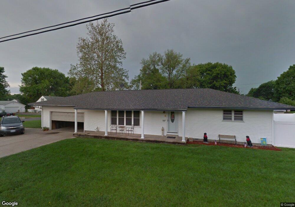
1250 George St Wood River, IL 62095
Estimated Value: $154,641 - $167,000
3
Beds
1
Bath
1,428
Sq Ft
$113/Sq Ft
Est. Value
About This Home
This home is located at 1250 George St, Wood River, IL 62095 and is currently estimated at $161,410, approximately $113 per square foot. 1250 George St is a home located in Madison County with nearby schools including Eastwood Elementary School, East Alton Middle School, and East Alton-Wood River High School.
Ownership History
Date
Name
Owned For
Owner Type
Purchase Details
Closed on
Nov 5, 2009
Sold by
Simmons Jr William W
Bought by
Young Rhonda M
Current Estimated Value
Home Financials for this Owner
Home Financials are based on the most recent Mortgage that was taken out on this home.
Original Mortgage
$88,268
Outstanding Balance
$57,959
Interest Rate
5.11%
Mortgage Type
FHA
Estimated Equity
$103,451
Purchase Details
Closed on
Apr 16, 2003
Sold by
Simmons Sr William W and Simmons June Frances
Bought by
Simmons Sr William W and Simmons June F
Create a Home Valuation Report for This Property
The Home Valuation Report is an in-depth analysis detailing your home's value as well as a comparison with similar homes in the area
Home Values in the Area
Average Home Value in this Area
Purchase History
| Date | Buyer | Sale Price | Title Company |
|---|---|---|---|
| Young Rhonda M | $90,000 | First American Title Ins Co | |
| Simmons Sr William W | -- | -- |
Source: Public Records
Mortgage History
| Date | Status | Borrower | Loan Amount |
|---|---|---|---|
| Open | Young Rhonda M | $88,268 |
Source: Public Records
Tax History Compared to Growth
Tax History
| Year | Tax Paid | Tax Assessment Tax Assessment Total Assessment is a certain percentage of the fair market value that is determined by local assessors to be the total taxable value of land and additions on the property. | Land | Improvement |
|---|---|---|---|---|
| 2024 | $2,882 | $38,560 | $3,730 | $34,830 |
| 2023 | $2,882 | $35,950 | $3,480 | $32,470 |
| 2022 | $2,687 | $33,180 | $3,210 | $29,970 |
| 2021 | $2,451 | $30,920 | $2,990 | $27,930 |
| 2020 | $2,377 | $28,400 | $2,880 | $25,520 |
| 2019 | $2,306 | $27,550 | $2,790 | $24,760 |
| 2018 | $2,242 | $26,180 | $2,650 | $23,530 |
| 2017 | $2,131 | $25,560 | $2,590 | $22,970 |
| 2016 | $2,139 | $25,560 | $2,590 | $22,970 |
| 2015 | $2,131 | $25,290 | $2,560 | $22,730 |
| 2014 | $2,131 | $25,290 | $2,560 | $22,730 |
| 2013 | $2,131 | $25,660 | $2,600 | $23,060 |
Source: Public Records
Map
Nearby Homes
- 345 Illinois Ave
- 283 Hi Pointe Place
- 959 Cedar Dr
- 250 Hi Pointe Place
- 523 Wilson Ave
- 104 Whitelaw Ave
- 121 Whitelaw Ave
- 98 Wood River Ave
- 211 S 9th St
- 141 S 9th St
- 144 S 9th St
- 830 N Wood River Ave
- 604 Wood River Ave
- 782 Berry Rd
- 641 Leslie Ave
- 777 Condit St
- 133 Lincoln Ave
- 833 State St
- 565 5th St
- 537 Tipton Ave
- 355 Woodland Ave
- 1260 George St
- 366 Woodland Ave
- 400 Summit St
- 350 Woodland Ave
- 344 Summit St
- 344 Woodland Ave
- 424 Woodland Ave
- 330 Summit St
- 431 Woodland Ave
- 431 Woodland Ave
- 342 Woodland Ave
- 315 Woodland Ave
- 1204 George St
- 430 Summit St Unit 1
- 319 Illinois Ave
- 442 Woodland Ave
- 442 Woodland Ave
- 355 Summit St
- 365 Summit St