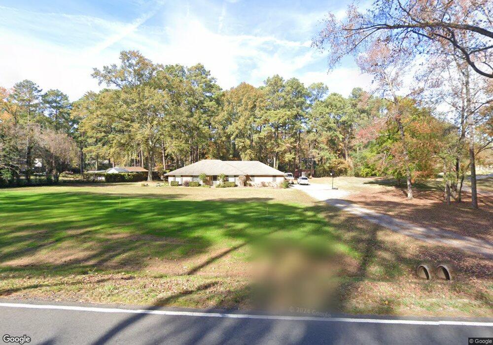
1250 Leonard Rd Shreveport, LA 71115
Estimated Value: $290,506 - $478,000
3
Beds
3
Baths
2,144
Sq Ft
$182/Sq Ft
Est. Value
About This Home
This home is located at 1250 Leonard Rd, Shreveport, LA 71115 and is currently estimated at $389,377, approximately $181 per square foot. 1250 Leonard Rd is a home located in Caddo Parish with nearby schools including Fairfield Magnet School, Judson Fundamental Elementary School, and Eden Gardens Fundamental Elementary School.
Ownership History
Date
Name
Owned For
Owner Type
Purchase Details
Closed on
Jun 6, 2016
Sold by
Maxey Samuel A and Maxey Linda Cox
Bought by
Peavy Frank and Peavy Kirsti Nicole
Current Estimated Value
Purchase Details
Closed on
Jun 6, 2008
Sold by
Mills Stuart Edward and Mills Patricia Holcomb
Bought by
Ferguson Ii John Hilton and Ferguson Kathryn Meier
Home Financials for this Owner
Home Financials are based on the most recent Mortgage that was taken out on this home.
Original Mortgage
$199,771
Interest Rate
6.07%
Mortgage Type
Unknown
Create a Home Valuation Report for This Property
The Home Valuation Report is an in-depth analysis detailing your home's value as well as a comparison with similar homes in the area
Home Values in the Area
Average Home Value in this Area
Purchase History
| Date | Buyer | Sale Price | Title Company |
|---|---|---|---|
| Peavy Frank | $380,000 | Vintage Title | |
| Ferguson Ii John Hilton | $235,025 | None Available |
Source: Public Records
Mortgage History
| Date | Status | Borrower | Loan Amount |
|---|---|---|---|
| Previous Owner | Ferguson Ii John Hilton | $199,771 |
Source: Public Records
Tax History Compared to Growth
Tax History
| Year | Tax Paid | Tax Assessment Tax Assessment Total Assessment is a certain percentage of the fair market value that is determined by local assessors to be the total taxable value of land and additions on the property. | Land | Improvement |
|---|---|---|---|---|
| 2024 | $3,731 | $23,555 | $3,898 | $19,657 |
| 2023 | $3,483 | $21,945 | $3,712 | $18,233 |
| 2022 | $3,483 | $21,945 | $3,712 | $18,233 |
| 2021 | $3,526 | $21,945 | $3,712 | $18,233 |
| 2020 | $3,527 | $21,945 | $3,712 | $18,233 |
| 2019 | $3,444 | $21,640 | $3,712 | $17,928 |
| 2018 | $2,294 | $21,640 | $3,712 | $17,928 |
| 2017 | $3,437 | $21,640 | $3,712 | $17,928 |
| 2015 | $2,383 | $22,370 | $3,710 | $18,660 |
| 2014 | $2,425 | $22,370 | $3,710 | $18,660 |
| 2013 | -- | $22,370 | $3,710 | $18,660 |
Source: Public Records
Map
Nearby Homes
- 2085 Pepper Ridge Dr
- 9940 Pecan Place
- 1330 Forest Creek Dr
- 354 Newburn Ln
- 255 Newburn Ln
- 254 Newburn Ln
- 229 Newburn Ln
- 0 Lot 249 Newburn Ln
- 0 Lot 237 Newburn Ln
- 1044 Bauxhall Cir
- 389 Newburn Ln
- 390 Newburn Ln
- 174 Creston Ln
- 0 Lot 269 Creston Ln
- 0 Lot 263 Creston Ln
- 0 Lot 256 Creston Ln
- 0 Lot 227 Creston Ln
- 0 Lot 218 Creston Ln
- 264 Creston Ln
- 191 Creston Ln
- 1240 Leonard Rd
- 1240 Leonard Rd
- 516 Turkey Trail
- 510 Turkey Trail
- 1224 Leonard Rd
- 1360 Leonard Rd
- 506 Turkey Trail
- 1266 Leonard Rd
- 10605 Deer Path Rd
- 515 Turkey Trail
- 521 Turkey Trail
- 10601 Deer Path Rd
- 10601 Deer Path Rd
- 10601 Deer Path Rd
- 1298 Leonard Rd
- 3028 Nottingham Dr
- 10612 Deer Path Rd
- 10612 Deer Path Rd
- 10612 Deer Path Rd
- 3026 Nottingham Dr