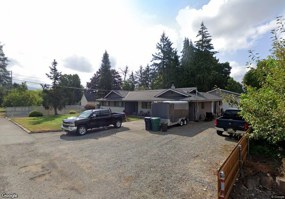
1250 Merritt Ave Enumclaw, WA 98022
Estimated Value: $619,000 - $759,000
4
Beds
2
Baths
1,890
Sq Ft
$356/Sq Ft
Est. Value
About This Home
This home is located at 1250 Merritt Ave, Enumclaw, WA 98022 and is currently estimated at $673,468, approximately $356 per square foot. 1250 Merritt Ave is a home located in King County with nearby schools including Byron Kibler Elementary School, Enumclaw Middle School, and Enumclaw Senior High School.
Ownership History
Date
Name
Owned For
Owner Type
Purchase Details
Closed on
Aug 14, 2002
Sold by
Lybeck Charles A and Lybeck Arleene G
Bought by
Froemke Danny L and Froemke Vivian M
Current Estimated Value
Home Financials for this Owner
Home Financials are based on the most recent Mortgage that was taken out on this home.
Original Mortgage
$188,800
Outstanding Balance
$79,719
Interest Rate
6.52%
Estimated Equity
$593,749
Purchase Details
Closed on
Jun 29, 1987
Sold by
Lybeck Charles A and Lybeck Arlene G
Bought by
City Of Enumclaw
Create a Home Valuation Report for This Property
The Home Valuation Report is an in-depth analysis detailing your home's value as well as a comparison with similar homes in the area
Home Values in the Area
Average Home Value in this Area
Purchase History
| Date | Buyer | Sale Price | Title Company |
|---|---|---|---|
| Froemke Danny L | $236,000 | Stewart Title | |
| City Of Enumclaw | -- | -- |
Source: Public Records
Mortgage History
| Date | Status | Borrower | Loan Amount |
|---|---|---|---|
| Open | Froemke Danny L | $188,800 |
Source: Public Records
Tax History Compared to Growth
Tax History
| Year | Tax Paid | Tax Assessment Tax Assessment Total Assessment is a certain percentage of the fair market value that is determined by local assessors to be the total taxable value of land and additions on the property. | Land | Improvement |
|---|---|---|---|---|
| 2024 | $5,893 | $614,000 | $189,000 | $425,000 |
| 2023 | $5,345 | $527,000 | $163,000 | $364,000 |
| 2022 | $4,934 | $601,000 | $187,000 | $414,000 |
| 2021 | $4,001 | $487,000 | $162,000 | $325,000 |
| 2020 | $3,658 | $359,000 | $125,000 | $234,000 |
| 2018 | $3,858 | $331,000 | $115,000 | $216,000 |
| 2017 | $3,429 | $312,000 | $105,000 | $207,000 |
| 2016 | $3,373 | $286,000 | $97,000 | $189,000 |
| 2015 | $3,434 | $277,000 | $92,000 | $185,000 |
| 2014 | -- | $270,000 | $90,000 | $180,000 |
| 2013 | -- | $208,000 | $72,000 | $136,000 |
Source: Public Records
Map
Nearby Homes
- 3053 Porter St
- 2921 Frederickson St
- 1854 Hillcrest Ave
- 42421 264th Ave SE
- 1776 Lafromboise St
- 1107 Griffin Ave
- 1486 Division St
- 42102 264th Ave SE
- 1722 Harding St
- 349 Rainier Ave
- 1720 Garfield St Unit 4
- 2632 Cascade Ave
- 1919 Clovercrest St
- 1903 Clovercrest St
- 1165 Harding St
- 1802 Clovercrest St
- 26803 SE 416th St
- 2040 Roosevelt Ave
- 2054 Roosevelt Ave
- 3035 Carbon Ridge St
- 1214 Mchugh Ave
- 1302 Merritt Ave
- 1247 Merritt Ave
- 1259 Merritt Ave
- 3112 Cole St
- 1311 Merritt Ave
- 1326 Merritt Ave
- 3106 Cole St
- 1216 Mchugh Ave
- 1242 Mchugh Ave
- 475 Michael Ave
- 485 Michael Ave
- 1329 Merritt Ave
- 1264 Mchugh Ave
- 1211 Chinook Ave
- 1340 Merritt Ave
- 1304 Mchugh Ave
- 1205 Chinook Ave
- 1320 Mchugh Ave
- 1339 Merritt Ave