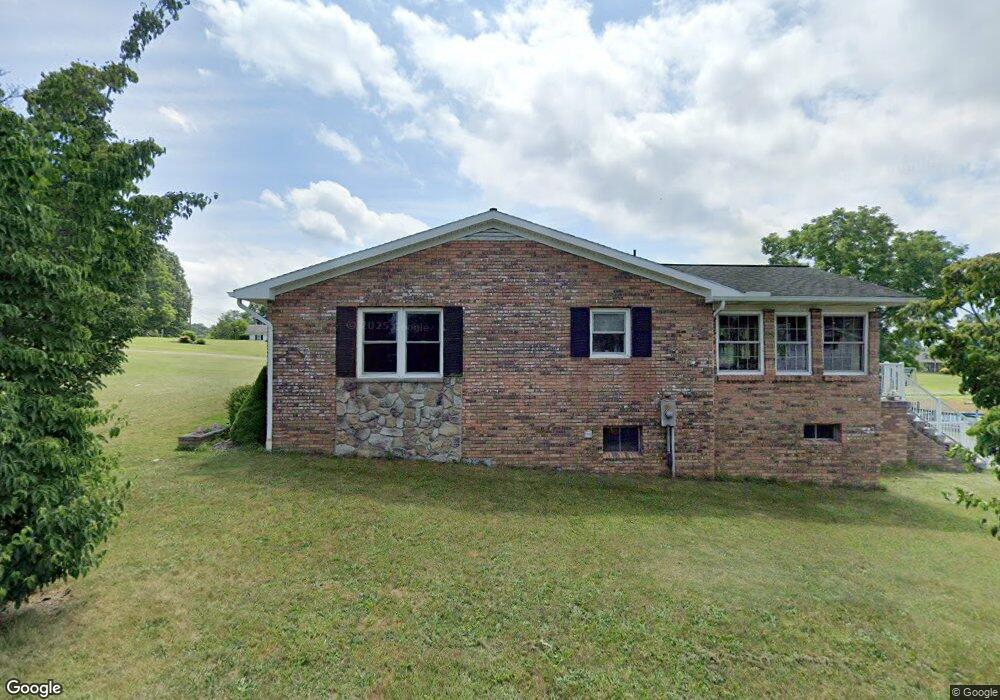
1250 Robin Roost Rd Jumping Branch, WV 25969
Estimated Value: $231,000 - $307,465
3
Beds
3
Baths
2,328
Sq Ft
$119/Sq Ft
Est. Value
About This Home
This home is located at 1250 Robin Roost Rd, Jumping Branch, WV 25969 and is currently estimated at $276,366, approximately $118 per square foot. 1250 Robin Roost Rd is a home with nearby schools including Summers County High School.
Ownership History
Date
Name
Owned For
Owner Type
Purchase Details
Closed on
Sep 6, 2013
Sold by
Ball Jeffrey T
Bought by
Houchins Joshua J and Houchins Wendy R
Current Estimated Value
Purchase Details
Closed on
Mar 7, 2012
Sold by
Bowling David Lee and Bowling Deborah Kay
Bought by
Ball Jeffrey T
Home Financials for this Owner
Home Financials are based on the most recent Mortgage that was taken out on this home.
Original Mortgage
$135,000
Interest Rate
3.86%
Create a Home Valuation Report for This Property
The Home Valuation Report is an in-depth analysis detailing your home's value as well as a comparison with similar homes in the area
Home Values in the Area
Average Home Value in this Area
Purchase History
| Date | Buyer | Sale Price | Title Company |
|---|---|---|---|
| Houchins Joshua J | $170,000 | -- | |
| Ball Jeffrey T | $150,000 | -- |
Source: Public Records
Mortgage History
| Date | Status | Borrower | Loan Amount |
|---|---|---|---|
| Previous Owner | Ball Jeffrey T | $135,000 |
Source: Public Records
Tax History Compared to Growth
Tax History
| Year | Tax Paid | Tax Assessment Tax Assessment Total Assessment is a certain percentage of the fair market value that is determined by local assessors to be the total taxable value of land and additions on the property. | Land | Improvement |
|---|---|---|---|---|
| 2025 | $893 | $131,580 | $12,660 | $118,920 |
| 2024 | $921 | $135,660 | $12,120 | $123,540 |
| 2023 | $878 | $129,240 | $10,020 | $119,220 |
| 2022 | $841 | $123,840 | $9,480 | $114,360 |
| 2021 | $814 | $119,880 | $9,120 | $110,760 |
| 2020 | $891 | $131,160 | $9,120 | $122,040 |
| 2019 | $894 | $131,700 | $9,120 | $122,580 |
| 2018 | $798 | $117,480 | $8,940 | $108,540 |
| 2017 | $770 | $113,400 | $8,940 | $104,460 |
| 2016 | $755 | $111,240 | $8,820 | $102,420 |
| 2015 | $727 | $107,040 | $10,260 | $96,780 |
| 2014 | $694 | $102,240 | $10,260 | $91,980 |
Source: Public Records
Map
Nearby Homes
- 114 Water Tank Rd
- 250 N Lakeview Dr
- 151 Broomstraw Ridge Rd
- 1587 Surveyor Branch Rd
- 1597 Bluestone Ridge Rd
- 35 Old Oak Ln
- 0 Ellison Ridge Rd Unit 25-683
- 0 Ellison Ridge Rd Unit 25-1307
- 0 Ellison Ridge Rd Unit 11545401
- 545 Moondance Ln
- 545 Moondance Ln
- 390 Joyful Way
- 00 Basham Branch Rd
- 0 Bluestone River Rd
- 708 Bluestone River Rd
- 800 Madams Creek Rd
- 3602 True Rd Unit Rd
- 3602 True Rd
- 110 Park Ave
- 214 Cedar Ave
- 1294 Robin Roost Rd
- 1267 Robin Roost Rd
- 12 Family Ln
- 1059 Robin Roost Rd
- 15929 Ellison Ridge Rd
- 664 Bolling Rd
- 1496 Robin Roost Rd
- 2 Jumping Bldgs Branch
- 16040 Ellison Ridge Rd
- 16140 Ellison Ridge Rd
- 73 Sams Ln
- 16191 Ellison Ridge Rd
- Lot 4 Ellison Ridge Rd
- Lot 2 Ellison Ridge Rd
- Lot 1 Ellison Ridge Rd
- 140 Cardinal Dr
- 16220 Ellison Ridge Rd
- 95 Cardinal Dr
- 100 Jade Dr
- 56 Sand Springs Rd