Estimated Value: $343,000 - $433,000
--
Bed
--
Bath
1,736
Sq Ft
$225/Sq Ft
Est. Value
About This Home
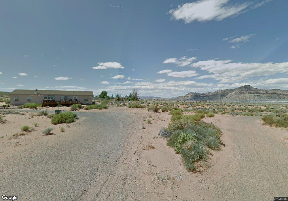
This home is located at 1250 S Freedom Way, Kanab, UT 84741 and is currently estimated at $389,760, approximately $224 per square foot. 1250 S Freedom Way is a home with nearby schools including Big Water School.
Ownership History
Date
Name
Owned For
Owner Type
Purchase Details
Closed on
Jun 24, 2021
Sold by
Boyd Floyd L
Bought by
Cowell Kale and Fink Molly E
Current Estimated Value
Purchase Details
Closed on
Feb 27, 2013
Sold by
Dunn Patti H
Bought by
Dunn Clay M
Purchase Details
Closed on
Nov 23, 2009
Sold by
Boyd Floyd L and Boyd Martha K
Bought by
Dunn Clay M and Dunn Patti H
Home Financials for this Owner
Home Financials are based on the most recent Mortgage that was taken out on this home.
Original Mortgage
$80,000
Interest Rate
4.83%
Create a Home Valuation Report for This Property
The Home Valuation Report is an in-depth analysis detailing your home's value as well as a comparison with similar homes in the area
Home Values in the Area
Average Home Value in this Area
Purchase History
| Date | Buyer | Sale Price | Title Company |
|---|---|---|---|
| Cowell Kale | -- | -- | |
| Dunn Clay M | -- | -- | |
| Dunn Clay M | -- | -- |
Source: Public Records
Mortgage History
| Date | Status | Borrower | Loan Amount |
|---|---|---|---|
| Previous Owner | Dunn Clay M | $80,000 |
Source: Public Records
Tax History Compared to Growth
Tax History
| Year | Tax Paid | Tax Assessment Tax Assessment Total Assessment is a certain percentage of the fair market value that is determined by local assessors to be the total taxable value of land and additions on the property. | Land | Improvement |
|---|---|---|---|---|
| 2025 | $1,846 | $184,546 | $34,927 | $149,619 |
| 2024 | $1,846 | $188,980 | $31,752 | $157,228 |
| 2023 | $1,588 | $169,783 | $29,400 | $140,383 |
| 2022 | $1,655 | $159,263 | $25,565 | $133,698 |
| 2021 | $1,402 | $197,367 | $37,720 | $159,647 |
| 2020 | $1,440 | $197,367 | $37,720 | $159,647 |
| 2019 | $1,368 | $182,299 | $37,720 | $144,579 |
| 2018 | $0 | $182,299 | $37,720 | $144,579 |
| 2017 | $1,385 | $177,379 | $32,800 | $144,579 |
| 2016 | $1,404 | $181,856 | $47,200 | $134,656 |
| 2015 | -- | $148,982 | $47,200 | $101,782 |
| 2014 | -- | $165,803 | $47,200 | $118,603 |
| 2013 | -- | $91,192 | $0 | $0 |
Source: Public Records
Map
Nearby Homes
- 1260 Patrick Henry Ct
- 1200 American Way
- 1140 Independence
- 1334 E Rock Ledge Ln
- 1140 S Independence Dr
- 1095 Canyon Dr
- 725 Freedom Way
- 1000 Canyon Dr
- 1100 Revolution Way
- 933 Freedom
- 1185 Independence
- 1107 E Old Glory Way
- 800 S Shelter Cove
- 0 B-11-2 B-J-28 Unit 25-264712
- 1330 E Lone Rock View
- 0 S Big Water Dr
- 245 S Big Water Dr
- 25 Quill St
- 0 E Old North Church
- 95 Old North Church
- 6 Discovery Ln
- 1240 S Freedom Way
- Lot 2 E Justice Dr
- 0 E Justice Dr
- 0 Justice
- 3 Justice
- Lot 2 Justice
- E E Justice Dr
- 1370 E Justice Way
- 1255 S Freedom Way
- 1390 S Freedom Way
- 1315 E Justice Way
- 715 Justice
- 1265 Patrick Henry Ct
- 1300 S Freedom Way
- 7 Discovery Ln
- 1385 Discovery
- 0 Patrick Henry Ct
- 1385 E Justice Way
- 1350 E Discovery Ln