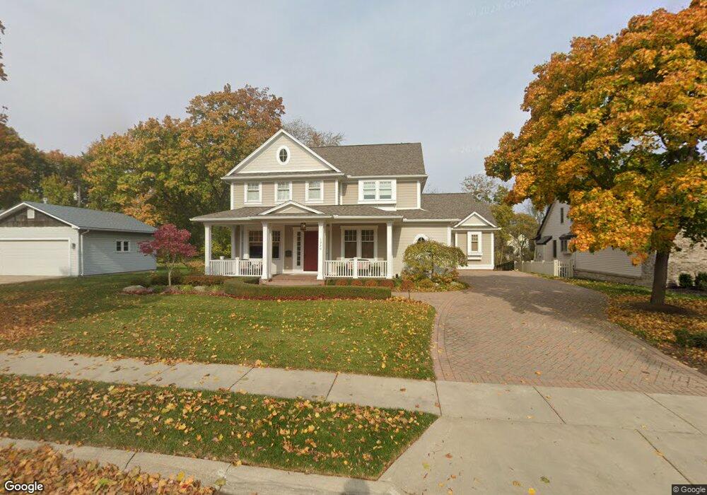
1250 Sheridan St Plymouth, MI 48170
Estimated Value: $529,000 - $1,309,000
--
Bed
3
Baths
4,009
Sq Ft
$246/Sq Ft
Est. Value
About This Home
This home is located at 1250 Sheridan St, Plymouth, MI 48170 and is currently estimated at $986,307, approximately $246 per square foot. 1250 Sheridan St is a home located in Wayne County with nearby schools including Canton High School, Bird Elementary School, and West Middle School.
Ownership History
Date
Name
Owned For
Owner Type
Purchase Details
Closed on
Sep 23, 2011
Sold by
Bff Sheridan Llc
Bought by
Aristeo Joseph A and Aristeo Judith A
Current Estimated Value
Purchase Details
Closed on
May 20, 2008
Sold by
Mcqueen Laura L
Bought by
Bff Sheridan Llc
Purchase Details
Closed on
May 30, 2006
Sold by
Gary Jon W and Gary Carey E
Bought by
Mcqueen Laura L
Purchase Details
Closed on
Sep 20, 2002
Sold by
Lee Kathleen M and Lee Clyde William
Bought by
Laing Thomas W
Create a Home Valuation Report for This Property
The Home Valuation Report is an in-depth analysis detailing your home's value as well as a comparison with similar homes in the area
Home Values in the Area
Average Home Value in this Area
Purchase History
| Date | Buyer | Sale Price | Title Company |
|---|---|---|---|
| Aristeo Joseph A | $195,000 | Reputation First Title Agenc | |
| Bff Sheridan Llc | -- | None Available | |
| Mcqueen Laura L | $230,000 | Multiple | |
| Mcqueen Laura L | -- | Multiple | |
| Laing Thomas W | -- | 1St Security Title Agency In |
Source: Public Records
Tax History Compared to Growth
Tax History
| Year | Tax Paid | Tax Assessment Tax Assessment Total Assessment is a certain percentage of the fair market value that is determined by local assessors to be the total taxable value of land and additions on the property. | Land | Improvement |
|---|---|---|---|---|
| 2025 | $18,407 | $564,400 | $0 | $0 |
| 2024 | $18,407 | $564,500 | $0 | $0 |
| 2023 | $17,799 | $558,100 | $0 | $0 |
| 2022 | $18,254 | $518,200 | $0 | $0 |
| 2021 | $17,683 | $509,200 | $0 | $0 |
| 2020 | $17,578 | $452,100 | $0 | $0 |
| 2019 | $15,999 | $373,900 | $0 | $0 |
| 2018 | $15,566 | $399,900 | $0 | $0 |
| 2017 | $2,245 | $388,300 | $0 | $0 |
| 2016 | $16,369 | $371,400 | $0 | $0 |
| 2015 | $26,445 | $329,010 | $0 | $0 |
| 2013 | $25,619 | $266,880 | $0 | $0 |
| 2011 | -- | $65,030 | $0 | $0 |
Source: Public Records
Map
Nearby Homes
- 1046 Church St
- 199 Arthur St
- 42384 Gateway Dr
- 188 N Harvey St
- 638 S Harvey St
- 730 Penniman Ave Unit 203
- 324 N Harvey St
- 668 Maple St
- 660 Maple St
- 543 Deer St
- 636 Maple St
- 644 Maple St
- 628 Maple St
- 525 W Ann Arbor Trail
- 416 N Sheldon Rd
- 432 N Sheldon Rd
- 770 Deer St Unit 204
- 190 Hamilton St
- 300 Hamilton St Unit 306
- 300 Hamilton St Unit 101
- 1230 Sheridan St
- 1298 Sheridan St
- 1261 Sheridan St
- 1210 Sheridan St Unit 3
- 1271 Sheridan St
- 359 Mckinley St
- 1251 Sheridan St
- 1231 Sheridan St
- 350 Mckinley St
- 1211 Sheridan St
- 1308 Sheridan St
- 1298 W Ann Arbor Trail
- 1280 W Ann Arbor Trail
- 1191 Sheridan St
- 1309 Sheridan St
- 1246 W Ann Arbor Trail
- 1224 W Ann Arbor Trail
- 1316 Sheridan St
- 1304 W Ann Arbor Trail
- 1317 Sheridan St