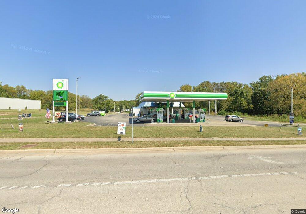
1250 W South Side Dr Decatur, IL 62521
Estimated Value: $717,169
--
Bed
--
Bath
--
Sq Ft
1.14
Acres
About This Home
This home is located at 1250 W South Side Dr, Decatur, IL 62521 and is currently estimated at $717,169. 1250 W South Side Dr is a home located in Macon County with nearby schools including South Shores Elementary School, Stephen Decatur Middle School, and Robertson Charter School.
Ownership History
Date
Name
Owned For
Owner Type
Purchase Details
Closed on
Sep 28, 2017
Sold by
Az Spe Llc
Bought by
Corner Gas Station Llc
Current Estimated Value
Home Financials for this Owner
Home Financials are based on the most recent Mortgage that was taken out on this home.
Original Mortgage
$600,000
Outstanding Balance
$500,630
Interest Rate
3.78%
Mortgage Type
Commercial
Estimated Equity
$216,539
Purchase Details
Closed on
Jun 29, 2017
Sold by
Hawthorn Propeties Llc and Singh Harjinder
Bought by
Az Spe Llc
Purchase Details
Closed on
Sep 12, 2006
Sold by
Borchers Cc Inc
Bought by
Sandhu Decatur Llc Borchers
Home Financials for this Owner
Home Financials are based on the most recent Mortgage that was taken out on this home.
Original Mortgage
$1,188,100
Interest Rate
6.59%
Mortgage Type
Commercial
Purchase Details
Closed on
Jan 1, 2002
Create a Home Valuation Report for This Property
The Home Valuation Report is an in-depth analysis detailing your home's value as well as a comparison with similar homes in the area
Home Values in the Area
Average Home Value in this Area
Purchase History
| Date | Buyer | Sale Price | Title Company |
|---|---|---|---|
| Corner Gas Station Llc | -- | -- | |
| Az Spe Llc | -- | None Available | |
| Sandhu Decatur Llc Borchers | $580,000 | Macon County Title Llc | |
| -- | $295,000 | -- |
Source: Public Records
Mortgage History
| Date | Status | Borrower | Loan Amount |
|---|---|---|---|
| Open | Corner Gas Station Llc | $600,000 | |
| Previous Owner | Sandhu Decatur Llc Borchers | $1,188,100 |
Source: Public Records
Tax History Compared to Growth
Tax History
| Year | Tax Paid | Tax Assessment Tax Assessment Total Assessment is a certain percentage of the fair market value that is determined by local assessors to be the total taxable value of land and additions on the property. | Land | Improvement |
|---|---|---|---|---|
| 2024 | $22,057 | $227,845 | $7,674 | $220,171 |
| 2023 | $21,874 | $219,779 | $7,402 | $212,377 |
| 2022 | $20,799 | $203,373 | $6,849 | $196,524 |
| 2021 | $19,543 | $189,929 | $6,396 | $183,533 |
| 2020 | $19,259 | $181,112 | $6,099 | $175,013 |
| 2019 | $19,259 | $181,112 | $6,099 | $175,013 |
| 2018 | $19,092 | $181,711 | $6,119 | $175,592 |
| 2017 | $19,541 | $186,561 | $6,282 | $180,279 |
| 2016 | $19,913 | $188,464 | $6,346 | $182,118 |
| 2015 | $18,923 | $185,132 | $6,234 | $178,898 |
| 2014 | $21,630 | $223,952 | $15,603 | $208,349 |
| 2013 | $22,182 | $232,363 | $16,189 | $216,174 |
Source: Public Records
Map
Nearby Homes
- 1740 S Fairview Ave
- 636 S Sycamore St
- 4220 S Lake Ct
- 650 S Crea St
- 51 Medial Dr
- 1677 W Sunset Ave
- 134 Madison Dr
- 1391 W Decatur St
- 365 S Taylor Ave
- 628 W Forest Ave
- 580 Powers Ln
- 441 S Seigel St
- 344 W Imboden Dr
- 1527 W Macon St
- 530 Powers Ln
- 617 W Decatur St
- 1739 Moorwood Dr
- 437 Powers Ln
- 1005 W Main St
- 612 W Macon St
- 0 Taylorville Road(rt 48) Unit MRD11754532
- 0 Taylorville Road(rt 48) Unit 6226729
- 1201 W South Side Dr
- 1395 S Taylorville Rd
- 1387 S Taylorville Rd
- 1387 S Taylorville Rd
- 1740 S Fairview Ave Unit 1760
- 1360 S Fairview Ave
- 1356 S Fairview Ave
- 1356 S Fairview Rd
- 1425 S Fairview Ave
- 1525 S Fairview Ave
- 1400 S Fairview Ave
- 1760 S Fairview Ave
- 1368 S Taylorville Rd
- 1725 S Fairview Ave
- 1725 S Fairview Rd
- 1620 S Taylorville Rd
- 1535 Legion Dr
- 1305 S Fairview Ave