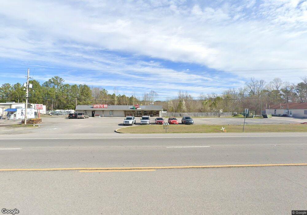
12500 Us Highway 431 Guntersville, AL 35976
--
Bed
--
Bath
5,000
Sq Ft
2.25
Acres
About This Home
This home is located at 12500 Us Highway 431, Guntersville, AL 35976. 12500 Us Highway 431 is a home located in Marshall County with nearby schools including Guntersville Elementary School, Cherokee Elementary School, and Guntersville Middle School.
Ownership History
Date
Name
Owned For
Owner Type
Purchase Details
Closed on
Aug 31, 2020
Sold by
Baucom Jeffrey L
Bought by
Baucom Kathryn
Home Financials for this Owner
Home Financials are based on the most recent Mortgage that was taken out on this home.
Original Mortgage
$350,000
Outstanding Balance
$310,602
Interest Rate
2.9%
Mortgage Type
Commercial
Purchase Details
Closed on
May 9, 2008
Sold by
Erskine & Sons Inc
Bought by
Baucom Jeffrey L and Baucom Kathryn S
Home Financials for this Owner
Home Financials are based on the most recent Mortgage that was taken out on this home.
Original Mortgage
$376,000
Interest Rate
5.84%
Mortgage Type
Future Advance Clause Open End Mortgage
Create a Home Valuation Report for This Property
The Home Valuation Report is an in-depth analysis detailing your home's value as well as a comparison with similar homes in the area
Home Values in the Area
Average Home Value in this Area
Purchase History
| Date | Buyer | Sale Price | Title Company |
|---|---|---|---|
| Baucom Kathryn | -- | None Available | |
| Baucom Jeffrey L | -- | None Available |
Source: Public Records
Mortgage History
| Date | Status | Borrower | Loan Amount |
|---|---|---|---|
| Open | Baucom Kathryn | $350,000 | |
| Closed | Baucom Jeffrey L | $376,000 |
Source: Public Records
Tax History Compared to Growth
Tax History
| Year | Tax Paid | Tax Assessment Tax Assessment Total Assessment is a certain percentage of the fair market value that is determined by local assessors to be the total taxable value of land and additions on the property. | Land | Improvement |
|---|---|---|---|---|
| 2023 | $3,684 | $85,680 | $44,940 | $40,740 |
| 2022 | $3,684 | $85,680 | $0 | $0 |
| 2021 | $75 | $0 | $0 | $0 |
| 2020 | $74 | $76,900 | $0 | $0 |
| 2017 | $3,364 | $1,240 | $0 | $0 |
| 2015 | -- | $62,040 | $0 | $0 |
| 2014 | -- | $62,040 | $0 | $0 |
Source: Public Records
Map
Nearby Homes
- 6200 Dalewood Ln
- 1.94 Acres S Us Highway 431
- 7009 J W Darnell Ave
- 16-17-1 Jarmon Rd
- 6608 Cannon Ave
- 6141 Sherry Dr
- 4.63 acres Lee St
- Lot 4 Cherrywood Dr
- Lot 3 Cherrywood Dr
- 2020 Ridge Crest Dr
- 47 Ogle Rd
- 71 Clyde Cir
- 381 Red Barn Rd
- 14 AC Jackson Trail
- 3919 Pecan Dr
- 3787 Colonial Dr
- B Lot 17 Cardinal Dr
- A Lot 16 Cardinal Dr
- Lot 15 Cardinal Dr
- A Lot 9 Cardinal Dr
- 12500 Us Highway 431
- 12542 Us Highway 431
- 6420 Jarmon Rd
- 6416 Jarmon Rd
- 0 Solitude Rd
- 4905 Linwood Ave
- 6400 Jarmon Rd
- .36 Dalewood Ln
- 4900 Linwood Ave
- 4904 Linwood Ave
- 0 Us Hwy 431 Unit 1021574
- 0 Us Highway 431 Unit 1021341
- 0 Us Highway 431 Unit 1034082
- 0 Us Hwy 431 Unit 1776282
- 6307 Jarmon Rd
- 6301 Jarmon Rd
- 6412 Dalewood Ln
- 6400 Dalewood Ln
- 6408 Dalewood Ln
- 6209 Dalewood Ln