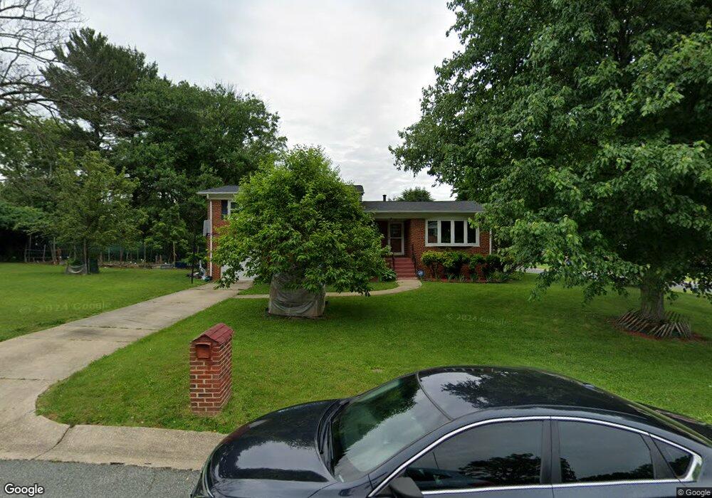
12501 Blake Rd Silver Spring, MD 20904
Estimated Value: $563,000 - $650,000
Studio
3
Baths
2,364
Sq Ft
$262/Sq Ft
Est. Value
About This Home
This home is located at 12501 Blake Rd, Silver Spring, MD 20904 and is currently estimated at $619,977, approximately $262 per square foot. 12501 Blake Rd is a home located in Montgomery County with nearby schools including Jackson Road Elementary School, White Oak Middle School, and Springbrook High School.
Ownership History
Date
Name
Owned For
Owner Type
Purchase Details
Closed on
Jan 29, 2021
Sold by
Smith Kenneth R
Bought by
Smith Kenneth R and The Kenneth R Smith Sr Living
Current Estimated Value
Purchase Details
Closed on
Nov 22, 2005
Sold by
Kim Yang Ok
Bought by
Smith Kenneth R
Purchase Details
Closed on
Feb 26, 2004
Sold by
Kim Hak M and Kim O Y
Bought by
Kim Yang Ok
Purchase Details
Closed on
Nov 5, 1993
Sold by
Potts C C
Bought by
Kim Hak M
Home Financials for this Owner
Home Financials are based on the most recent Mortgage that was taken out on this home.
Original Mortgage
$199,500
Interest Rate
6.83%
Create a Home Valuation Report for This Property
The Home Valuation Report is an in-depth analysis detailing your home's value as well as a comparison with similar homes in the area
Home Values in the Area
Average Home Value in this Area
Purchase History
| Date | Buyer | Sale Price | Title Company |
|---|---|---|---|
| Smith Kenneth R | -- | None Available | |
| Smith Kenneth R | $400,000 | -- | |
| Smith Kenneth R | $400,000 | -- | |
| Smith Kenneth R | $400,000 | -- | |
| Smith Kenneth R | $400,000 | -- | |
| Kim Yang Ok | -- | -- | |
| Kim Yang Ok | -- | -- | |
| Kim Hak M | $210,000 | -- |
Source: Public Records
Mortgage History
| Date | Status | Borrower | Loan Amount |
|---|---|---|---|
| Previous Owner | Kim Hak M | $199,500 |
Source: Public Records
Tax History Compared to Growth
Tax History
| Year | Tax Paid | Tax Assessment Tax Assessment Total Assessment is a certain percentage of the fair market value that is determined by local assessors to be the total taxable value of land and additions on the property. | Land | Improvement |
|---|---|---|---|---|
| 2025 | $5,182 | $417,300 | -- | -- |
| 2024 | $5,182 | $397,400 | $0 | $0 |
| 2023 | $4,237 | $377,500 | $233,900 | $143,600 |
| 2022 | $3,043 | $377,500 | $233,900 | $143,600 |
| 2021 | $3,945 | $377,500 | $233,900 | $143,600 |
| 2020 | $8,727 | $418,600 | $233,900 | $184,700 |
| 2019 | $4,096 | $396,800 | $0 | $0 |
| 2018 | $3,837 | $375,000 | $0 | $0 |
| 2017 | $3,677 | $353,200 | $0 | $0 |
| 2016 | $3,968 | $347,667 | $0 | $0 |
| 2015 | $3,968 | $342,133 | $0 | $0 |
| 2014 | $3,968 | $336,600 | $0 | $0 |
Source: Public Records
Map
Nearby Homes
- 906 Venice Dr
- 716 Downs Dr
- 708 Hollywood Ave
- 12814 Greenbriar St
- 1408 Chilton Dr
- 605 Rosemere Ave
- 12608 Norcross Ct
- 13007 Tamarack Rd
- 13137 Broadmore Rd
- 1116 Tiffany Rd
- 7 Shaw Ave
- 1216 Kathryn Rd
- 13146 Kara Ln
- 1415 Smith Village Rd
- 12416 Loft Ln
- 12509 White Dr
- 1513 Menlee Dr
- 6 & 10 Vital Way
- 1407 Northcrest Dr
- 1631 Treetop View Terrace