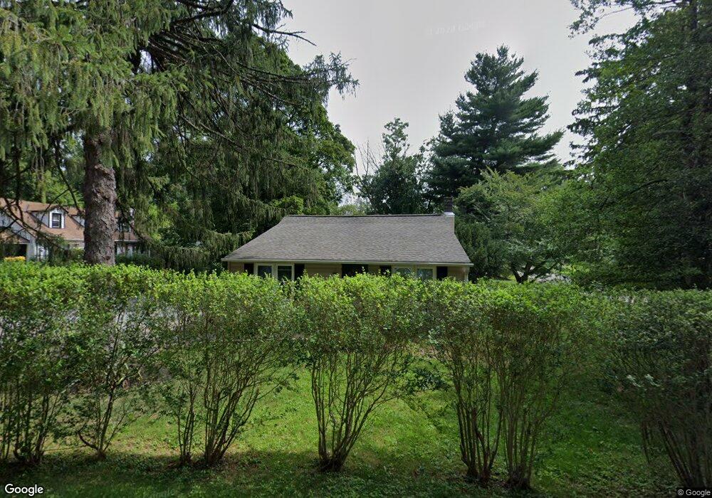
1251 Ashbridge Rd West Chester, PA 19380
Estimated Value: $369,366 - $511,000
4
Beds
2
Baths
1,500
Sq Ft
$300/Sq Ft
Est. Value
About This Home
This home is located at 1251 Ashbridge Rd, West Chester, PA 19380 and is currently estimated at $449,842, approximately $299 per square foot. 1251 Ashbridge Rd is a home located in Chester County with nearby schools including Fern Hill Elementary School, E.N. Peirce Middle School, and Henderson High School.
Ownership History
Date
Name
Owned For
Owner Type
Purchase Details
Closed on
Jun 25, 1998
Sold by
Barbato Richard A and Barbato Karen A
Bought by
Barbato Richard A and Barbato Karen A
Current Estimated Value
Home Financials for this Owner
Home Financials are based on the most recent Mortgage that was taken out on this home.
Original Mortgage
$95,700
Interest Rate
7.02%
Create a Home Valuation Report for This Property
The Home Valuation Report is an in-depth analysis detailing your home's value as well as a comparison with similar homes in the area
Home Values in the Area
Average Home Value in this Area
Purchase History
| Date | Buyer | Sale Price | Title Company |
|---|---|---|---|
| Barbato Richard A | -- | -- |
Source: Public Records
Mortgage History
| Date | Status | Borrower | Loan Amount |
|---|---|---|---|
| Closed | Barbato Richard A | $95,700 |
Source: Public Records
Tax History Compared to Growth
Tax History
| Year | Tax Paid | Tax Assessment Tax Assessment Total Assessment is a certain percentage of the fair market value that is determined by local assessors to be the total taxable value of land and additions on the property. | Land | Improvement |
|---|---|---|---|---|
| 2025 | $3,748 | $129,300 | $50,130 | $79,170 |
| 2024 | $3,748 | $129,300 | $50,130 | $79,170 |
| 2023 | $3,748 | $129,300 | $50,130 | $79,170 |
| 2022 | $3,699 | $129,300 | $50,130 | $79,170 |
| 2021 | $3,648 | $129,300 | $50,130 | $79,170 |
| 2020 | $3,624 | $129,300 | $50,130 | $79,170 |
| 2019 | $3,574 | $129,300 | $50,130 | $79,170 |
| 2018 | $3,498 | $129,300 | $50,130 | $79,170 |
| 2017 | $3,287 | $124,180 | $50,130 | $74,050 |
| 2016 | $2,772 | $124,180 | $50,130 | $74,050 |
| 2015 | $2,772 | $124,180 | $50,130 | $74,050 |
| 2014 | $2,772 | $124,180 | $50,130 | $74,050 |
Source: Public Records
Map
Nearby Homes
- 1302 Ashbridge Rd
- 1322 Ashbridge Rd
- 300 Kirkland Ave Unit DEVONSHIRE
- 300 Kirkland Ave Unit HAWTHORNE
- 300 Kirkland Ave Unit SAVANNAH
- 300 Kirkland Ave Unit AUGUSTA
- Kipling Plan at The Woodlands at Brandywine
- Nottingham Plan at The Woodlands at Brandywine
- Hawthorne Plan at The Woodlands at Brandywine
- Savannah Plan at The Woodlands at Brandywine
- Magnolia Plan at The Woodlands at Brandywine
- Woodford Plan at The Woodlands at Brandywine
- Augusta Plan at The Woodlands at Brandywine
- Devonshire Plan at The Woodlands at Brandywine
- Ethan Plan at The Woodlands at Brandywine
- Covington Plan at The Woodlands at Brandywine
- 116 Windridge Dr
- 1205 Killington Cir
- 90 Eakins Cir
- 95 Eakins Cir
- 1255 Ashbridge Rd
- 1307 Ashbridge Rd
- 1245 Ashbridge Rd
- 619 Howard Rd
- 1304 Ashbridge Rd
- 1241 Ashbridge Rd
- 617 Howard Rd
- 1239 Ashbridge Rd
- 1309 Ashbridge Rd
- 1306 Ashbridge Rd
- 805 Countryside Dr
- 1240 Ashbridge Rd
- 1244 Ashbridge Rd
- 2006 Jessica Ln
- 615 Howard Rd
- 1311 Ashbridge Rd
- 809 Countryside Dr
- 616 Howard Rd
- 1238 Ashbridge Rd
- 1310 Ashbridge Rd